This page is currently under construction. Please check back soon!
RMIT Maps:
Associate Diploma of Engineering (Survey and Mapping)
"Great Ocean Road"(1996)
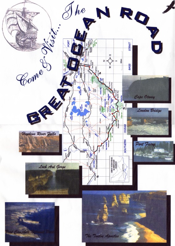
As an early learning exercise into using Corel Draw a project was undertaken to re-create an existing map. For this I chose to map my favourite area to visit... the Great Ocean Road and surrounds.
This map follows traditional mapping conventions, lettering styles and colours and includes some photographs of the tourist attractions. Its one of my personal favourite maps that I have produced partly because of the way the "Mahogany" ship turned out(top left corner), and partly because this is the first map I ever really produced. The "Mahogany" is just a scan of a simple greylead pencil tracing I did to enhance the overall appearance of the map itself. The final result was above expectation and truly captured the meaning behind the "Mahogany".
For those that are unaware, the "Mahogany" is a tall ship of Portuguese origin said to have reached our shores more than 200 years before Captain James Cook in 1521. It is believed to have wrecked along the treacherous Ship Wreck Coast and lies somewhere between Warnambool and Port Fairy. If ever found the history books of Australia's heritage will be re-written. Rumour also suggests that maps of the East Coast of Australia were in Cooks possession as he navigated his way to discover Austalia in 1770.
This is a smaller version of the completed map. The actual finished size is an A3 size (420 x 297mm).
Please contact me at [email protected] if you would like any further information or if I can be of service to you.
Jason Allan Mapping & Graffix
Page Last Edited: 21st December 2006
Back to Home Page
