|
||||||||
 |
||||||||
|
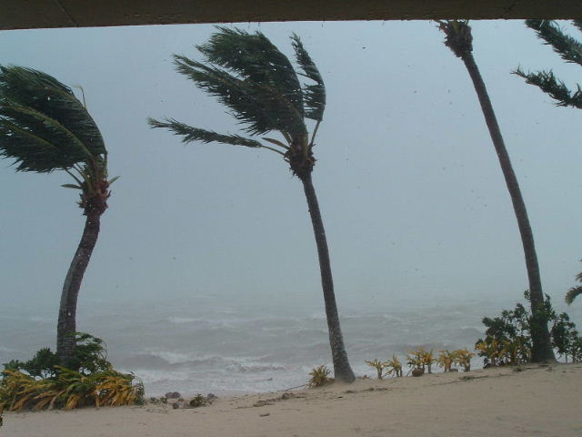
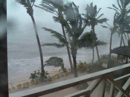
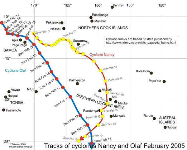
This is what it looked like at the height of Cyclone Nancy. This is taken from our room. When we arrived at the hotel February 12th, the General Manager Paiao met us and showed us around. She also mentioned that Cyclone Meena had done damage to the island the Saturday before. We were sorry to hear this, but happy that we had not been there. Moreover, we were happy to hear about a recent cyclone since the history of the Cook Islands is that only 2 or 3 cyclones hit there in a decade. We figured we were pretty safe. The next morning at church we heard about Cyclone Nancy. As you can see by the chart above, Nancy was very near the island of Suwarrow Sunday morning, February 13th. As we heard more about Nancy, people mentioned Olaf. It seems there was a third cyclone trailing right behind Nancy! By the way, as far as I can tell, there is nothing different between a hurricane and a cyclone. Apparently they call them hurricanes in the Atlantic and cyclones in the Pacific. Sunday afternoon it was rainy and the wind picked up. We listened to the radio and tried to figure out what it meant when they would say "South of Suwarrow" or "West of Palmerston and heading south". We spent a lot of time studying our maps. We also spent time praying. You can see a map at the bottom of this page which shows "our two cyclones". At 8am Tuesday, February 15th, we met in the lobby of our hotel. The regular staff was not there and the restaurant was closed. Paiao, and her father who owns the hotel, explained our options. The forecast called for Nancy to move to the west of Rarotonga, while we were located on the southeast corner. There were already reports of damage on the north shore, where Avarua is. If things got really bad, we would evacuate to a local college. But, "for now", we would wait here. We packed all of our luggage and stacked it in the bathroom on the counter. We also packed two bags to take with us in case we needed to evacuate for a period of time. Paiao brought us a key to one of the units on the top floor (we were on the ground floor), in case we wanted to move upstairs. At 2:30pm the radio reported that Nancy was only 21 miles east of us. It had not turned to the west as forecast! At 3:30pm we saw waves splashing up to our tree line. From there it is only about one foot up to the level of our unit. The wind was 55 miles per hour and gusting to 90 miles per hour. We decided to move up to the top floor. After being there about 30 minutes the wind calmed and the sun came out. I guess we were in the eye of the storm. We decided to move back downstairs.
At 5:45pm the radio reported that Nancy was only 14 miles South/Southeast of us. The winds were 70 miles per hour. However, Nancy was moving off and they forecasted she would be about 170 miles south of us by 8am the next day. At 6:30pm we went out onto our deck and the wind was fairly calm, but there were some really huge waves. |
||||||||
 |
 |
|||||||
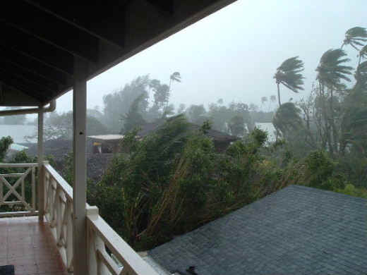
| The two photos above show what Nancy looked like from the third floor of our hotel. Actually this was just after she was at her worst. | ||||||||
| The next morning, Wednesday, February 16th, was beautiful. We went snorkeling before breakfast! Then we were off to the rental place to rent a scooter for the next 7 days so we could explore at our own speed. When we got to town (on the other side of the island) we found that our area had indeed been spared the brunt of the storm. | ||||||||
 |
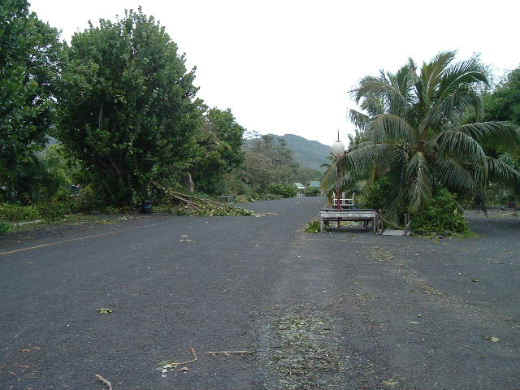 |
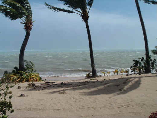
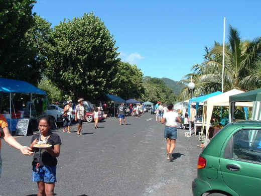
The picture at the far left shows the cultural market we attended on our first day on the island. The second picture was taken 4 days later from the same place. You can see how the trees have just been beaten. |
||||||
|
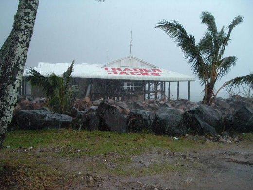
This is Trader Jack's; a very popular bar and grill in Avarua. The picture does not tell the story. It was completely gutted inside. |
 |
|||||||
 |
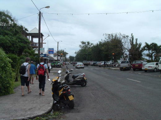 |
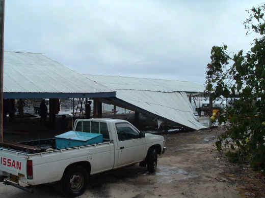
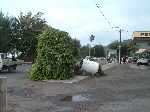
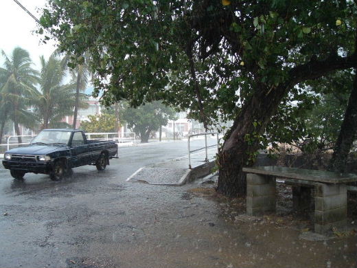
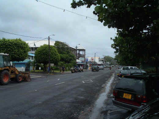
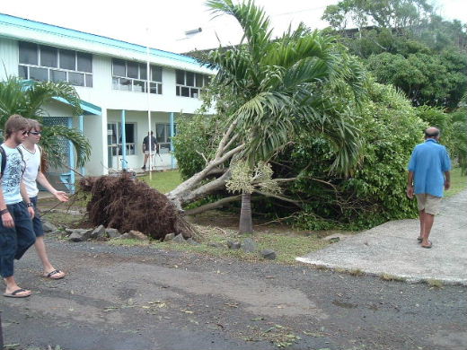
These 5 pictures show some of the damage in Avarua from the cyclone. When we got there around noon on Wednesday, we had expected less damage and wanted to go shopping. Most of the stores were just closing as we got there so that their employees would have time to work on damage to their homes. We wanted to find a loaf of bread and stopped at several stores. They were either closed, or out of bread. (We wanted bread in case of a power failure!) When we picked up the scooter it was a very pleasant day. Since I had never driven a scooter (or motorcycle) and had never driven on the left side of the road (as they do in the Cook Islands), we were having quite a wonderful adventure! By the time we got back to the hotel, it was raining and we were soaked (of course it was about 80 degrees!) Later we found out that we had managed to get sunburns out on the scooter! |
||||||
 |
||||||||
 |
||||||||
 |
||||||||
 |
||||||||
 |
After picking up the scooter, I was supposed to go directly to the police station and get my license. The picture on the left shows the police station Wednesday. The tree was across their sidewalk and they had water standing inside, so they were closed. | |||||||
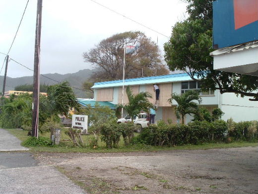 |
Thursday morning (February 17th) was nice at our hotel and we went snorkeling again. Then we went into town and found everyone preparing for Olaf. This picture shows them boarding over the police station. Olaf was reported to be much larger and stronger than Nancy and headed right for us. It was scheduled to be nearest to us around midnight. However, at 8:30pm the radio reported that it was west of us and moving quickly to the south. We had some strong winds, but nothing like Nancy. | |||||||
|
This church had it's roof torn off and thrown into the ocean. This soccer field looked like a good spot for water polo. |
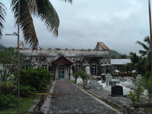
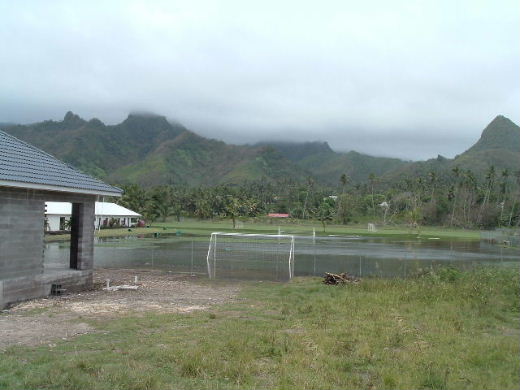 |
|||||||
 |
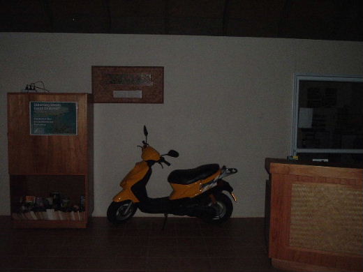 |
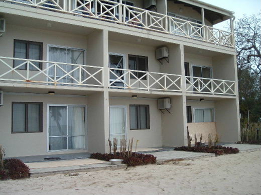
Our hotel boarded up the windows on the main floor for Olaf, but it really was not necessary. They parked our scooter in the lobby to protect it. Thanks Paiao! |
||||||
|
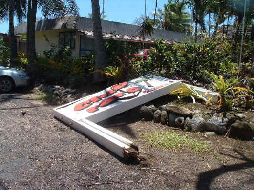
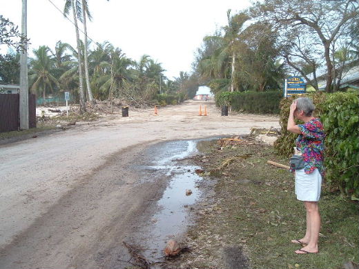
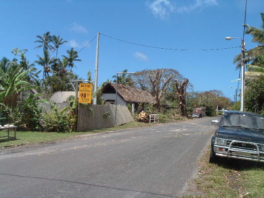
The Club Raro sign looked a lot nicer a few days before. Jackie is checking out the main road. The section beyond her was closed for at least a week. |
   |
|||||||
|
Well, I wouldn't wish a cyclone on anyone, but we survived with no problems. As far as I know, no one on any of the islands died or were seriously injured. One of the interesting things we noted was the weather reporting, both on the radio and in the paper. We were told wind speeds, sunset and sunrise times, moonrise and moonset times, high tide and low tide times. We never saw or heard the temperature, humidity or rainfall on the island. The temperatures and humidity that I have mentioned in this web site were learned from the internet. I did not learn how much rain we had, but Rarotonga averages 9.2" of rain in February! |
||||||||
 |
||||||||
| Moana Sands Moana Sands Moana Sands Moana Sands Moana Sands Moana Sands |
Moana Sands Moana Sands Moana Sands Moana Sands Moana Sands Moana Sands |
Moana Sands Moana Sands Moana Sands Moana Sands Moana Sands Moana Sands |
Moana Sands Moana Sands Moana Sands Moana Sands Moana Sands Moana Sands |
|||||