The role of
plate tectonics
As the Caribbean
plate broke away from the South American plate and slowly moved
northwards pressure within and beneath the mantel caused
deformations to occur on the ocean floor. This intense build up
of pressure caused faults to develop. The continued movement of
the plate forced parts of the earth`s crust between
fault-lines to be pushed upwards .
This upward
movement of the ocean floor was also accompanied by folding of
the rocks into synclines, anticlines and recumbent folds. Over
millions of years this combination of folding and faulting
eventually lead to an emergent block of land which became
Barbados.
The role of
corals
Barbados` geology
consists entirely of limestone and the reason for this can be
found in its geologic history. In the tropical waters of the Caribbean
ideal conditions for coral growth existed. The ocean currents
that circulated the equator are warm which provided the corals on
the ocean floor with suitable temperatures as well as nutrients.
Over time the
coral colony gradually grew extending itself several kilometers
across the ocean floor and several kilometers thick. These coral
limestone were important because they not only gave rise to
Barbados` unique shape, but also the physical characteristics of
the island. As the ocean floor continued to rise the hard coral
limestone became emerged to form the island of Barbados.
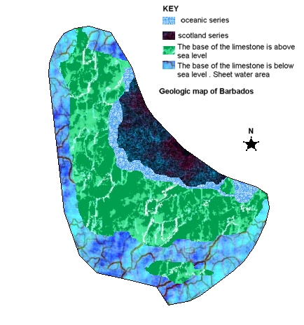
Surface geology
of Barbados
Many of the
Caribbean islands of the island arc such as Martinique, Grenada
and St. Vincent display very high mountain ranges due to their
volcanic origin . Barbados, on the other hand, is almost flat except
for some very small hills. This is because during its formation
the entire block of coral limestone was uplifted to form a flat
surface.
In addition to
this, years of chemical, biological and mechanical weathering of
the limestone ensured that the landsurface was flat. One very
unique feature of Barbados is that there are no surface rivers on
the island. This is because limestone is very porous
and eaisly eroded away.
There are,
however, an abundance of subterranean features such as sinkhole ,
underground caves and subterranean streams. The underlying layers of
Barbados consists of complex networks of these features.
IF BARBADOS
HAS NO SURFACE RIVERS THEN WHERE DOES THE COUNTRY GET ITS WATER
SUPPLY FROM ? All of the country`s drinking water is obtained
from underground sources. There are many aquifers located across
the island that provide what is considered to be among the purest
supplies of water in the world.
The island is
dotted with many caves which are among the most popular tourist
attractions to visit. Harrisons cave is a good example of these
physical forces that continue to shape the island. Within
the cave pools, stalgamites, stalactites, pillars and flow stones
{formed thousands of years ago} show the effects of weathering
and erosion.
Did Dinosaurs
Inhabit Barbados ?
Unlike Trinidad,
dinosaurs did not inhabit Barbados. There are several reasons for
this. The island is relatively young when compared to the age of the
continents. There are, however, fossils of marine organisms such as
mollusc, fishes and coral that can be found.The old raised beach
terraces which can be found on coastal areas are a good place to
start looking for fossil remains.
Because Trinidad
was once connected to Venezuela on the South American continent,
dinosaurs fossils will be present on this island. In fact the leg bone
of a GIANT SLOTH was found in south Trinidad. The fossil is
now on exhibit at the National History Museum in Trinidad.