Town of Springport
New York Historical Markers
August 10, 2004
Ira with Marker
N 42° 50.529 W 076° 41.532
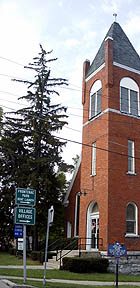
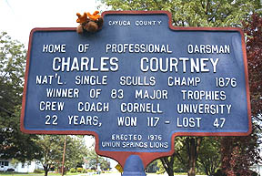
Sign to north side of Union Springs Church
Corner of Route 90 and Seminary Street
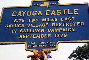
Ira with Marker
N 42° 50.555 W 076° 41.620
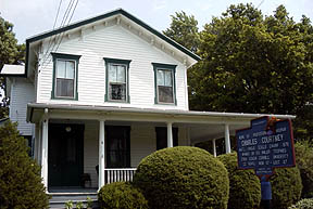
House today - north side of Seminary Street
Ira with Marker
N 42° 50.291 W 076° 41.309
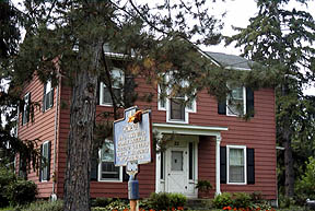
House today - south side of Homer Street
Ira with Marker
N 42° 48.747 W 076° 41.926

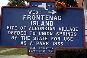
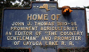
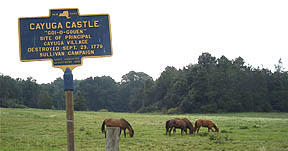
Sign at the junction of Route 90 and Great Gully Road
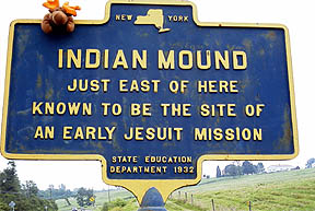
Ira with Marker
N 42° 48.607 W 076° 42.047
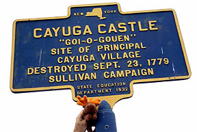
Ira with Marker
N 42° 48.593 W 076° 42.048
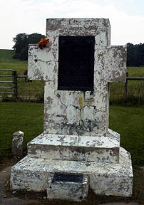
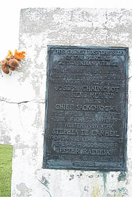
These two markers are located within a
hundred feet of each other is a parking area on Route 90 across
from Great Gully Farm.
In this same parking area are two monuments.
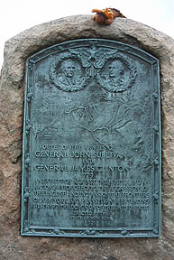
General Washington orders General John Sullivan to lead a
expedition.
So frequent had been the forages of the Indians which had always
been conducted with much cruelty, that it was decided to make an
expedition into the land of the Iroquois and "pay them off in their
own coin." Washington made his dispositions as early as January,
1779. John Sullivan, the New Hampshire lawyer chosen to command the
expedition, had proved his competence as an improvised major
general.
Descendants of the Clinton-Sullivan campaign?
René
Menard was a French Jesuit missionary who worked in the Great
Lakes region of North America among the Hurons, Algonquins and
Iroquois. He was one of the first Europeans to set foot in many of
the places he visited.
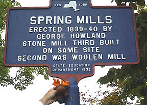
Ira with Marker
N 42° 50.722 W 076° 41.473
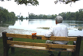
Ira and friend share a seat on Spring Mills Pond.
[email protected]