Shiretoko Peninsula
After luxuriating in the early morning tranquility of Lake Kussharo, we had to push on to the Shiretoko Peninsula, our next destination and campsite. On day 8 of the tour, we did about one-seventh of the total tour distance in one day. That is, we covered over 100km in one day. It was nice to cruise on mainly flat roads, drafting whenever there is sufficient headwind to justify it. We left Lake Kussharo at about 7:00am in the morning and arrived at our campsite at around 3:30pm with two long stops for breakfast in Teshikaga and a very leisurely lunch at Shari.
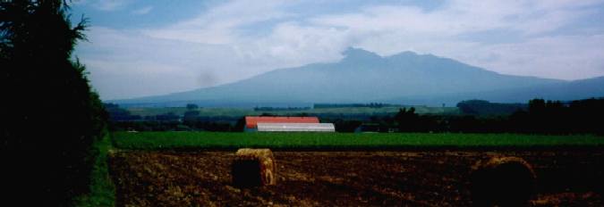
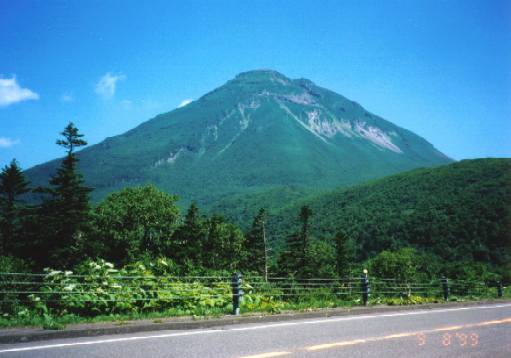
Mount Shari and the countryside near Shari, viewed from Route 1115, about 10km out from Shari.
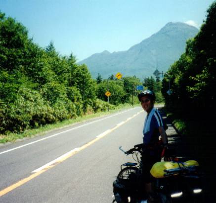
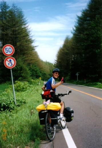 This
fir-lined road is Route 805 on our way to Shari, the beginning of the Shiretoko
Peninsula. It was quite a hot day, but manageable. When you ride through such
beautiful countryside, you hardly notice the kilometres clocking up as you are
so caught up with admiring the passing scenery.
This
fir-lined road is Route 805 on our way to Shari, the beginning of the Shiretoko
Peninsula. It was quite a hot day, but manageable. When you ride through such
beautiful countryside, you hardly notice the kilometres clocking up as you are
so caught up with admiring the passing scenery.
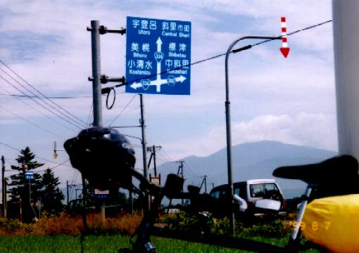 Don't
worry if you can't read Japanese. A lot of the Japanese road signs are displayed
in English and Japanese. This picture was taken just before we entered Shari
at the Routes 334 and 1115.
Don't
worry if you can't read Japanese. A lot of the Japanese road signs are displayed
in English and Japanese. This picture was taken just before we entered Shari
at the Routes 334 and 1115.
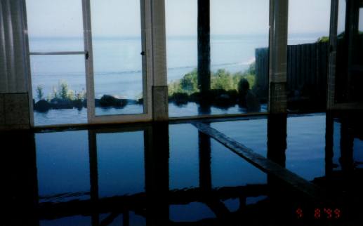 We
were hot, sweaty and smelly by the time we got to our campsite at Shizenmura
Camping Ground at a little town called Utoro. Lucky for us, at this place, they
had an onsen (hot spring). It was 500 yen per camper and then another 500 yen
for unlimited usage of the onsen until 9 or was it 10am the next morning? Well,
1,000 yen or about A$15 is pretty cheap. It is amazing what an onsen can do
for tired muscles. We visited an onsen on daily basis if possible. An onsen
a day will keep the weariness (and muscular pains) away. The outdoor section
(rotemburo) offers a panoramic view of the Pacific Ocean.
We
were hot, sweaty and smelly by the time we got to our campsite at Shizenmura
Camping Ground at a little town called Utoro. Lucky for us, at this place, they
had an onsen (hot spring). It was 500 yen per camper and then another 500 yen
for unlimited usage of the onsen until 9 or was it 10am the next morning? Well,
1,000 yen or about A$15 is pretty cheap. It is amazing what an onsen can do
for tired muscles. We visited an onsen on daily basis if possible. An onsen
a day will keep the weariness (and muscular pains) away. The outdoor section
(rotemburo) offers a panoramic view of the Pacific Ocean.
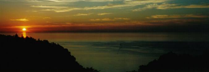
Sunset at Shiretoko Peninsula. This magnificent sunset was seen from our campsite at Shizenmura Camping Ground. I cannot think of a better way to cap off a long ride than with a nice hot bath and watching the sun sink languidly below the horizon.
 We
woke up to a brilliant sunny day. Unfortunately, it turned out to be a really
hot one, another 35C day. By this stage of the tour, our legs were pretty accustomed
to both hard and long, or sharp and short climbs, but the heat really did us
in (again!) as we struggled from sealevel over the hump at around 700m above
sealevel to the other side of the Shiretoko Peninsular. Taking Route 334, we
were treated to the rugged beauty of the undeveloped peninsular. On the left
is the majestic Mt Raosu (1,660m) as viewed from Route 334. This spot is about
3km below the top of the climb.
We
woke up to a brilliant sunny day. Unfortunately, it turned out to be a really
hot one, another 35C day. By this stage of the tour, our legs were pretty accustomed
to both hard and long, or sharp and short climbs, but the heat really did us
in (again!) as we struggled from sealevel over the hump at around 700m above
sealevel to the other side of the Shiretoko Peninsular. Taking Route 334, we
were treated to the rugged beauty of the undeveloped peninsular. On the left
is the majestic Mt Raosu (1,660m) as viewed from Route 334. This spot is about
3km below the top of the climb.
e
 The
hot climb up to the top. Mount Raosu is in the background. This picture was
taken as we rested and had a drink beneath what little shade that we could find
on the opposite side of the road. We stopped every 3 kms or so, because of the
heat. In hindsight, we should have left earlier when it was cooler.
The
hot climb up to the top. Mount Raosu is in the background. This picture was
taken as we rested and had a drink beneath what little shade that we could find
on the opposite side of the road. We stopped every 3 kms or so, because of the
heat. In hindsight, we should have left earlier when it was cooler.
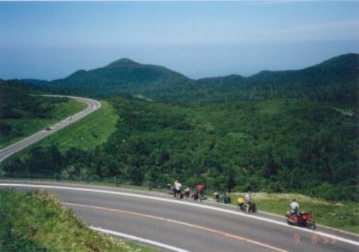 The
view from near the top of the climb. The climb was quite steep, but nowhere
near as tough as what we did in the Mt Hokkado region. The downhill ride to
the other side of the peninsula to Raosu was lot of fun. Descents on a bike
is the best part about every climb...talk about the adrenalin rush as you hang
tight into and out of the bends of the windy mountain road, on a fully loaded
bike, and going as fast as the drivers dare (around 50km/h)!
The
view from near the top of the climb. The climb was quite steep, but nowhere
near as tough as what we did in the Mt Hokkado region. The downhill ride to
the other side of the peninsula to Raosu was lot of fun. Descents on a bike
is the best part about every climb...talk about the adrenalin rush as you hang
tight into and out of the bends of the windy mountain road, on a fully loaded
bike, and going as fast as the drivers dare (around 50km/h)!