 |
|
|
|
|
|
|
|
|
|
|
|
|
|
|
|
|
|
|
|
|
|
|
|
|
|
|
|
|
|
|
|
|
|
|
|
|
|
|
|
|
|
|
|
River Descriptions - South-east Idaho |
|
|
|
 |
|
|
|
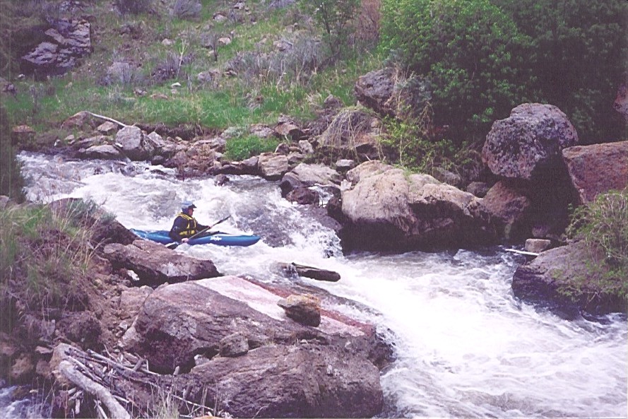
The Blackfoot River |
|
|
|
 |
|
 |
|
 |
|
|
|
|
|
|
|
Kayaker - Bryce Broughton |
|
|
|
|
|
|
|
The Blackfoot River is a great late season run. Flows are typically 350-600 cfs well into September, with the ideal flow being 600 cfs. The river contains two flatwater sections, one at the beginning and one at the end (approximately 1 1/2 miles). Inbetween the flat water is 5 miles of continuous class IV with 2 class V drops and 1 class VI (it has been run at 350 cfs). For levels call (208) 238-0586. |
|
|
|
|
|
Kayaker - Bryce Broughton
Safety - Walt Nagel |
|
|
|
|
|
|
Put-in: |
|
From 91, head east on Wolverine Rd (600 N). Right on Blackfoot River Road, put-in 8 miles up. |
|
|
|
|
|
|
|
|
|
|
Take-Out: |
|
1 1/2 miles up from the turn off onto Blackfoot River Road. You will have to hike 1/2 mile out or float more flatwater until the river meets the road. |
|
|
|
|
|
|
|
|
Gradient: |
|
|
|
|
80 feet/mile |
|
|
|
|
|
|
Length: |
|
8 miles |
|
|
|
|
|
|
|
|
|
|
Canyon Creek |
|
|
|
|
|
|
|
|
 |
|
|
|
|
|
Canyon Creek is a great low volume technical creek. Spring Flows are typically 100 - 200 cfs and normally runnable May - July. The run is primarily class III, but does contain 4 class V drops and one portage around a log jam. Be prepared for a very long flatwater paddle out on Teton River. |
|
|
|
|
Put-in: |
|
East on 33, turn right after crossing Canyon Creek bridge. |
|
|
|
|
|
|
|
|
Take-Out: |
|
Old Teton Dam site, follow the signs from 33. |
|
|
|
|
|
|
|
|
|
|
|
Gradient: |
|
70 feet/mile |
|
|
|
|
|
|
|
|
|
|
|
Kayaker - Walt Nagel |
|
|
|
|
|
Length: |
|
10 miles plus 5 miles flatwater |
|
|
|
|
|
|
|
|
|
|
|
|
|
|
|
|
|
|
|
 |
|
|
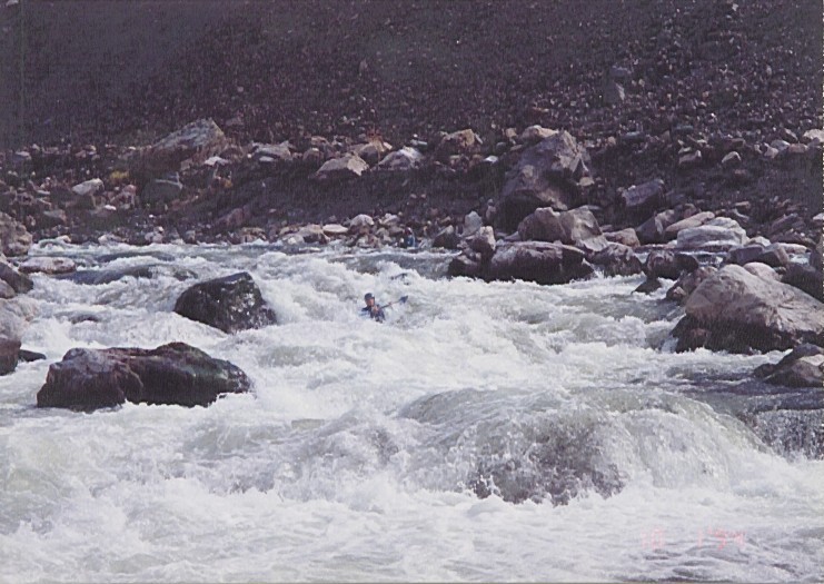
Madison River - Quake Lake |
|
|
|
|
|
|
|
This is a fun 1.5 mile stretch of class IV-V located 2.5 hours north of Idaho Falls. The picture pretty much describes the entire run. Quake Lake is normally runnable all summer as long as it has at least 800 cfs. |
|
|
|
|
|
|
|
Put-in: |
|
Quake Lake. Take US 20 North from Idaho Falls. Turn left on US 87. Drive past Henry Lake into Montana. Turn right on 287. Quake Lake is a few miles up the road. |
|
|
|
|
|
|
|
|
|
|
|
Length: |
|
1.5 miles |
|
|
|
|
|
|
|
|
|
|
|
Kayaker - Kevin Veon |
|
|
|
|
|
|
|
|
|
|
|
|
|
|
|
|
|
|
 |
|
|
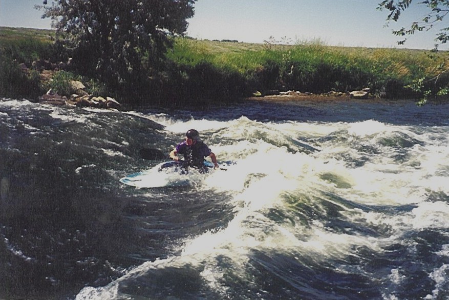
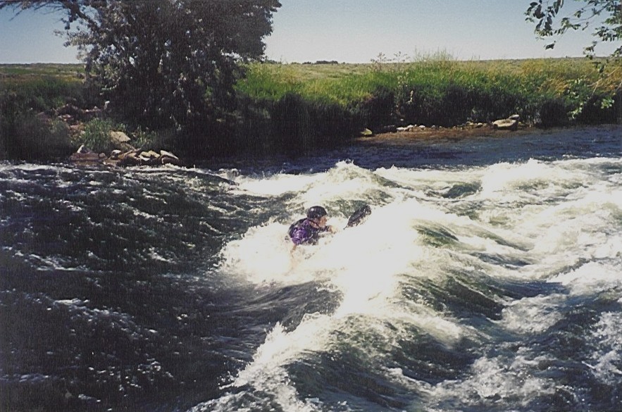
Groveland |
|
|
|
|
|
|
|
This is a single park and play wave with a large eddy on one side. It's a good spot for surfing and flat spinning, but is too shallow for cartwheels. It is runnnable all summer while irrigation water lasts. |
|
|
|
|
|
|
|
Put-in: |
|
From I-15, take the Rose exit a few miles north of Blackfoot. At the exit head west (on W 450 N). You will actually stay on this road all the way to the wave, but it is a little tricky to follow:
After about 1 mile take a right on Rose rode. Once you cross the first canal, turn left. After another mile, turn right on Johnson road. Once you cross the second canal turn left again. Go straight for about five more miles. The road will end at MacDonaldville road. Directly across MacDonaldville road is a small dirt road. Follow the dirt road for about 100 yards, the wave is in the canal on your left. |
|
|
|
|
|
|
|
|
|
|
|
|
|
 |
|
|
|
|
|
|
|
|
|
|
|
|
Home |
|