Wollongong Roadpics
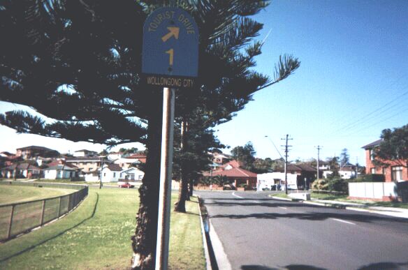
Wollongong City Council has its own system of Tourist Drives in addition to other Tourist Drives with the brown pentagon marker seen across the state. This is a picture of one on Olympic Boulevarde, Port Kembla.
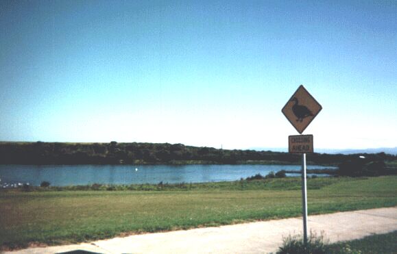
A duck crossing sign on Parker Street, Port Kembla, adjacent to Coomaditchy Lagoon (in the background). In the many times that I have travelled down this street, I've yet to see a duck actually on the roadway (though there are plenty on the lagoon itself).
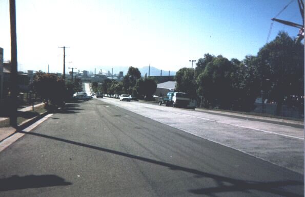
Military Road (NSW-155) looking north in Port Kembla towards the Steelworks. Particularly interesting is the mixed type of pavement - while the centre lanes are concrete, the edges are paved with asphalt. I originally thought that this might be due to a tramway running along this street in the past, but it appears that it's simply a result of a road widening project.
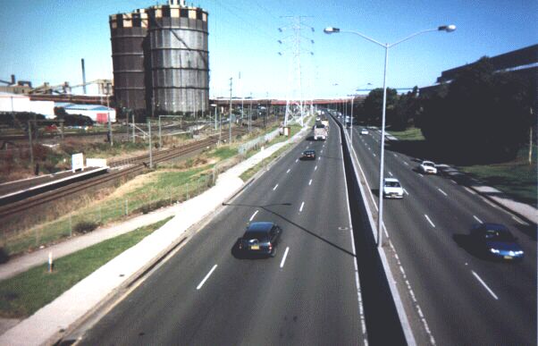
Five Islands Road (NSW-151/NSW-155) looking eastbound from a pedestrian overpass at Cringila. To the left of this major arterial you can see two large gas reservoirs needed for the coke ovens and steelworks. In the foreground on the left is the Port Kembla branch railway and the platforms for Cringila station.
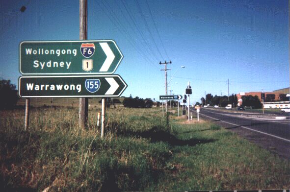
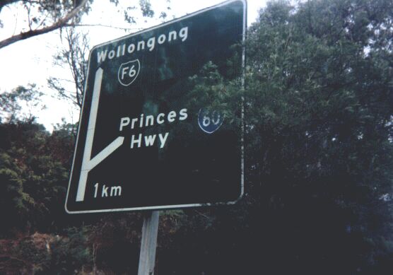
Signs at the junction of NSW-155 (Northcliffe Drive) and NSW-60 (Princes Highway) at Kembla Grange. The signs also point the way to the F6 freeway which is parallel to the Princes Highway. The F6 marker is now defunct but the Roads & Traffic Authority has decided to leave the 25-year-old existing markers in place.
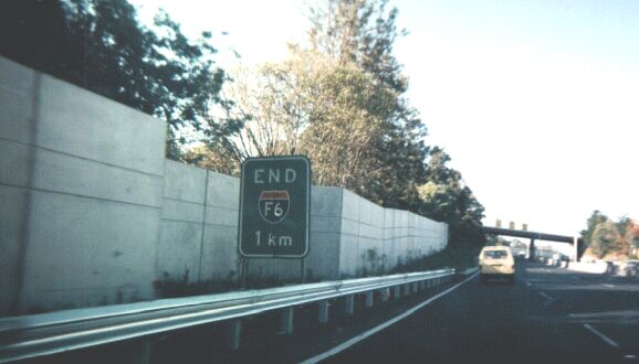
This sign is found on northbound F6 approaching the end of the southern section of the F6 at Gwynneville. Yet another original gem from the days of the freeway's opening left in place. Let's hope it stays there.
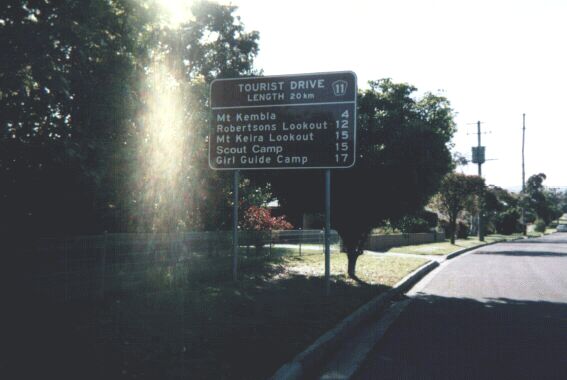
A Big Brown Sign giving distances to attractions along Tourist Drive 11, and also giving the length of the Tourist Drive. Notice the different font that 'Scout Camp' is written in. This ugly font is now infecting the state road network with alarming rapidity.
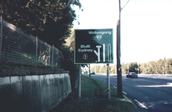
Sign on northbound NSW-60 (Princes Highway) just before the Ghosts Creek Interchange with the F6 freeway at Figtree. This interchange was recently re-aligned, and I believed that this sign was a temporary measure while the roadworks were in place. But the roadworks are now long gone, and this sign (complete with ugly font and inaccurate markers) is still here.
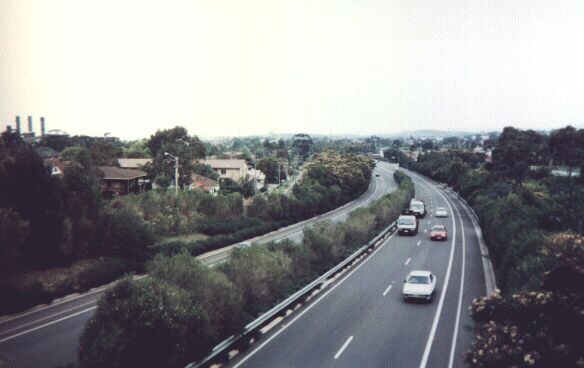
Photograph of the Northern Distributor (NSW-60) looking southbound from a pedestrian overpass at Corrimal. This is nearly a freeway-grade road, but it has several traffic lights along its length.
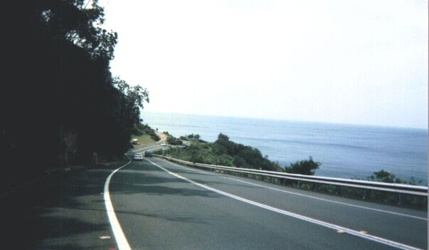
Northbound on Lawrence Hargreave Drive (NSW-68) near Stanwell Park. This twisty road hugs the cliffline for around 10 miles from Thirroul to Stanwell Tops. A Department of Main Roads engineer once commented that the road 'hangs there by the grace of God'.
A Big Green Sign at the northern end of the F6 freeway at Waterfall. It features a later F6 marker used in the 1980's. The fact that Princes Hwy is used as a control city is also rather unusual.
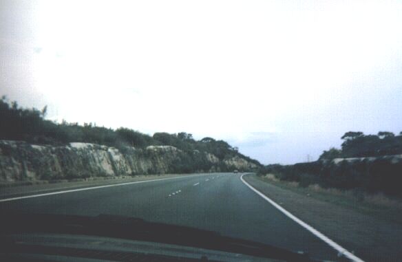
The F6 southbound approaching Bulli Tops. This stretch of freeway is the longest between interchanges in Australia (that I know of) - approximately 11 miles / 18km!
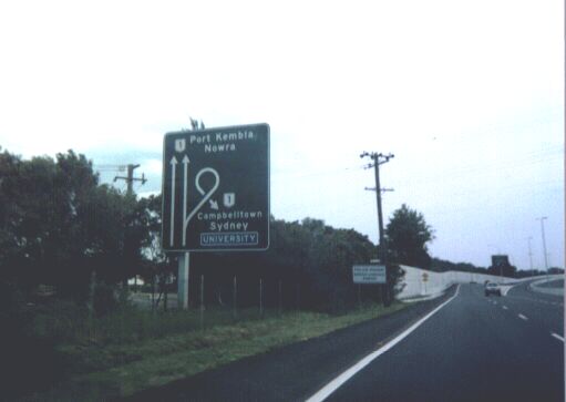
An interesting Big Green Sign on the Northern Distributor southbound approaching the rebuilt Gwynneville Interchange. The sign features the loop of this trumpet interchange. This interchange is also one of only three freeway-to-freeway interchanges in the State of New South Wales.