The F3 is one of my favourite freeways, primarily because of its length. At 128km (79 miles), it is the longest fully limited access road in Australia. It is also an impressive feat of engineering, especially along its southern section where it cuts through rugged sandstone ridges and crosses very deep and wide river valleys.
The F3 has also had a significant impact on population distribution to the north of Sydney. Before the F3, the only way to access areas north of Sydney such as the Central Coast and Newcastle was by a very windy and dangerous two-lane road (the Pacific Highway, now signed as State Route 83) or by an equally windy railway. The completion of the F3 brought about the possibility of massive residential development along the Central Coast, with families looking for cheap housing and the ability to commute to Sydney via a reliable world-class superhighway. Even now, the F3 is a major umbilical cord between the Central Coast and Sydney; during major accidents, bushfires, etc. there are few alternatives.
The F3 is quite windy around the Hawkesbury River area due to the mountainous and rocky terrain. This stretch has seen many accidents over the years, and recently the speed limit was lowered from 110km/h to 90km/h along this stretch, with good results in terms of safety.
The F3 has very much been a work in progress over the past thirty years; the first section was opened in the mid-1960's and the freeway was only completed in 1999. However, some may argue whether it really is completed; at the southern extremity of the F3, there were originally plans to extend it by about 6km to the M2 Hills Motorway. However, the reservation order for this extension has been deleted from the plans by the State Government due to environmental concerns (it would dissect the Lane Cove River National Park) and the fact that right-of-way acquisition costs would be prohibitive (the planned freeway would have gone through some of the wealthiest suburbs in Australia).
For excellent pictures of the F3 freeway, I suggest that you visit Lockstar's Wide World of Roads and Highways.
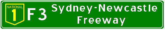
Below is an exit guide for the Sydney-Newcastle Freeway. The distances listed are not entirely accurate, being subject to the vagaries of my odometer. All comments and corrections are eagerly solicited, please feel free to contact me at [email protected].
(Northbound) |
(Read Down) |
(Read Up) |
Attractions, etc. |
|
|

|

|
|
  PACIFIC HWY Sydney Hornsby |
 Hornsby |
||
Mt Colah Bobbin Head |
National Park |
||
Berowra |
|||
PACIFIC HWY Berowra Hornsby |
|
||
PACIFIC HWY Moonee Moonee Brooklyn |
|||
Mt White |
|||
Weigh Station |
|||
 Calga Peats Ridge |
Peats Ridge |
||
PACIFIC HWY Gosford Woy Woy |
Gosford Hospital
Old Sydney Town |
||
Peats Ridge |
Wisemans Ferry USE THIS EXIT |
||
Ourimbah Palmdale |
Gosford Hospital
REST AREA
Gosford via Ourimbah |
||
The Entrance Yarramalong |
USE THIS EXIT |
||
(Caltex) |
(Caltex) Gas - Food Toilet - Info |
||
Toukley |
Toukley |
Wyong
|
|
 Budgewoi Swansea Charlestown |
USE THIS EXIT |
||
Morrisett Cooranbong |
Doylason Cooranbong |
USE THIS EXIT |
|
 Kurri Kurri Cessnock |
|||
 Cardiff |
|||
Newcastle |
USE THIS EXIT |
||
|
|
|
||

© Bradley Torr. Last updated 19-Jan-2000.
