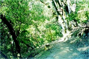
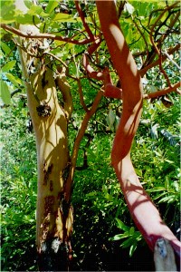
In mid-October 1997, my sister and I hiked what one area guidebook calls "the best hike in the South Peninsula," a loop trail in Castle Rock State Park. With spectacular views across Big Bear valley to the ocean and Monterey Bay, the hike lives up to its hype. This is a hike that begins with a descent along a creekbed to an impressive waterfall, then branches out along the side of the mountain, before looping back along the mountain ridge through a peaceful stand of mature madrone. When the weather is gorgeous, as it was for us, nothing could be better.
The early part of the hike features a steady downhill path that crosses over the creek at about the .3 mile marker. Soon after, the park service has built a platform out over a cliff, allowing spectacular views of the Santa Cruz ridge opposite and the waterfall just below your feet. The trail then curves outward, emerging from the trees to become a mountain-side path through chapparal and low-growing madrone. The Pacific Ocean appears directly in front of you, and the view is remarkable. We began the hike in early morning, but this would also be a great hike for late afternoon and the setting sun.
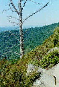 This mountain-side section offers the most challenging section of the hike, especially if you have a fear of heights (as I do). There is almost no incline of any kind--the hike itself is quite relaxing--but only the low bushes hide from sight the almost-sheer drop just below your feet. At one point, the park service has inserted chains to help hikers over a boulder-fall across the path. In other words, wear boots or shoes with good treads.
Soon after the chain-and-boulder adventure, the trail turns up and eastward into trees again. Follow the trail signs back toward Goat Rock, a popular practice area for local mountain-climbers that lies back above the waterfall. This section of the hike can be marred by the constant gunfire coming from a shooting range that operates nearby: no doubt it is quieter during the week. Eventually the close-growing madrone open into a grassland-and-oak landscape, and the path branches toward Goat Rock itself or toward a scenic overlook; from the overlook, the path loops back below Goat Rock and on toward the parking lot.
We lingered both to enjoy the fine views of Monterey Bay, and to watch the Stanford mountain-climbing team at work on Goat Rock itself. From Goat Rock, it's a half-mile hike over large boulders to the falls. You will need to do some hand-over-foot climbing in two places, but it should not pose a challenge. From the falls, it's a steady climb back up the canyon to the parking lot. After 5 miles in sunshine and dappled shade, the damp shadows in the canyon were chilly enough to make us pick up the pace.
Castle Rock is located on the west side of Skyline Boulevard, two miles south of Highway 9 in Saratoga. We arrived at 10am on Sunday, and the parking lot was still almost empty. By the time we left just after noon, there were people waiting for spaces to open up. We had the trail to ourselves going in but had to step aside frequently on the last stretch back from Goat Rock to the Parking lot. Consider taking this hike early or late in the day to experience it in relative peace.
Update: Werner Hager of CyberHikes has written to say that the shooting range is active all week.
Visit the California State Parks
![]()
![]()
![]()
![]()
![]()
![]()