 |
 |
 |
 |
 |
| My Hikes up HALF DOME Yosemite National Park California 8-30-02 & 9-27-02 |
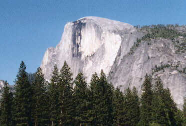
| This hike has been on my "Gotta Do" list for some time. It is a 17 mile round trip hike (the parking lot is 1/2 mile from the trailhead). The trail starts on the right side and spirals around the back of the dome and up the left side. The starting elevation is 4,040 feet above sea level and ends at 8,836 feet above sea level. This is an elevation gain of 4,796 feet. |
| HALF DOME from Yosemite Valley |
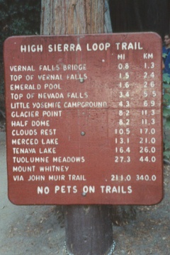
| TRAILHEAD SIGN at Happy Isles |
| The hike starts at Happy Isles Nature Center and goes towards Vernal & Nevada Falls |
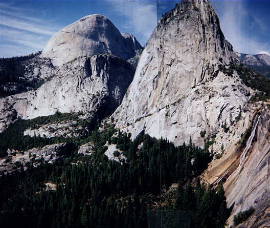
| HALF DOME - LIBERTY CAP - NEVADA FALLS from the John Muir trail |
| You start seeing Half Dome on the trail between Vernal and Nevada Falls. These waterfalls are much more spectular in the spring and early summer. At 3.5 miles I was at the top of Nevada Falls |
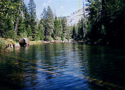
| From the top of Nevada Falls the trail follows along the Merced river for a short while, then the trail branches off into Little Yosemite Valley. |
| MERCED RIVER above Nevada Falls |
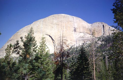
| BACK SIDE OF HALF DOME from Little Yosemite Valley |
| In Little Yosemite Valley you can see the back side of Half Dome. It is also some easy flat hiking for about a mile, and the half way portion of the hike. |