|
|
|
|
|
|
|
|
|
|
|
|
|
|
|
|
|
|
|
|
|
|
|
|
|
|
|
|
|
|
|
|
|
|
|
|
|
|
|
|
|
|
|
|
|
|
|
|
|
|
|
|
|
|
|
|
|
|
|
|
|
|
 |
|
|
|
Satellite Images for Pros: Part I |
|
|
|
Click on pictures for full-size image |
|
|
|
This section will only suit people who are passionate about maps & geography |
|
|
|
ProSat1. An Island... |
|
|
|
 |
|
|
|
HINT
Highlight area between ** for hint
**About one third of the country is visible on this photo** |
|
|
|
|
|
 |
|
|
|
|
|
Highlight area between ** for answer
** Taiwan (or Formosa) ** |
|
|
|
|
|
 |
|
|
|
How to work it out ? Look at the size and location of the cities. |
|
|
|
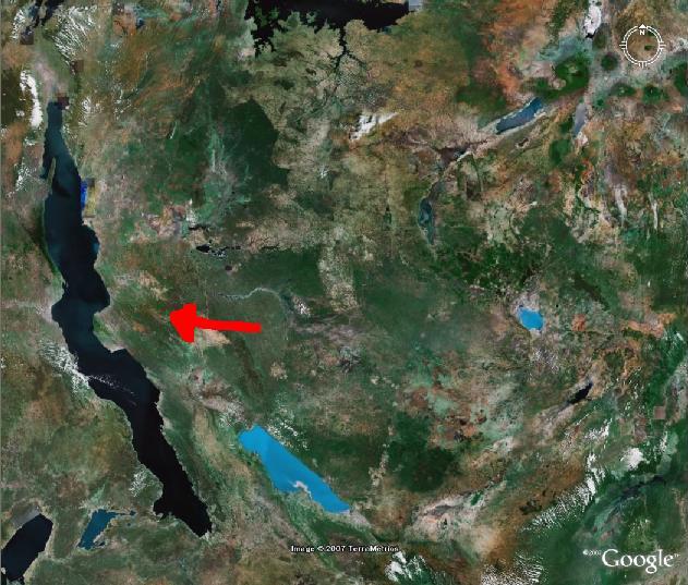
ProSat2. The main water feature is... |
|
|
|
 |
|
|
|
HINT
**2 French-speaking and 2 English-speaking countries border this major lake** |
|
|
|
|
|
|
|
|
|
|
|
** Lake Tanganyika
The Ngorongoro Crater is also visible (up left) ** |
|
|
|
|
|
|
|
|
|
|
|
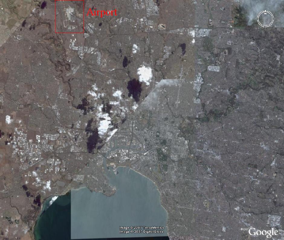
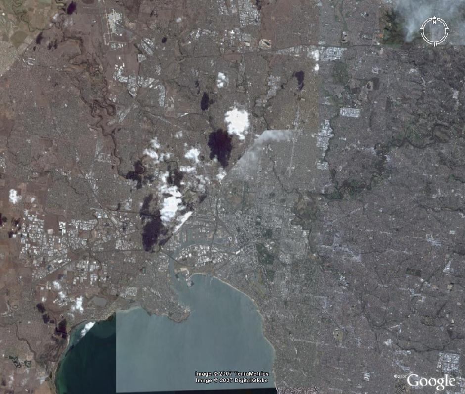
ProSat3. A Major City... |
|
|
|
 |
|
|
|
HINT
**Located on a scarcely inhabited continent** |
|
|
|
|
|
|
|
|
|
|
|
** Melbourne, Australia
with Tullamarine Airport ** |
|
|
|
|
|
|
|
|
|
|
|
How to work it out ? This city has a characteristic shape. Locating the airport can also help. |
|
|
|
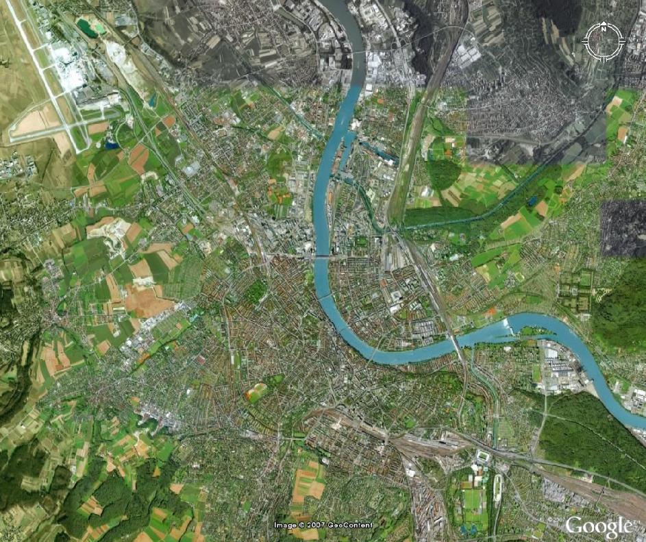
ProSat4. A Border City... |
|
|
|
 |
|
|
|
HINT
**This city is famous for its pharmaceutical companies and watch makers** |
|
|
|
|
|
|
|
|
|
|
|
** Basel, Switzerland ** |
|
|
|
|
|
|
|
|
|
|
|
How to work it out ? Even if you don't recognise the city at first sight, there are many clues: Is this a big city ? Are there any shanty towns ? How is the agricultural layout ? Does the Urban infrastructure indicate that the city grew recently or that it is old ? Any indication that a border is nearby ? |
|
|
|
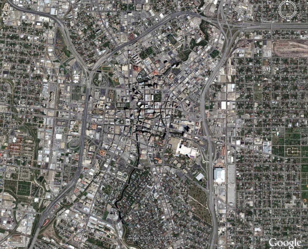
ProSat5. A City with a famous fort and a picturesque river... |
|
|
|
 |
|
|
|
HINT
**A Spanish name but not in a Spanish speaking country** |
|
|
|
|
|
|
|
|
|
|
|
** San Antonio, Texas
Fort Alamo is not easily visible, but the Riverwalk is ** |
|
|
|
|
|
|
|
|
|
|
|
 |
|
|
 |
|
|
|
|
|
|
All images used by special courtesy of Google, unless stated otherwise. Copyright. All Rights reserved for all countries. |
|