| Solar X-rays: Geomagnetic Field: |
| Solar X-rays: Geomagnetic Field: |
North Wales is often considered a great place for amateur radio, because we have lots of hills. In the map below the darkest green is the highest bit (well I drew it in summer!)
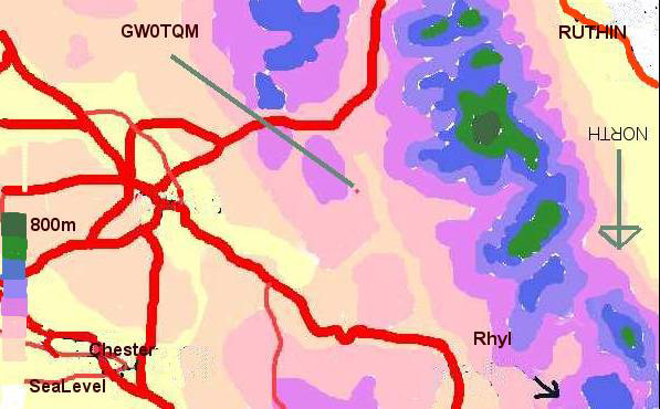
However, not all of us live on top of these hills! The two images below both refer to the same geographical area. One is distorted slightly in the name of 'perspective'... both images invert the above map, and as with the above image put SOUTH pointing to the top (This is because the view from the north is screened, so if I plotted it in 3D the nearest mountain would block your view!)
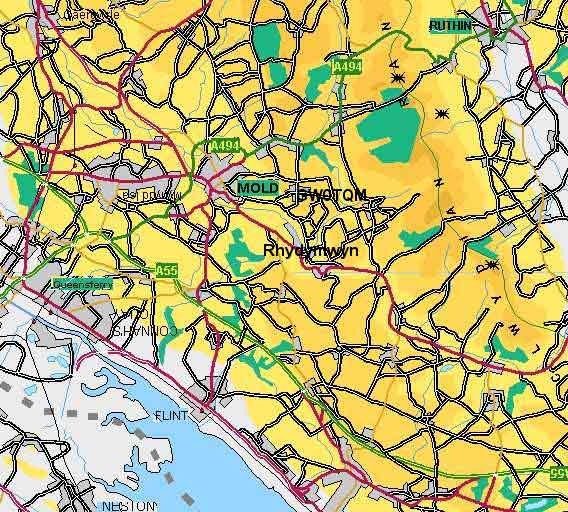
This map is also drawn upside down, North pointing down, so you can orientate yourself better with the following chart. On this map Rhydymwyn is the small village at about 4 o'clock from Mold. This is where I moved from - and GW0TQM marks the spot where I am now!
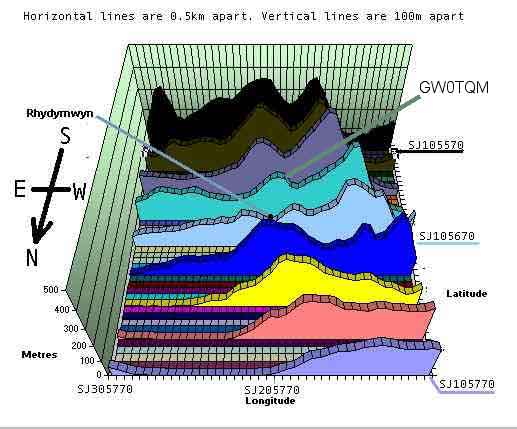
Notice on this map, the low lying nature of the Vale of Clwyd (top right) where Ruthin is to be found. Not also that I live in a hole, over a 100m above sea level!
Return to GW0TQM's: APRS/UIVIEW page
or Magnetic Loop page
or Homepage
or just click [BACK] on your browser.