 |
| Climbs are listed in order of increasing distance from the car or trailhead. Mile 0.0 is the airport intersection. |
| Mile 15.47 left side of the highway Boot Hill III 220' This climb is located halfway between Hanging Tree and the bridge. It follows thin, hollow ice up a north facing slab dihedral. From a riverside belay stance, climb a hollow curtain onto a thinly iced slab. Climb 60' up to an alder and follow a steep snow-ice gully to a vertical pillar with a belay cave behind it. From the top of the pillar climb 60' up a hollow ice gully to an alder and the end of the route. Rappel. Mile 15.49 left side of the highway Hanging Tree Left IV 120' This route is located across the Lowe, visible on the left past the double bridge. It is the left hand taller pillar of the pair and is steeper as well. Rap from trees or v-thread. The climb may be completed by climbing up the snow gully above the ice then hiking over to Snowslide Gulch and down. Mile 15.49 left side of the highway Hanging Tree Right IV 110' This climb is the shorter and less steep of a pair across the Lowe from the highway at the upstream end of the Canyon. Wading the normally unfrozen river is usually required though rubber knee boots are usually adequate. The climb reaches the bottom of a steep, left slanting snow gully at whose base there used to be a bent down tree, giving the climb it's name. Rap from trees or v-thread. |
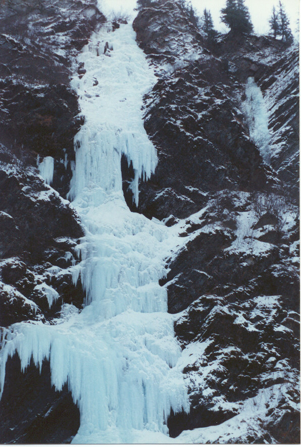 |
| Bridalveil Falls |
| All information is taken, with permission, directly from Andrew Embick's book Blue Ice and Black Gold |