 |
 |
 |
 |
 |
 |
 |
 |
 |
 |
 |
 |
 |
 |
 |
 |
 |
 |
 |
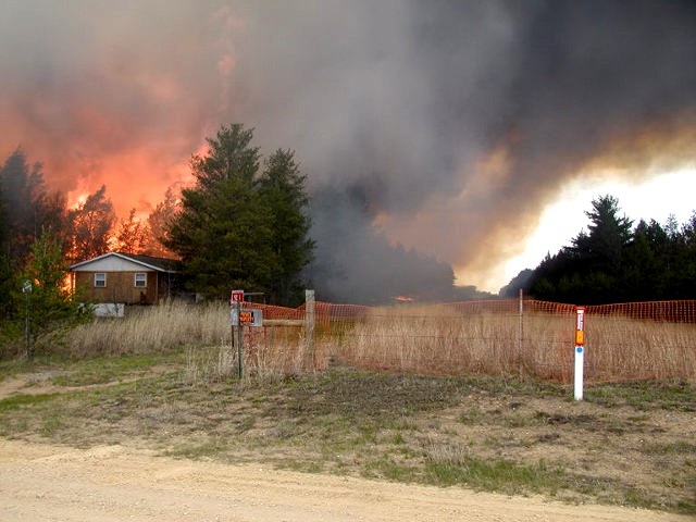
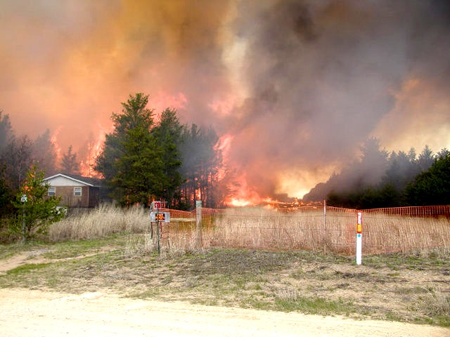
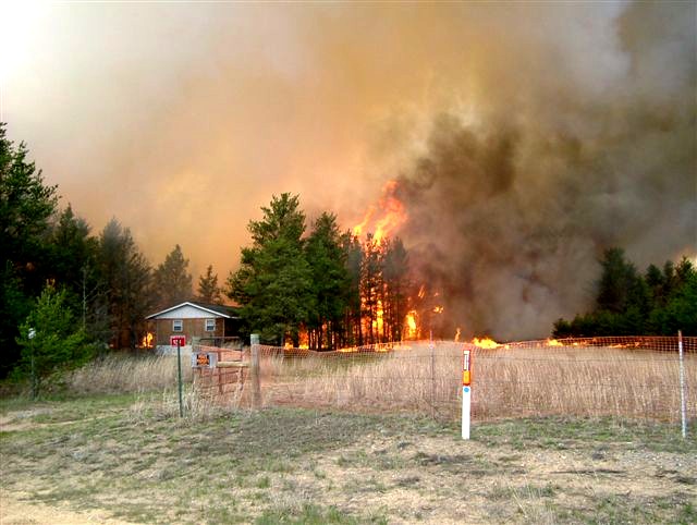
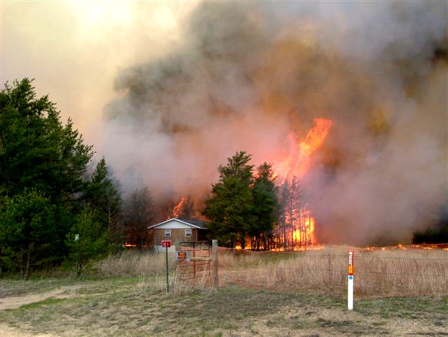
| Cottonville Fire |
| Adams County, Wisconsin Thursday May 5, 2005 |
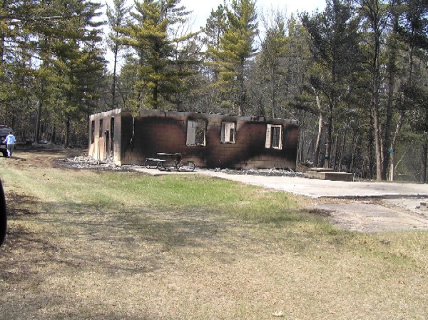
| - 3,480 acres - 78deg, 18% RH, 14mph - 7 miles long and 1 mile wide - Ignition ~1345 - Full Containment: 0030 - 13 primary residences lost - 17 secondary residences lost - 60+ misc out buildings lost - 100+ primary, secondary and misc buildings saved |
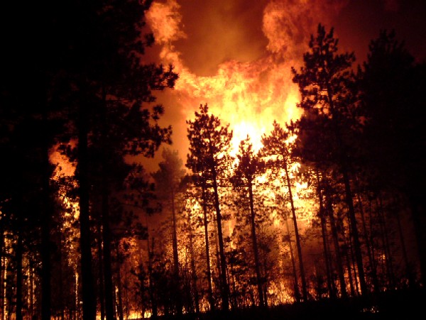
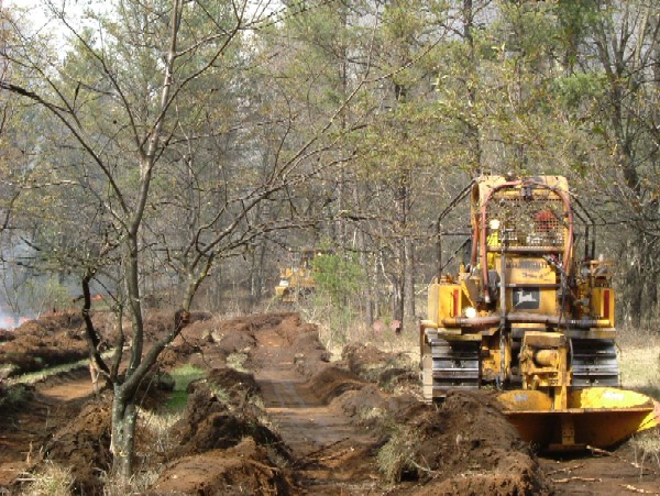
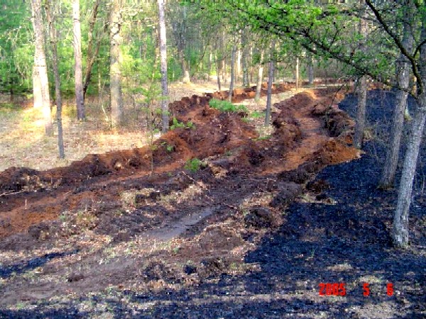
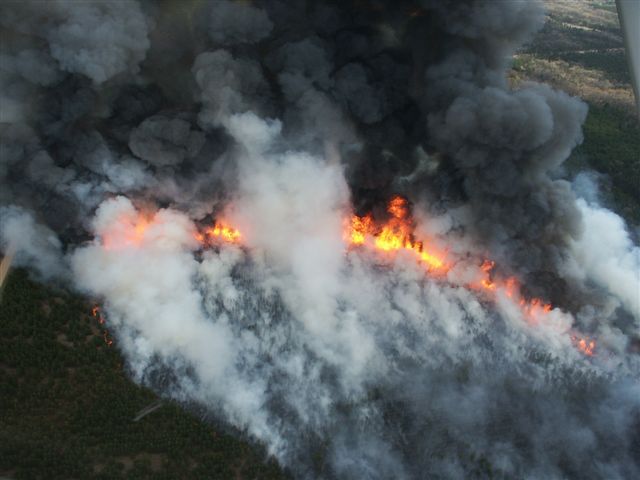
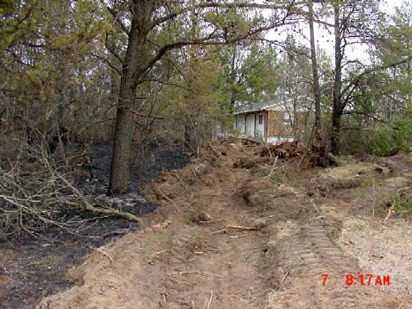
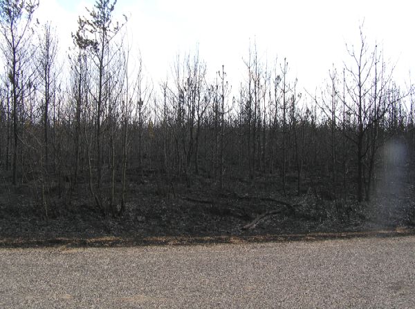
| I'm not sure where these photos were taken, but due to the mixed oak/pine fuels and the amount of daylight, I think they were very early in the fire. Photo at left was taken the following day and shows good results from double furrows and burnout operation. probably on the left flank of the fire. |
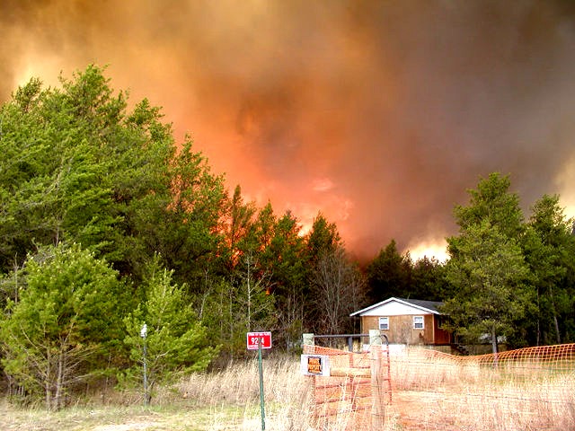
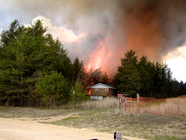
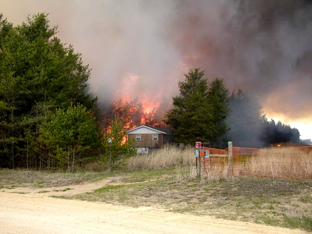
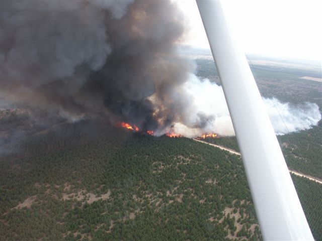
| Pilot photos early in the fire. At left the head and right flank are burning hard. I believe the road in the above photo is actually a utility right of way which is also seen in the last of the series below. |
| Yup, somehow this place survived. |
 |
 |
 |
 |
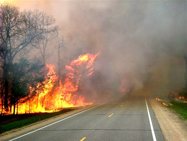
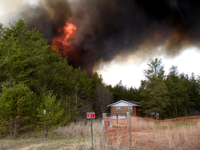
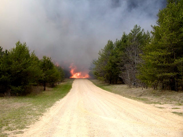
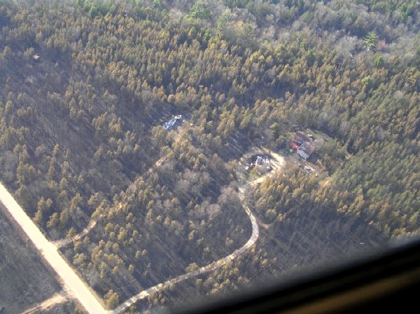
| Roads were no barrier for the head of the fire. |
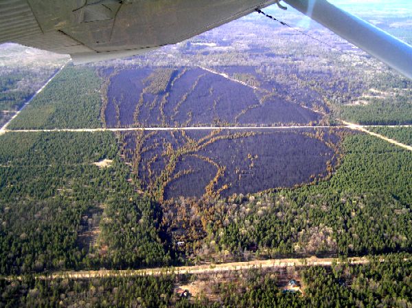
| Within 250 ft of the origin, the fire moved into a large young pine plantation with trees were about 15 ft. tall |
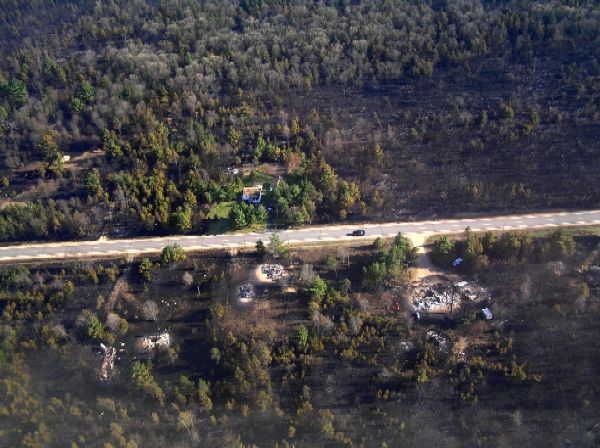
| Winners and Losers |
| At left: One out of four survive. The one with a well maintained yard, the others with a yard of wildland fuel. Hmmmm.... |
| At Right: one home survives while another and an outbuilding (in the circle driveway) are lost. This was along one of the flanks. You cant see it but the fireline is just beyond the scorched pine in the upper right of the photo. |

|