(Birmingham Central Library)
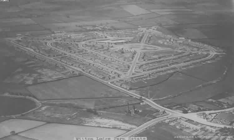
Witton Lodge
Circle, circa 1960
(Birmingham Central Library)
I reckon this is from around Streetly Road, beyond shot at the top would be College Road. So down the bottom is Bleak Hill Road meeting Perry Common Road and Turfpits Lane, and Witton Lakes bottom left corner (the lakes themselves of course are further over to the left). Not asphalted it seems. Note it was called the Witton Lodge Farm Estate, the farmland once covered that entire area.
It was known as The Wreck (or maybe Rec). During WWII it was used to store buses overnight. This was a dispersal tactic. Such was the reliance on public transport that if all buses were concentrated in garages and one was hit (e.g. Hockley Garage) a very large number of buses was put out of action. So at night they were spread in bunches all over the city.
Gates were at the end of Witton Lodge Road that now leads up the Spinney. Like today The Wreck was a play-area (between those two times it was just an open asphalt area). Became a play area with facilities again in the 1980's.
A former resident has more;
"You are right about the location of the roads.The fields on the opposite side of the road to Witton Lakes are the cornfields that the Italian PoW's worked on. I attended Hastings Road School during the 40's and you can see it above and to the left of the Ring. I walked through the Ring every day and it was tarmacked then".