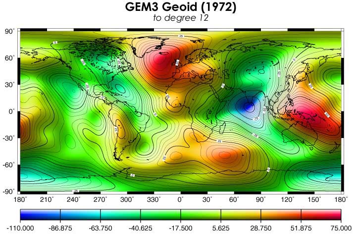
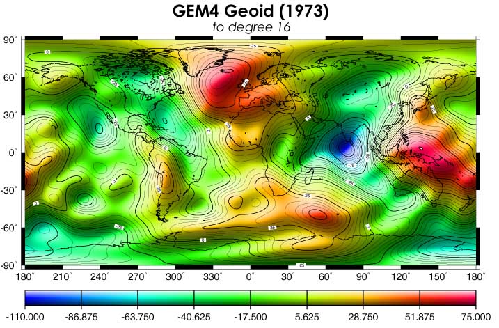
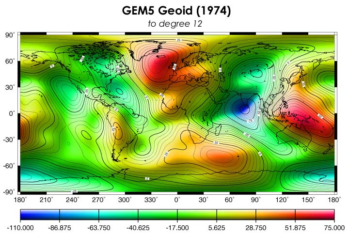
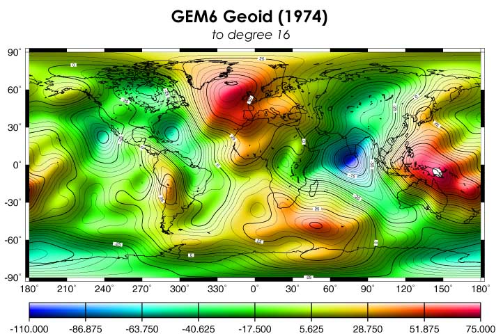
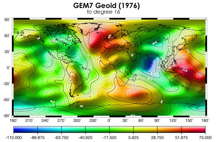
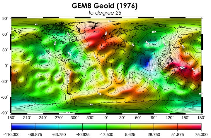
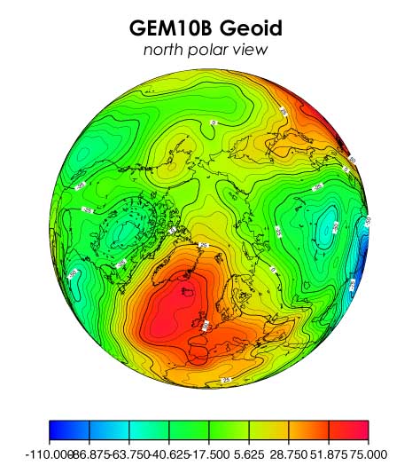
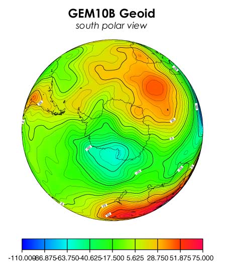
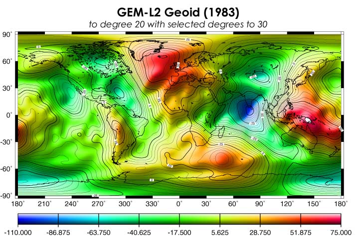
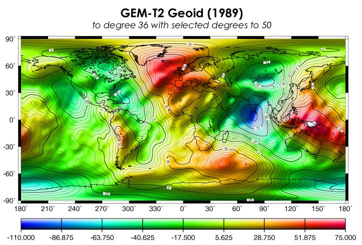
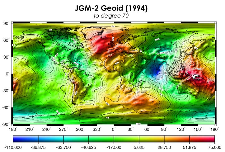
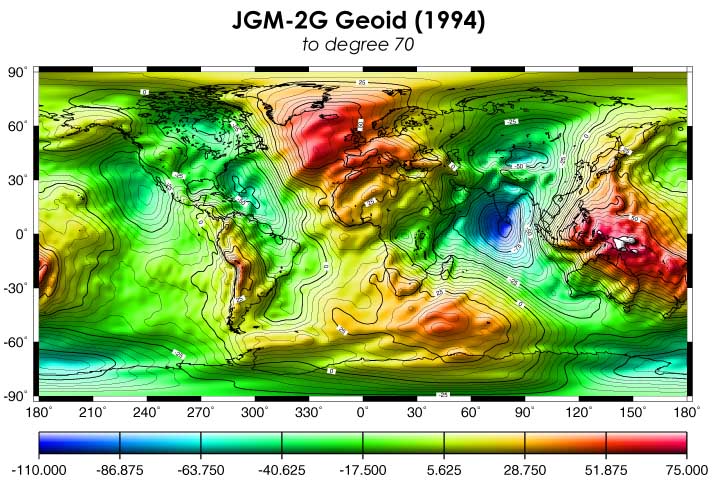
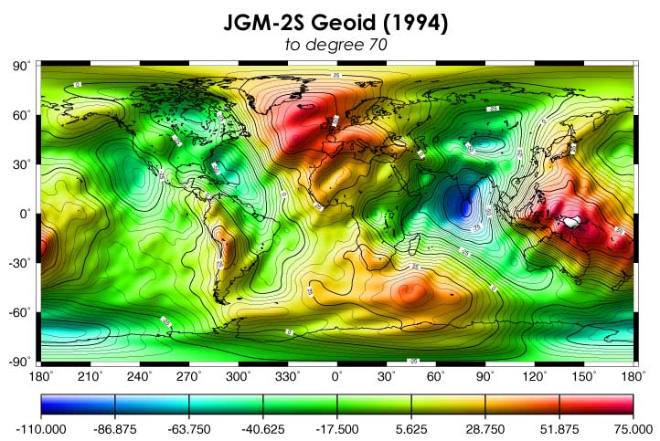
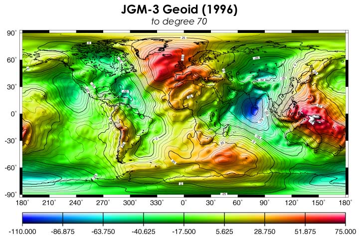
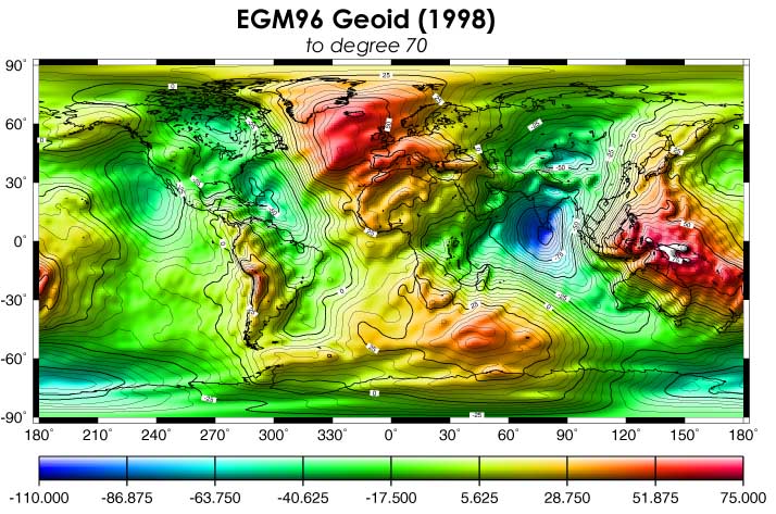
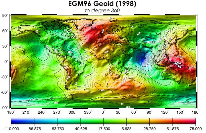
NASA has been in the gravity model business since the launch of the first earth orbiting satellite.But it wasn't until the early 1970's that NASA took the lead in the development of more accurate gravity models. This page uses maps of the Geoid to illustrate how the development went. What is notable in the sequence of these maps is an increase in the resolution of the geoid. The current state-of-the-art gravity model is the jointly developed EGM96 gravity model.
This page is dedicated to the memories of James Marsh, Frank Lerch and Girish Patel.
To use this page, simply click on the links below to see each map of the geoid.
Page last modified: November 12, 1999