ANALYSIS
& RESULT
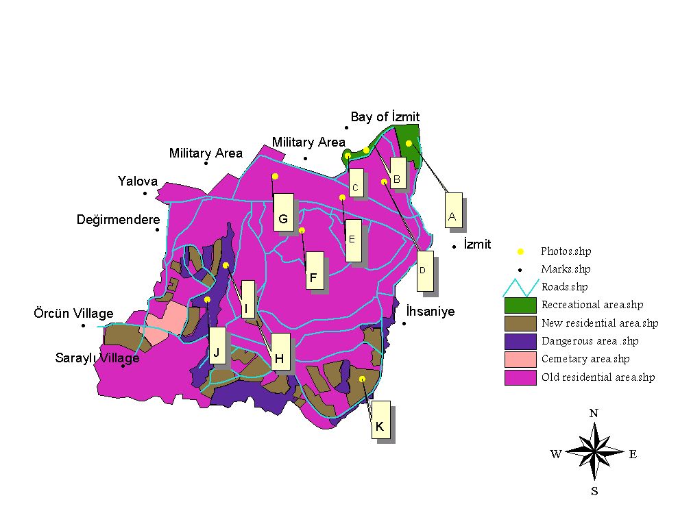
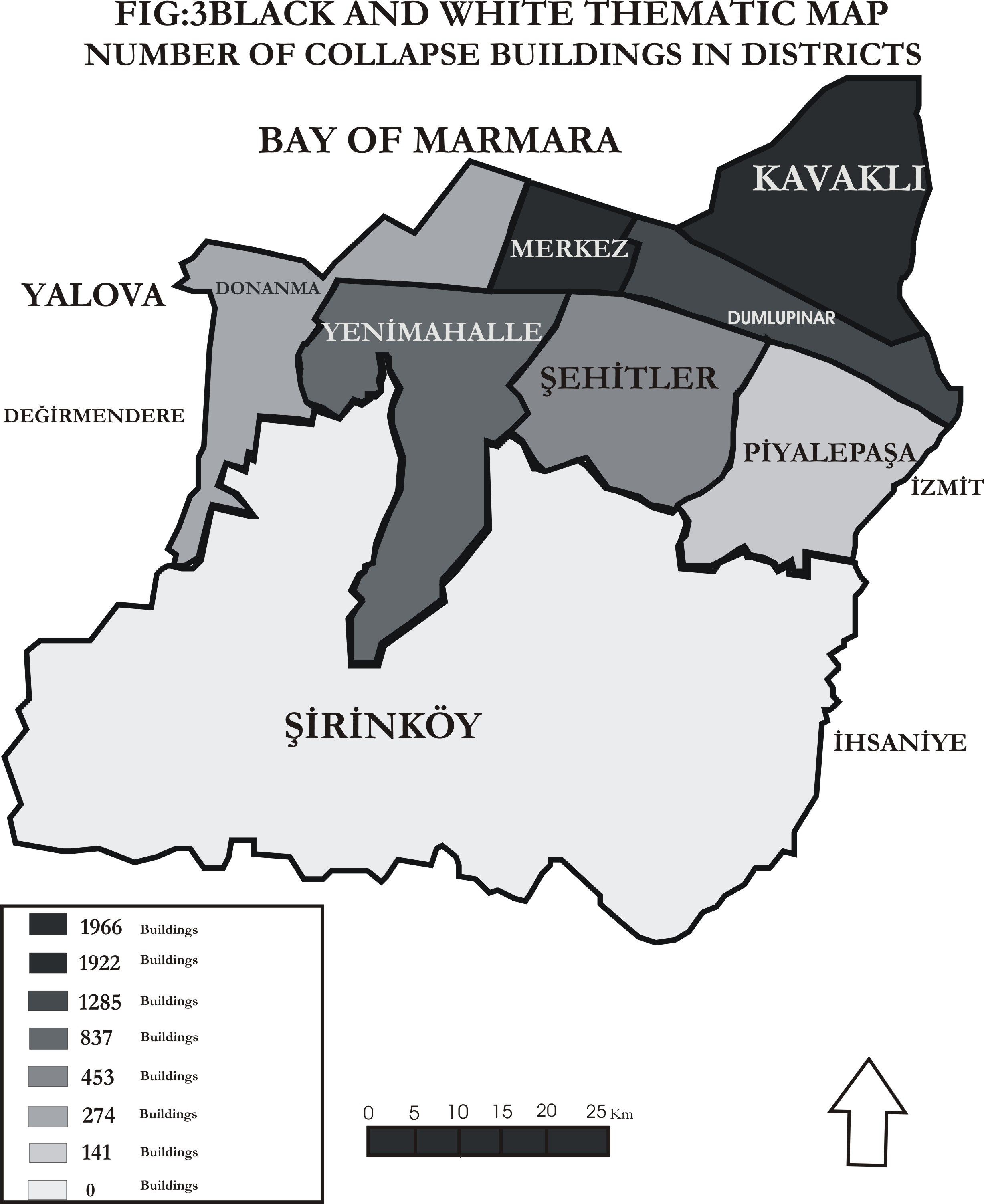
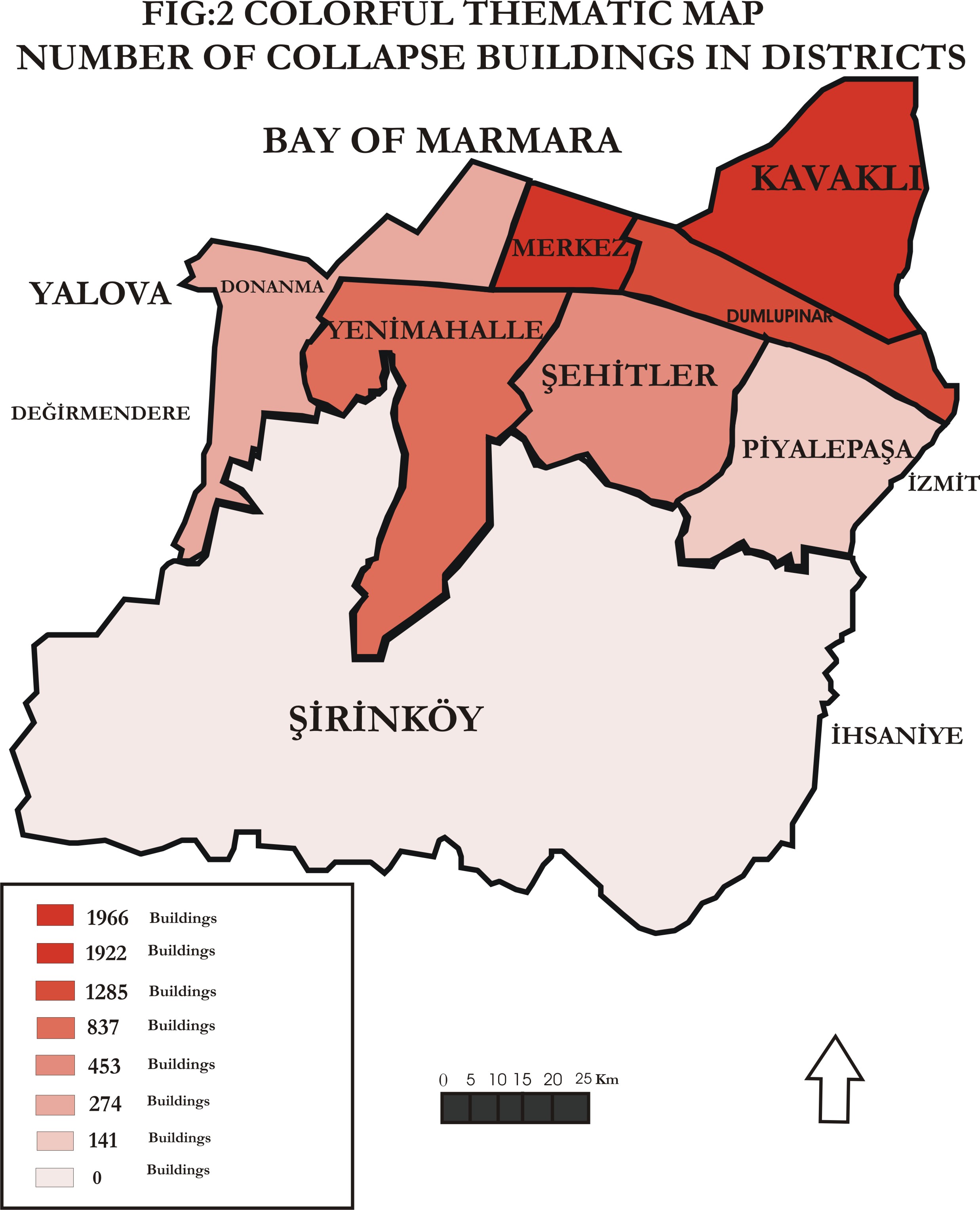
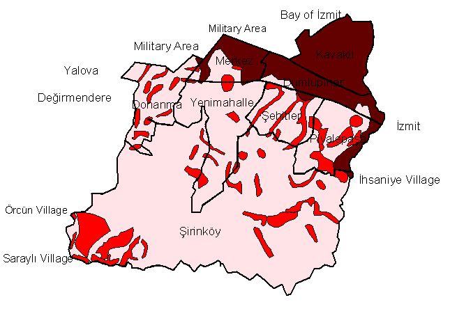
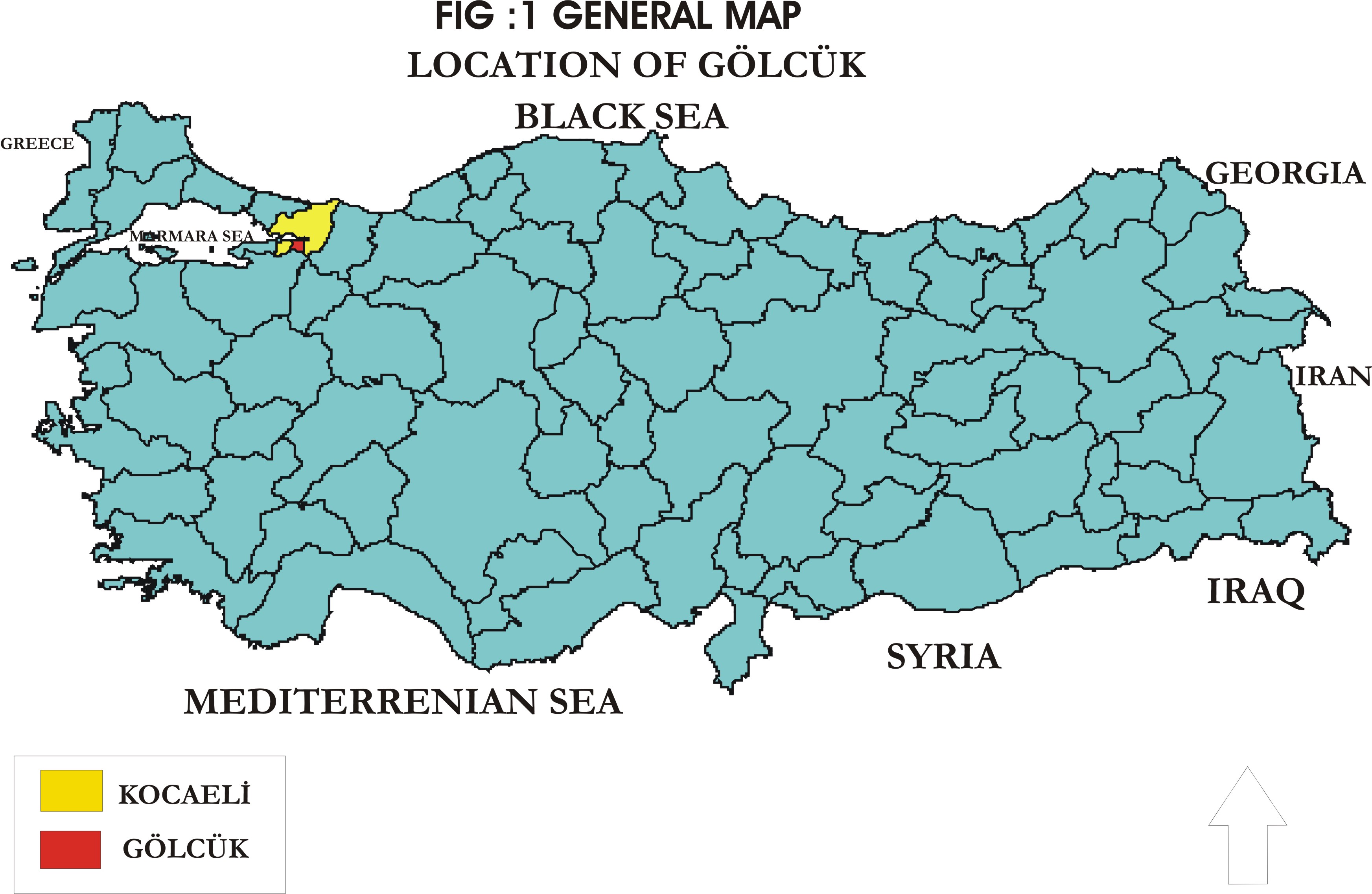
I created quarters map of golcuk from the base map of golcuk and I compered it with geology map , I seperated geology of golcuk in 3 class with using spatial analysis , these classes show worst , modarete and best for settlement , so dangerous regions are distinguished clearly with it , mostly dangerous areas was formed alluvium that place is around the coastal part of Gölcük . Safety places were formed by Aslanbey Formation that found high region of Gölcük . Moreover I created two thematic map these are colorful and black & white thematic map , these maps include damaged buildings amount according to quarters . And I used hotlink methods for showing photos about golcuk with using base map of golcuk .