
|
||||
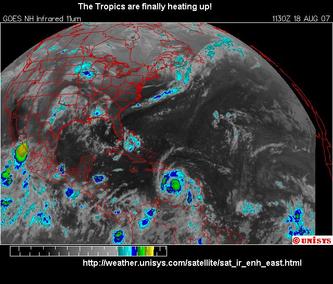
The tropics are finally heating up!
Image above from the Unisys weather satellite images site.
When Dean's central pressure reading reached 930 millibars on August 18, it became one of only a handful of storms in the last decade to attain a pressure this low. A lower pressure means a more powerful storm overall. The central pressure combined with the radius of the eyewall determines the wind speed. Most hurricanes only achieve category five status over open water, where the atmospheric conditions are perfect for intensification. The storms intensity also tends to "pulse" as the storm evolves. Very few storms make landfall above category three.
Remember 2005? When I asked "Is Dean Another Wilma?" you will notice that I did not say Katrina or Rita, even though those storms were more intense. Katrina was not a Cape Verde storm, it was a "Bermuda triangle" storm that originated in the waters off the Bahamas and crossed Florida from east to west before intensifying rapidly over the warm Gulf water. Wilma formed in the Carribean and intensified rapidly as it approached Yucatan. It was Wilma that made a direct hit on Cancun and then turned in the gulf and crossed the Florida peninsula from west to east affecting both coasts(!). Only five storms that year had a central pressure lower than 930 mb- Dennis, Emily, and of course the three most intense storms on record in 2005 or any year- Katrina, Rita, and Wilma.