  The 'making of'
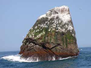
As most readers will probably understand, Friland only exists in my imagination. In the real world there is nothing but an elevation of the ocean floor where Friland is located, which is called the Rockall Plateau. The only part of it that is visible above water is a tiny, uninhabitable rock named Rockall, which has in the past been annexed by England but is also claimed by Ireland, Denmark and Iceland. Not because of the rock itself but to be able to claim fishing grounds and any raw materials that might be present in the surrounding ocean floor. Below: I've taken this picture during a flight to America, while I was flying directly above the spot where 'Friland' is located. Below these clouds lies the Atlantic Ocean, in which the Rockall Plateau is situated on a depth of 1,3 kilometers (0.83 miles). Down there I would have loved seeing the impressive Langfergun, the reflection of the sun in the Innansai and the buildings of the capital Riksgard, but alas... Only in my dreams! 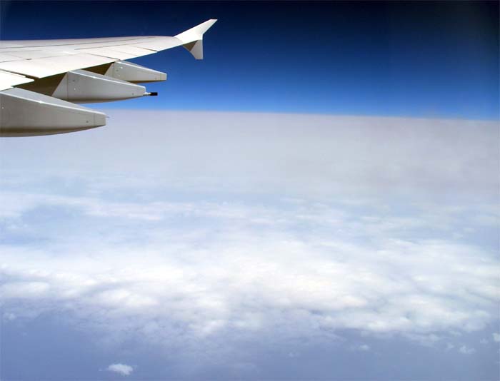 Background information As a little boy I was already a daydreamer with too much imagination. When I was ten years old I wrote big files about dinosaurs, invented my own bank notes and when playing war I tired the other children from the neighbourhood by designing elaborate attack plans for the capture of the park and the playground, including pincer movements, wedge formations and code names. In that period I also created my first fictional country: it was called "Alerië" (Aleria) and was inspired on the United States. Naturally, the other children thought I was a bit weird, but psychologists preferred to call it Asperger's syndrome, which is not that inappropriately nicknamed 'The geek syndrome' or the 'Oops! wrong planet syndrome'. Earlier geofiction projects In 1994 I started with my first serious geofiction project: the country I made up was originally an island but later I decided to give everyone I knew his or her own country and add that to my island. After school I then enjoyed myself with the total annihilation of the country of the one who had crossed me that day, after which I added it to my own, which started to look more and more like the Evil Empire from Star Wars. The world around it grew into a planet with continents, for which I then created new countries like the city state Bôlon, the empire of Hunolia, the Scandinavia-like country of Hårkdaven and the big country of Zandië (Sandia), which was inspired on the Middle East. The tropical land of Reksonië had similarities with Indonesia and Tuigland (Scumland), the bad guy of the story, had strong similarities with the Soviet Union. Eventually I grew tired of the project and threw away dozens of files and lists, amongst these were atlases, city maps, aircraft designs, newspapers and the complete space program. I only saved one map with basic information, which I sometimes leaf through when I'm in a nostalgic mood. Hereafter I worked on a Tolkien-like project that was inspired on the Nibelungenlied and the fall of Constantinople and I wrote a few science-fiction stories. The Friland project Because I'm fond of the "What if" conversations that many history enthusiasts tend to engage in, I have often wondered what England would have looked like when the Anglo-Saxons would have won the battle of Hastings, or what Europe would have looked like without the Romans or Christianity. In 2007 I therefore decided to start the Friland project: it was to become a country in which the ancient, native culture of North-western Europe is preserved and fit into a modern, Western society. Europe as it would have been when history would have gone slightly different. The people I told about the project were enthusiastic and advised me to put it on the internet, hence this website. Work started in May 2007 and was almost a year later sufficiently progressed to put it online, I however doubt that the project will ever be "finished". I created Hiveria, the rival neighbouring country, as a counterpart to Friland. Both countries show aspects of modern Europe: Friland that what it used to be and Hiveria that what it is becoming; the old against the new. However, it's not the case that either of these countries is "good" or "evil": one person will identify more with Friland while the other feels more for Hiveria. Both countries are no utopias but have their own advantages and disadvantages. Hereunder: a piece of the map of Friland after tracing the first rough sketch and adding the hight and depth lines. Thereunder the finished version. 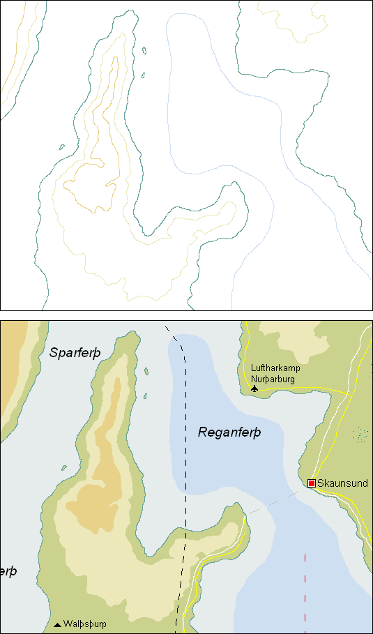 Little facts about Friland Hereunder: the city map of the Frilandic capital Riksgard. At the top you see the original sketch and thereunder the final version. 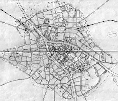 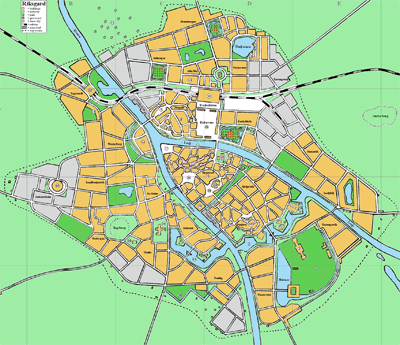  |