We headed north on Sunday, August 6, which happened to be Linda's 40th birthday. We were fully recovered from the party on Friday night. Traffic in the morning on Interstate 95 was not too bad, but by the time we reached New York City, it was afternoon, and the road was clogged with weekend travelers. It took almost and hour and a half to travel the last two miles to the Washington Bridge to get across the Hudson. Once across, we bailed off of 95, hoping to find less crowded roads further inland.
The strategy worked through Connecticut, but once we reached the Massachusetts Turnpike west of Boston, we were back to a crawl. I-190 and I-495 were much better, but I was getting quite tired. We started looking for a motel but the pickings were very slim. I didn't know that the area west of Boston was such a high tech business zone, which made the lodging rates sky high. I finally gave in and paid $115 for an average room just south of Lowell, MA. The pool closed at 8 PM, which disappointed the kids, and I found rather strange.
We got a good start the next morning, and in no time were back on I-95 near the New Hampshire border. Traffic thinned out quickly and was very light by the time we were past Portland. It was a gray day, and soon the clouds were skimming the treetops and drizzle was falling. It was along haul across Maine, and we arrived at the border town of Houlton around 3 PM. After a stop at the grocery store and topping off the gas tank, we crossed into New Brunswick hoping to get to a bank to change currency before they closed.
It was good that we took the time to stop at the information center just across border. We found out it was a holiday (New Brunswick Day) and the banks were all closed. The helpful staff there said we might have problems finding lodging. They helped us find a room in Grand Falls, about an hour away.
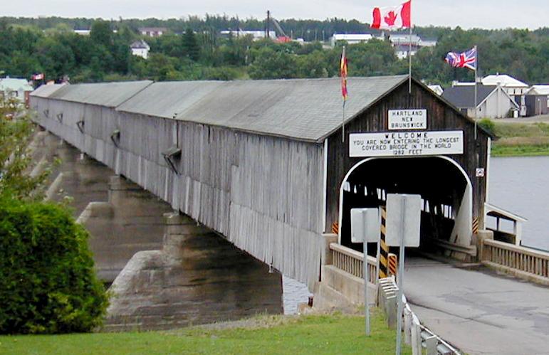
We headed north with no Canadian money, but assured of a place to sleep. The drizzle had stopped, but it was still gray and gloomy. We took time to drive into Hartland to check out the "world's longest covered bridge".
(Hartland Bridge || Photo 2)
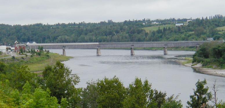
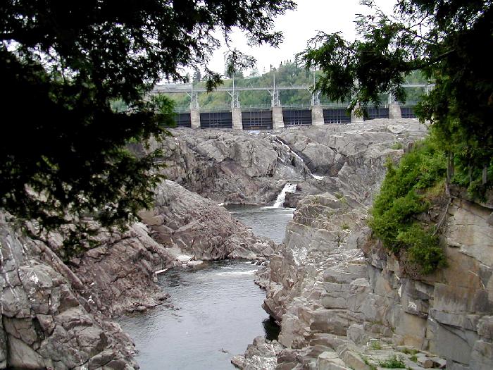
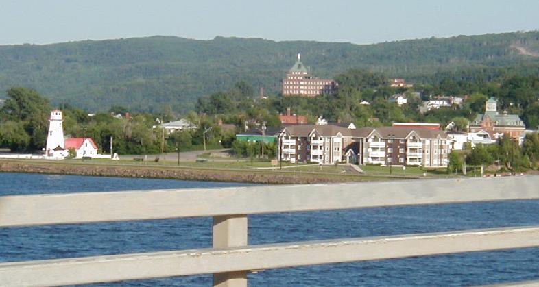
Grand Falls was a nice little town, cut in half by its namesake falls and gorge.
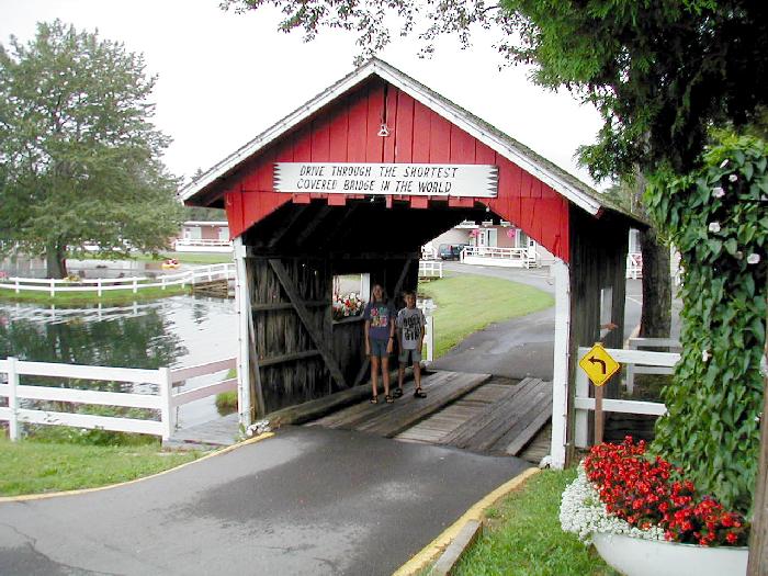
Our accommodations turned out to be very nice, with a wonderful indoor pool for about $75 US. The "Auberge" had very nice grounds, with a small pond, many flowers, and the "world's shortest covered bridge".
There were a few breaks in the overcast when we continued north at 8:00 the next morning. We were only about 40 miles out of Grand Falls when progress came to an abrupt stop. A tire on the tent trailer blew, no thanks to the bumpy road. It took me the better part of an hour to get the wheel off because I couldn't stop the tire from spinning when I tried to break loose the lugs. I guess that proves the trailer wasn't overloaded. As soon as I got it off, I noticed that the rim was split from the stress of the blowout. I wasn't going to head further north without a spare.
Speaking of spares, when I put it on, I found it was too low on air to use. Those tires run about 75 - 90 lbs psi, and my cursory hand pressure on the spare before the trip did not diagnose the problem. Well, I unhooked the trailer, and headed back to the nearest town (St. Leonard) with the low spare and the wrecked rim. A very nice fellow that spoke good English (as opposed to French) helped me out at "Flat Fixers" by airing up the spare and valiantly looking for but failing to find a replacement rim. He did know of a place that would have one that was only about 30 miles further out of our way.
We drove the 60 miles out and back to Edmundston and got a brand new heavy duty tire and rim for only about $60 US. Then we drove the now familiar 15 miles from St. Leonard back to the trailer, but guess what? The new tire was also under-inflated! That was nearly the last straw, but somehow I managed to at least mostly control my temper. I put on the spare, but since it was quite old, didn't want to trust it for 50 miles to the next town, so back we went to St. Leonard to air up the new tire. I came real close to bringing my 12 volt DC air pump on the trip. Its small and light. I bet I won't leave it home again!
Anyway, it was after 1 PM when we finally started making further northbound progress. I came real close to bagging the whole idea and vacationing in Maine instead. The weather was alternating between sun and torrential downpours from scattered afternoon convection, which also slowed our progress. We had reservations for a campground that night in le Parc de la Gaspesie (a Quebec Provincial Park), but I had no idea how long it was going to take to get there.
Reaching Campbellton by 5 PM put me more at ease.
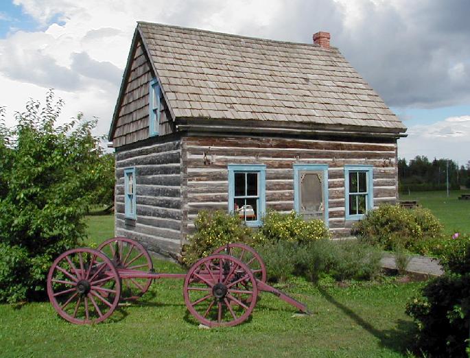
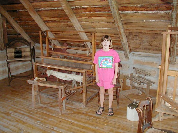
We crossed the Chaleur Bay bridge and entered Quebec shortly thereafter. A nice information center located next to an 1845 vintage cabin made for a good rest stop.
The interior was furnished by period antiques.
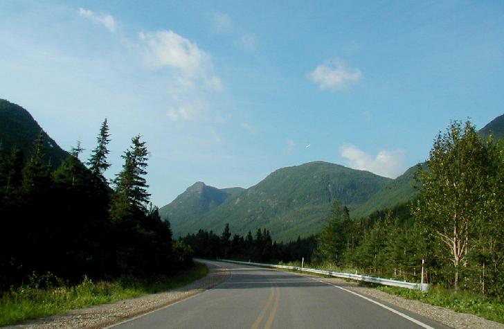
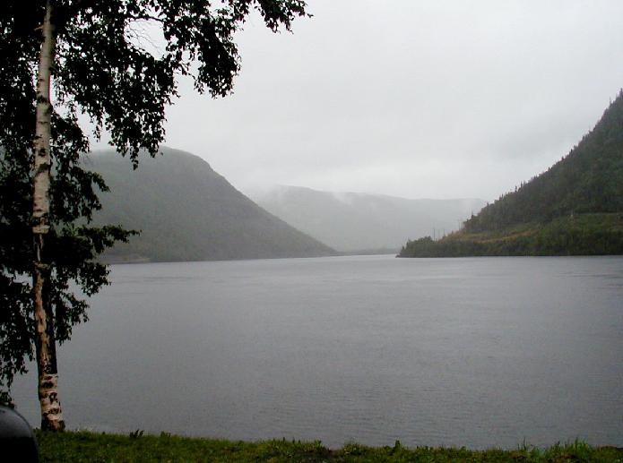
After another hour up the coast, we turned inland heading for the mountainous center of the Gaspé Peninsula by following the Cascapedia River.
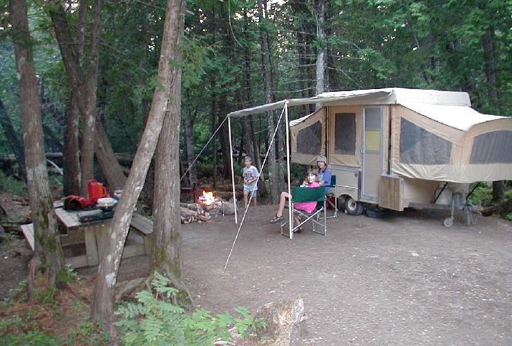
We arrived at the campground at about 6:30 PM, and received by luck of the draw one of the nicest sites there.
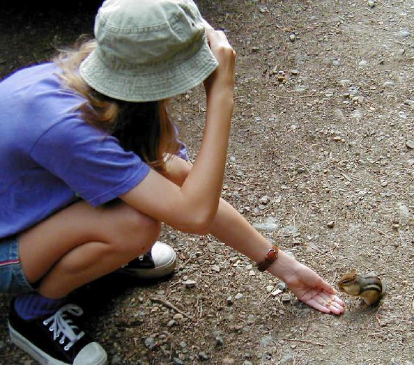
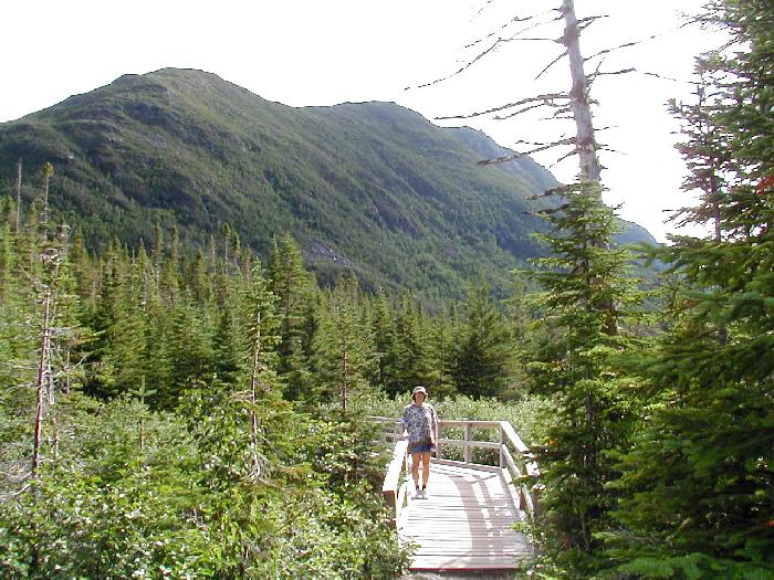
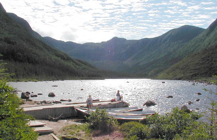
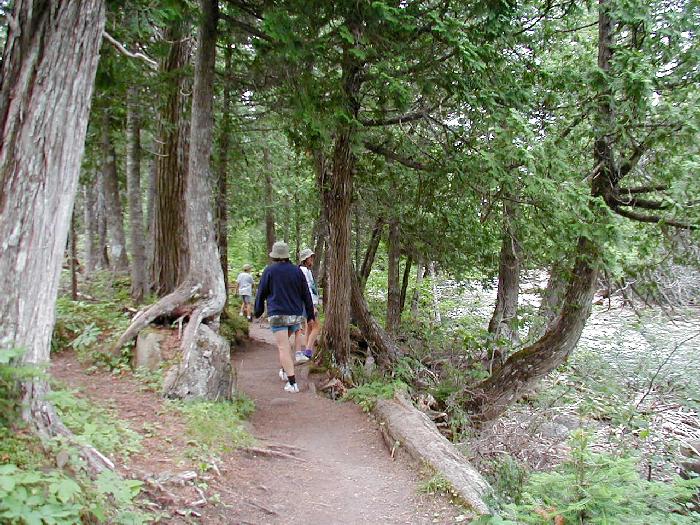
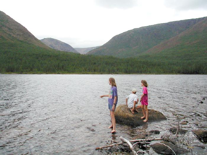
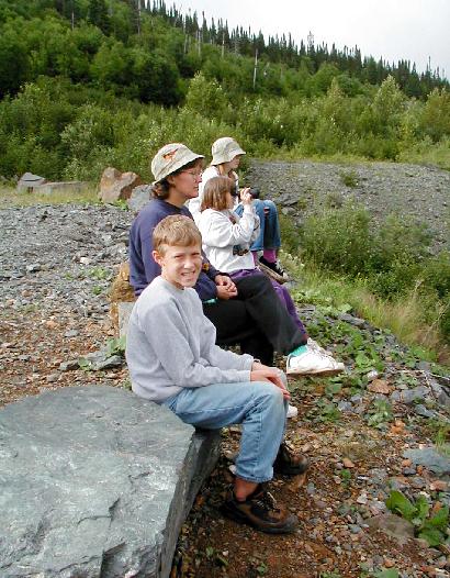
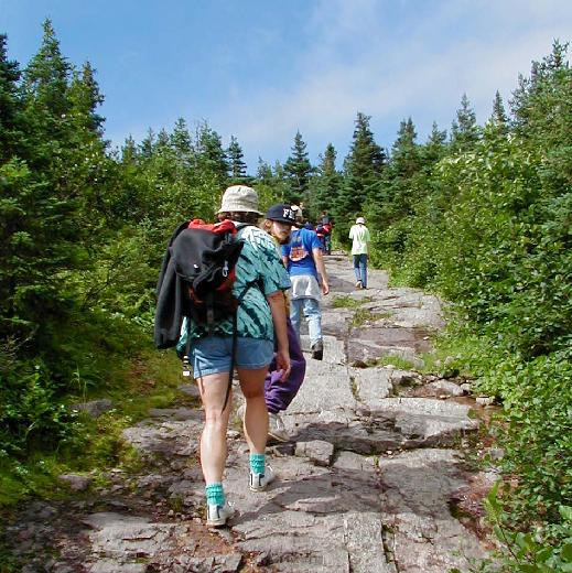
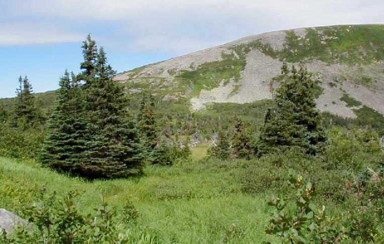
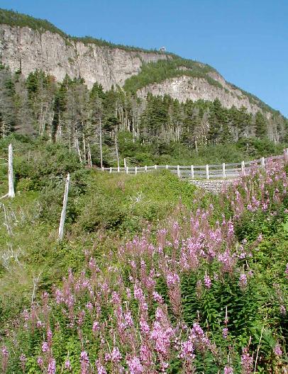
The next morning dawned clear and calm. The kids started their day by feeding the brazen chipmunks. I know you are not supposed to feed wildlife in a campsite, but these critters would come right up and demand food.Plans called for a leisurely morning followed by a half hour drive to the Mont Jacque-Cartier trail head with a 9:45 AM arrival. The trail to the summit is only open from 10 AM to 4 PM for a couple of summer months. This is to protect a small herd of caribou that inhabit the tundra that covers the summits of the McGerrigle Mountains. By the time we hit the road, low clouds were obscuring the higher summits, so I aborted the drive at a much closer trailhead; Lac aux Américains. It was a short hike to a large lake filling a cirque on the west side of the McGerrigles.
(Linda on the trail near the lake || Lac aux Américains || Joanna and the lake)
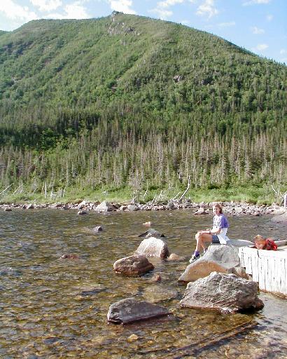
There is a day-use shelter at the lake, and an overnight use hut a short distance before the trail reaches the lake.
(Linda at the shelter || Matt at the cabin)
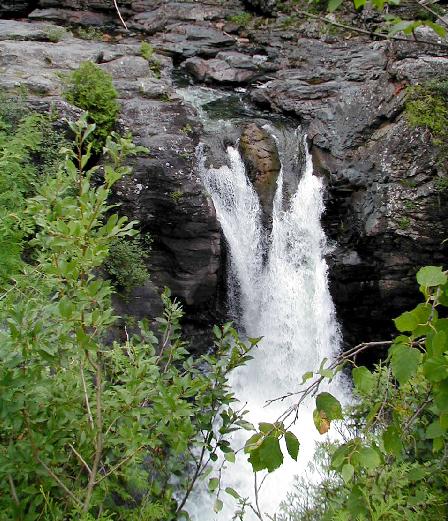
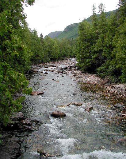
It was still early enough to head for Mont Jacques-Cartier after the hike, but the weather looked marginal. The Chute de Riviere Ste-Anne near camp sounded like a good alternative. It turned out that the walk to the falls was only a few dozen yards.
We continued upstream.
(On the trail along Riviere Ste-Anne || Riviere Ste-Anne)
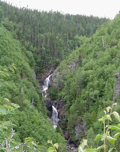
The hike to Chute des Diables took well under an hour.
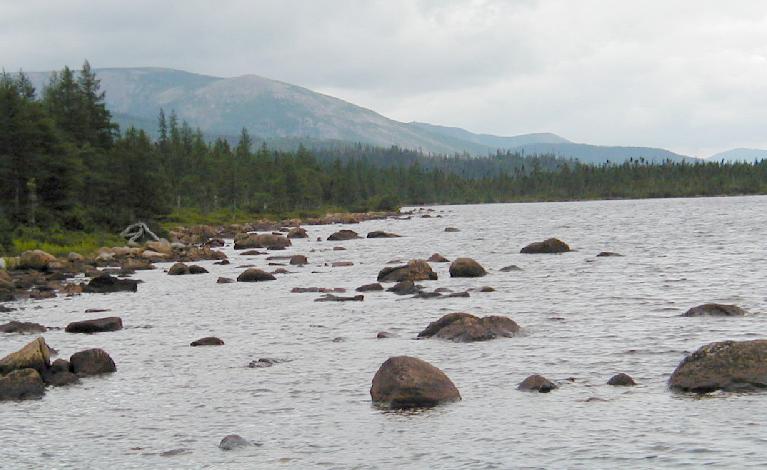
A very steep climb brought us to Lac des Diables.
(View south from Lac des Daibles || Mont Albert from Lac des Daibles)
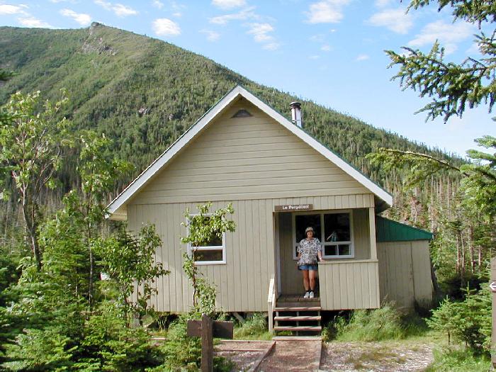
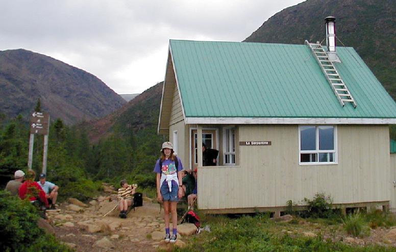
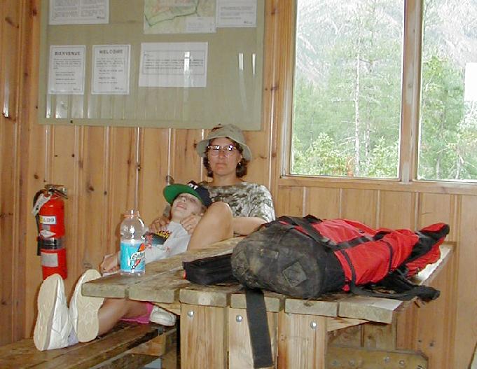
An easy hike from there brought us to the day-use shelter further up a huge glacial gorge on Mont Albert.
(La Shepertine Shelter || Linda and Kayla relax in the shelter)
There were many blueberries along the trail that were enjoyed by all. For some reason, we seemed to be the only ones on the trail to be eating them? It started to drizzle just as we headed back down the trail from the shelter. By the time we were back into the deep woods, it was raining and we were all wet, but too warm to bother with rain gear. Matt started to run out of gas and needed constant prodding for the last 2 kilometers to the trailhead. He wasn't complaining, just lethargic. Had it been colder, I would have thought him hypothermic, or even drunk. The rain continued on into the night. Linda cooked dinner in the rain undaunted. She briefly sported a foil hat to mock the rain gods. Matt was fully recovered once his stomach was full.
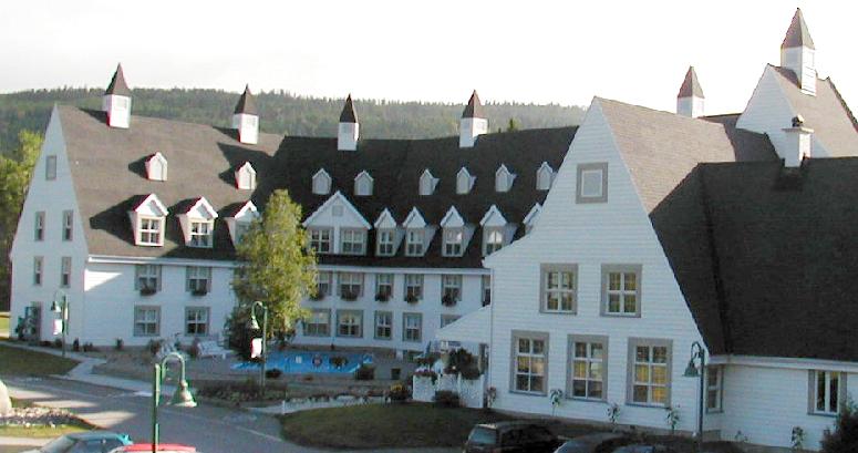
Our campground registration gave us access (for a fee) to the heated pool at the nearby lodge. A combination of weather and laziness kept us from taking advantage of this option. In fact, we never even went into the lodge, which was celebrating its 50 year anniversary and had been recently refurbished.
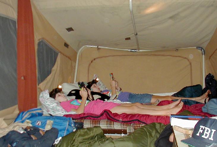
That evening we started a bedtime ritual of reading in bed for about an hour before lights out. This relaxing time was observed every night for the rest of the trip. Actually, in the photo below, the kids are playing with their Game Boys, which worked wonders to keep them occupied during driving times.
It rained hard on and off throughout the night and into the morning. Hiking Jacques-Cartier was out of the question, so we jumped into the van and headed for the copper mining town of Murdochville to get a mine tour. Just outside of the park, we stopped at the Mont Lyall Agate Mine. The fellow there was the first person we ran across that spoke no English at all. Even so, he wanted to sell us a tour (at a very reasonable price) or let us dig for a considerably higher price. I managed to utter enough French to tell him I just wanted to buy a specimen, and found a nice cut and polished geode for about $15 US.
From there, we followed logging roads east, keeping a watchful eye out for moose. Once I turned off the main road to visit a lake where moose might more likely be. In a short distance, I was flagged down by a passing pickup. Another friendly non-English speaking fellow proceeded to ramble on quite awhile, even though I told him I didn't speak French and didn't understand a word he said. It turned out he was telling me about some road construction ahead, and instead of trying to get through it, I just turned around and headed back down the main road. I bet those road workers don't see too many vans full of American tourists there.
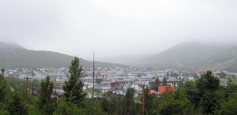
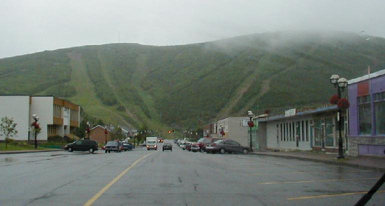
It was pouring rain at Murdochville, with low clouds hiding everything more than a hundred feet above valley level.
(Murdochville from the Interpretation Center || Main Street)
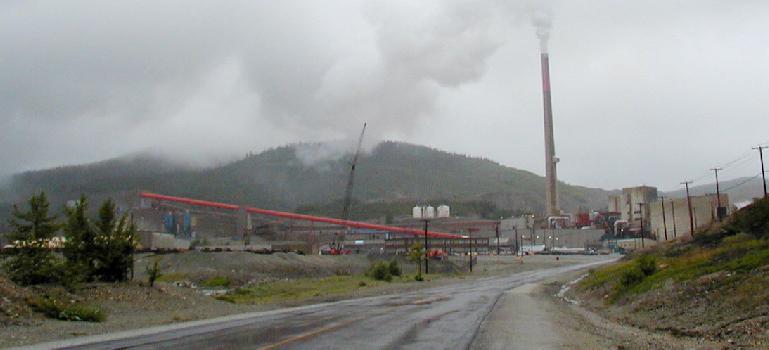
I missed the sign for the interpretation center, but was given directions (in broken English) at the main gate to the mine.
(Mines Gaspé Mill and Smelter)
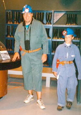
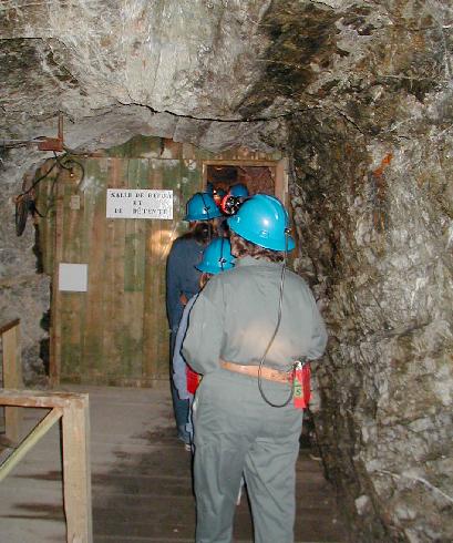
They found us an English-speaking guide at the visitors center. We wanted the complete tour, but were informed that children under 14 were not allowed in the smelter. To be fair, none of us went on the mill/smelter tour, but we all opted for the underground tour. We were directed into a room full of miner's apparel and dressed appropriately. Everyone got a good laugh when the largest jumpsuit was about 6 inches short on me, and my bare legs below my shorts were quite exposed.
(Shivers family miners | Shorts?)
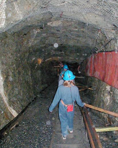
After dressing, we were led underground into the Miller Mine, an exploration effort from the late 50s dug solely by a fellow that was 68 years old when he started, 72 when he quite, and lived to 104! Although sulfide mineralization was evident, the vein he was following never led to the mother load (now mined by open pit methods), which was discovered nearby.
(Joanna descends into the mine || Linda near the underground lunch room door)
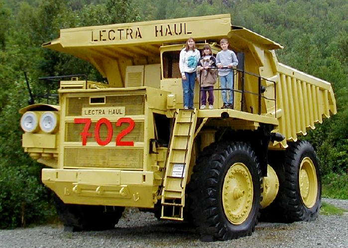
Once back on the surface, climbing on the heavy equipment on display was a must.
(Joanna, Kayla, and Matt on a rather large dump truck)
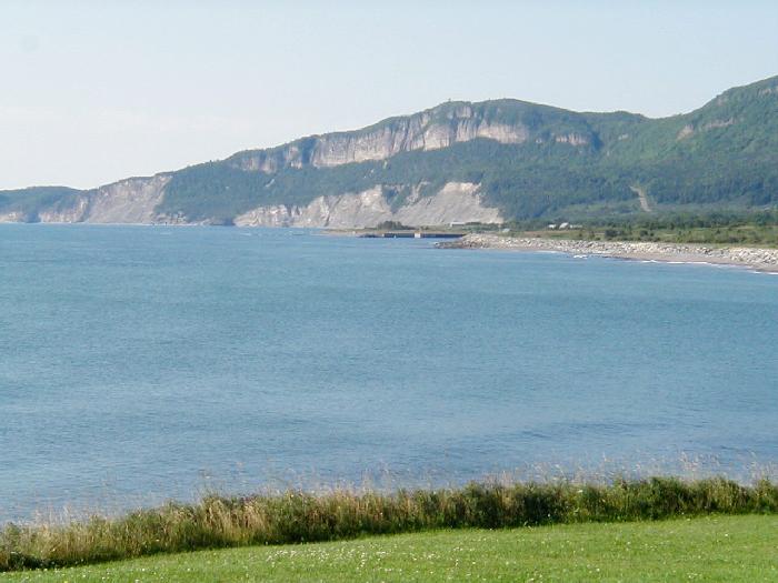
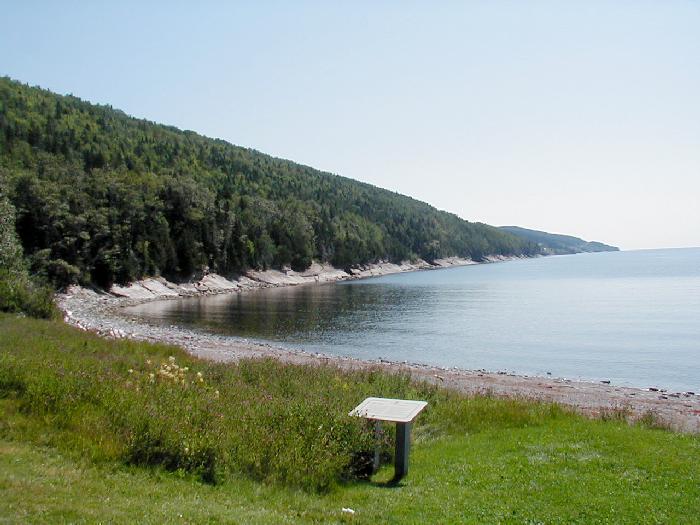
From Murdochville, we headed north for the Fleuve St Laurent, lunching at a nice lakeside park just south of the coast.
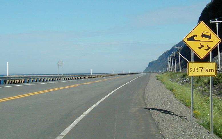
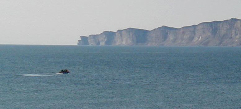
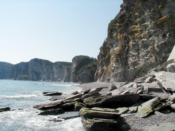
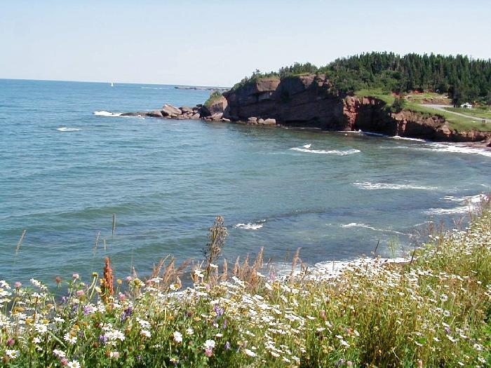
The stormy coast was far more impressive than I expected. We headed west, aiming to complete a loop tour for the day. The Saint Lawrence estuary was wind whipped into a frenzy. Waves were crashing on the rocky shore and splashing higher than the road. Signs warned of the danger.
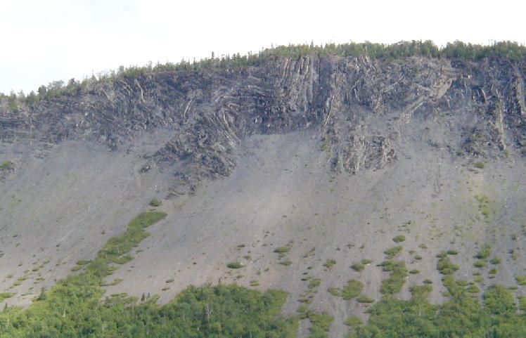
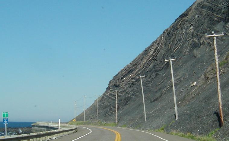
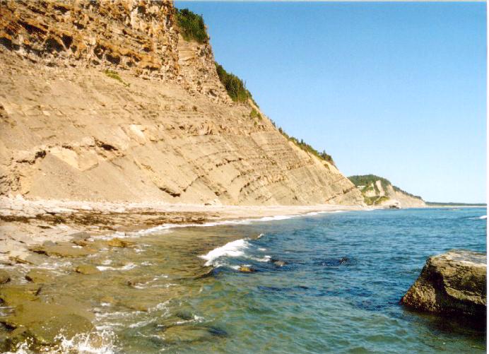
The visibility was poor, but the scenery was still impressive. In most places, the road hugged the base of sedimentary layer-caked sea cliffs.
(Mont Louis - textbook geology || Roadside geology)
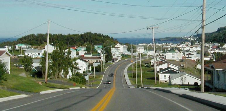
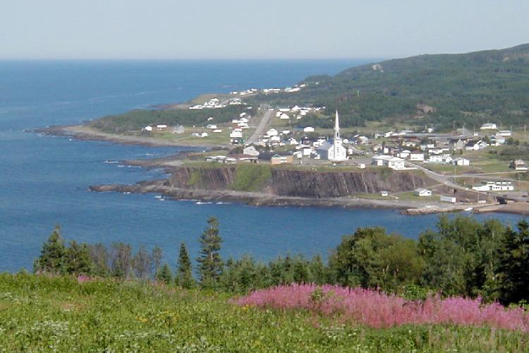
Small villages were closely spaced.
(Stormy village of Les Méchins)
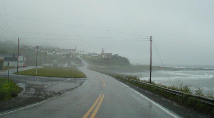
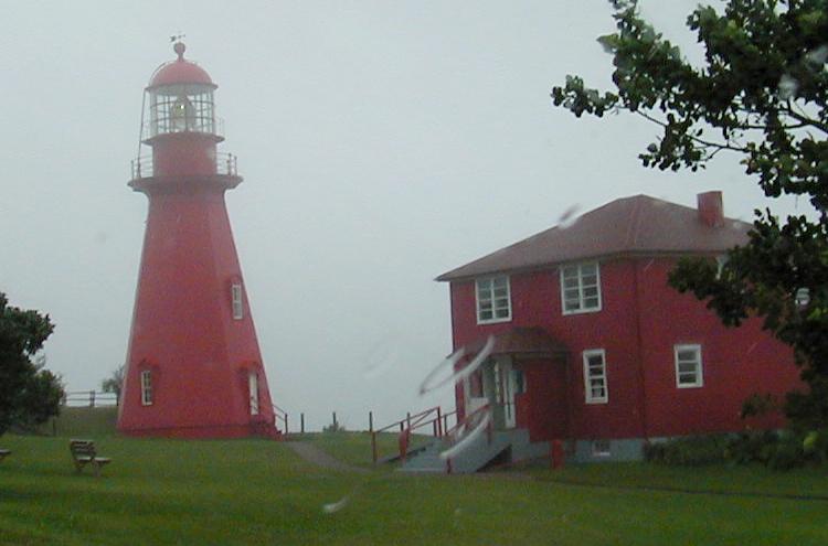
When we pulled off of the highway in one town to take a closer look at a lighthouse, we found a archeological museum across the street.
The museum turned out to be quite small, but made for an interesting stop. The young fellow who was manning the office spoke very limited English, but did a good job reading from a cheat sheet as he gave the tour. We saw a number of spear points and other artifacts from the area that dated back to 8000-9000 years before present, which was shortly after the continental glaciers had retreated from the peninsula. The tour also included a visit to the dig area, but the because of the wind and rained, we passed on that part.
By the time we reached Ste Anne des-Monts, the largest town on our loop tour, the wind was blowing at gale force. We visited the grocery store to re-supply before returning inland. Shopping there was fun. Everything and everyone was French. The cashiers were all ladies wearing matching dress uniforms.
Back at camp, the rain had stopped, and a few breaks were appearing in the cloud cover. The next morning dawned clear, and we broke camp and headed for the Mont Jacques-Cartier Trailhead. Along the way, we stopped several times at viewpoints to look for moose, to no avail.
The trailhead is actually four kilometers up a road that is only open to shuttle busses. The shuttle nearly cut the distance to the summit in half, which was well worth the modest fee. We were surprised to see a patch of snow, still surviving in the mid-August sun, on the mountainside above the parking lot.
(A small patch of snow remained on Mont Jacques-Cartier)
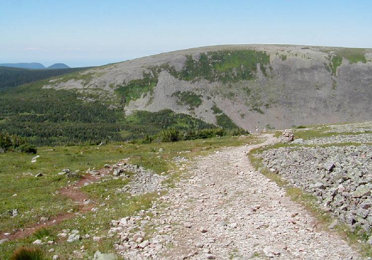
The trail climbed at a steep but tolerable rate. Much of it seemed more like a sidewalk than a trail, as it was cleared down to smooth bedrock.
About half way up the trees started thinning out and the views began to open up.
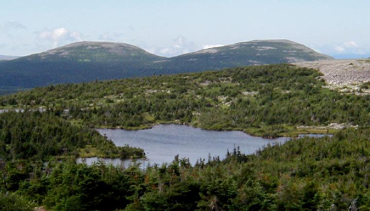
We reached a saddle just below timberline, where we took time to snack near a small lake.
(Lake)
From there, the trail ascended some 125 steps and emerged above timberline just as the steep climbing ended.
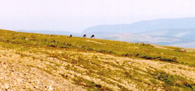
We spotted a couple of caribou high on a distant ridge. They looked great through binoculars, but were to far away to appear as more than dots in a photograph.
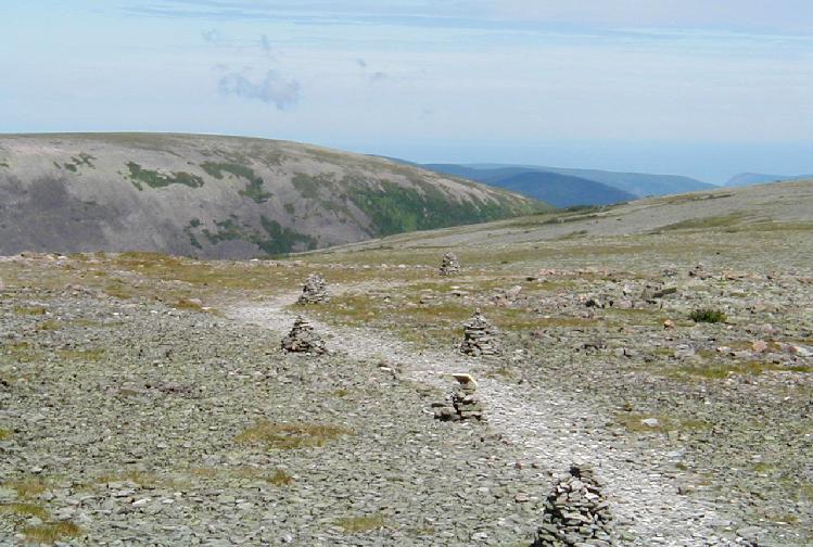
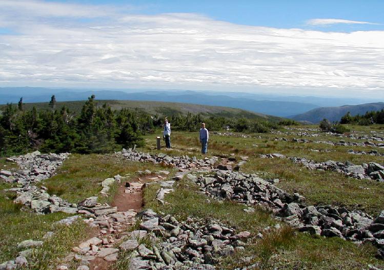
The trail became a path of least resistance across the boulder-strewn summit ridge.
(Trail across the boulder field)
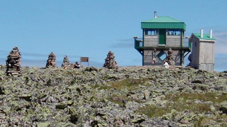
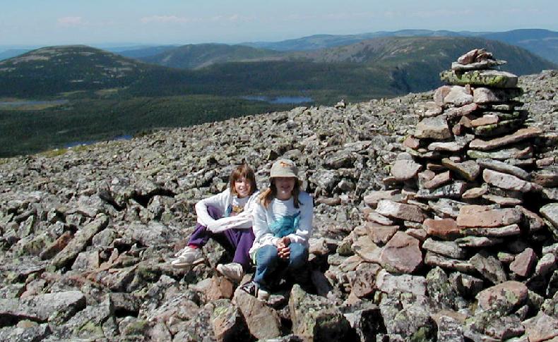
There was a lookout tower/shelter on the rocky summit that provided protection from the 30 mph winds and 50 degree temperature on top.
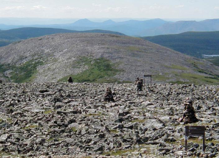
The views there were great. The trail continued across the boulder field, heading southwest along the crest of the range. Plans call for this trail to become a part of an extension of the Appalachian Trail that will join that famous trail at its northern terminus on Mt. Katahdin in Maine and extend to the Gaspé Cape in Forillon National Park.
(The trail continues southwest)
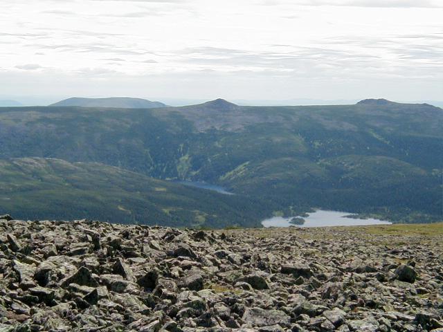
The view north stretched all the way to the Saint Lawrence (barely visible in the photo).
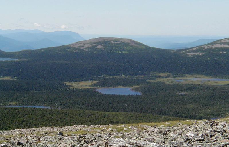
The view south included several lakes below a barren ridge.
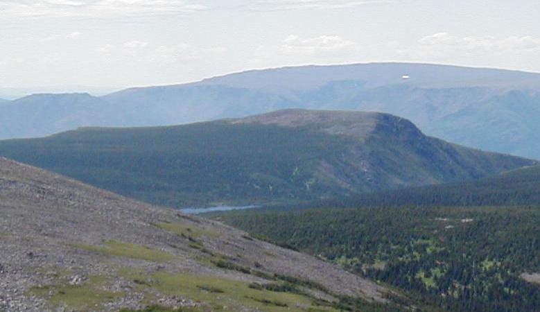
Far to the west was the massive plateau summit of Mont Albert, with its own small patch of snow. Its home to another small herd of caribou that is essentially completely isolated from the herd here on Jacques-Cartier.
The view northwest covered the steep front of the Chic-Choc Mountains and a hazy St. Lawrence estuary.
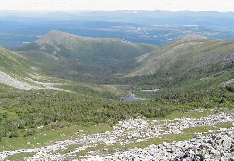
After leaving the summit, we followed a trail that looped further to the south into an area frequented by caribou. The route lead through stunted trees growing amongst parallel lines of frost sorted boulders.
The trail passed much closer to the eastern edge of the massif, yielding a nice view down into a glacial valley.
The trail did allow us to see quite a few more caribou. They were also fairly far away, but we still enjoyed seeing them. All in all, we saw somewhere in the neighborhood of 25 animals. In order to make the 2:15 PM shuttle, we had to really hustle back down the trail. We arrived there with minutes to spare. It was truly a wonderful hike.
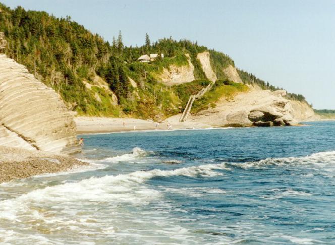
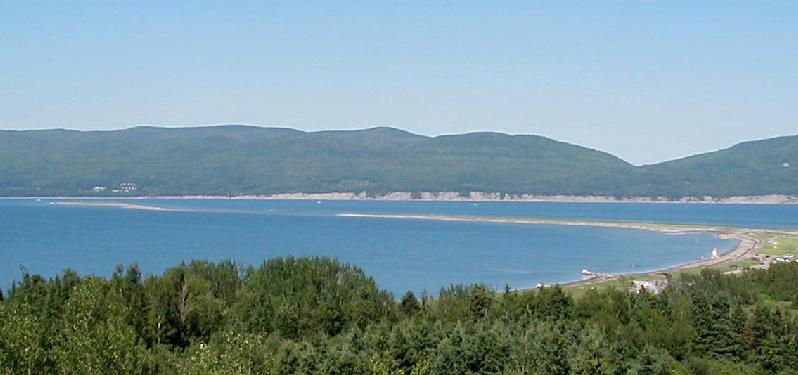
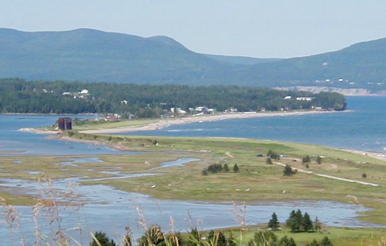
It was finally time to leave the mountains and explore further up the coast. Ten miles on a sometimes rough gravel road brought us to village of Mont-Louis, which looked must nicer than the day before in the rain and fog.
The coastal road passed through village after village, all squeezed between the mountains and the sea.
(Most villages were small. || Some were fair sized. || But all were scenic.)
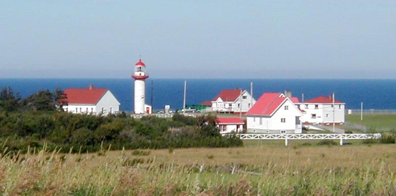
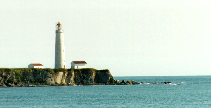
There were a number of lighthouses guarding the headlands.
(Lighthouse | Another Lighthouse)
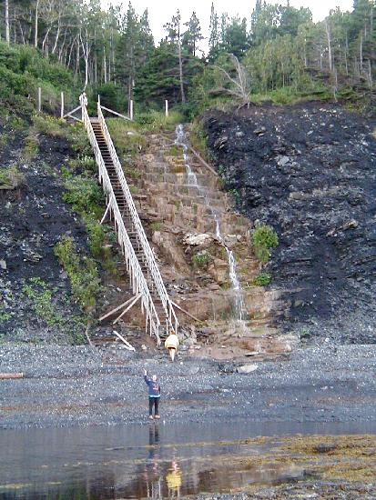
Several whales were spotted during the day as we continued toward the tip of the peninsula and Forillon National Park. It was shortly after 6:00 PM when we arrived at the information center near the entrance to the park. All the park's campsites that could accommodate our tent trailer were full (there were tent sites available) but a commercial campground just a kilometer away had plenty of space. The sites were nicely spaced on a bluff that dropped to the sea. A long stairway provided beach access.
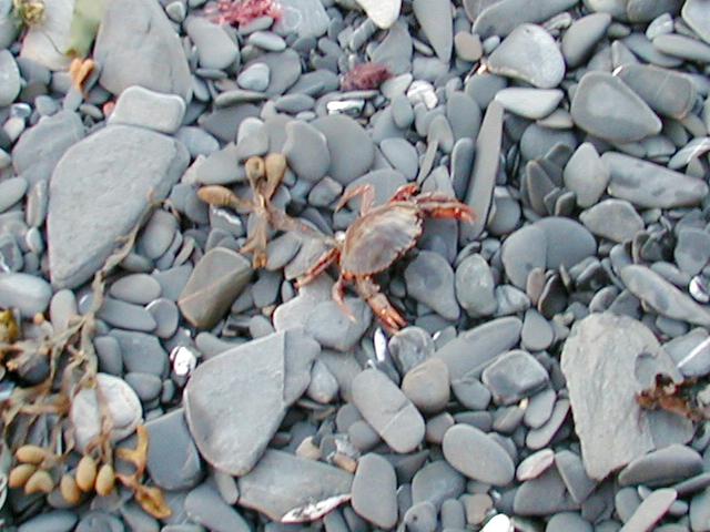
Although the sun was setting and it was getting chilly, the kids shed their shoes and waded into the rocky tide pools.
Matt caught several small crabs.
Fair weather continued the next morning as we headed into the northern section of the National Park.
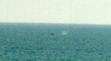
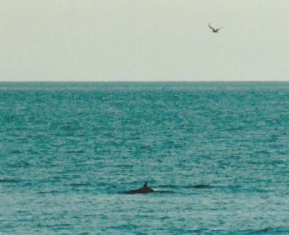
Joanna began spotting whales as soon as we started driving. At one point, we pulled over to watch at least a dozen whales spouting seemingly everywhere we looked. A fellow raking hay on a cliff-side field also paused to watch the procession.
Just inside the park boundary, we finally saw a humpback whale close to shore.
(The Forillon Peninsula | Whale)
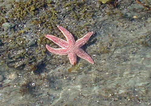
I got several photos with my 35 mm camera, and sat waiting patiently for the massive mammal to swim into a view that lined up with a nearby lighthouse, but the shot I hoped for never materialized. The rest of the family began to enjoy the nice beach. The kids started finding starfish, which was a new experience for them.
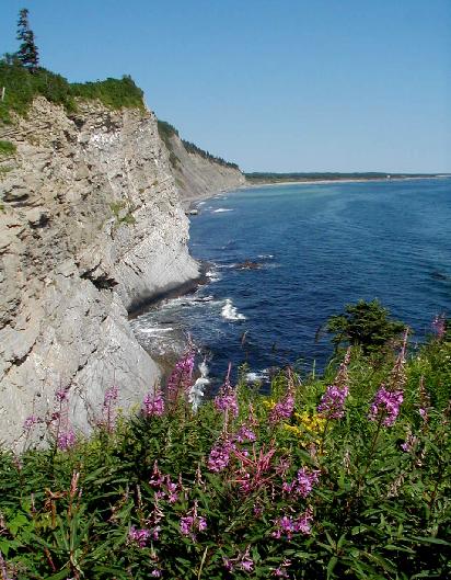
Soon we headed on toward the rugged peninsula that is the backbone of the park.
The northern park road ends at a beautiful viewpoint with stair access to a rocky beach.
The view back to the west was nearly as good.
(The view west from Cap Bon Ami)
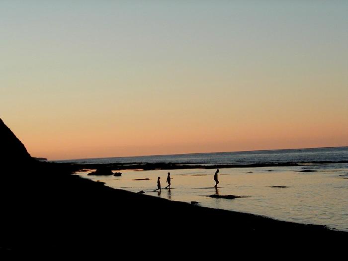
We all headed down to the beach to enjoy the wonderful morning.
The kids went straight for the water to play in the surf.
(Kayla runs while Joanna waits for a wave)
I headed east down beach to see how far I could get. I made it past two rocky ribs but was stopped by a sign prohibiting further exploration. The area beyond the sign was reserved for seals and birds only.
(Looking east into the restricted beach area)
I found the sound of the surf moving the small rocks on the beach to be very soothing. A seal was watching the activity on the beach from a short distance off shore.
(On the beach | Looking east from the edge of the restricted area)
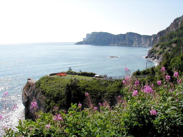
Back at the car, we decided to forgo a hike to the observation tower atop Mont Saint-Alban in order to have more time to explore the south side of the park.
(Mont Saint-Alban from Cap Bon Ami)
Crossing to the south side, we took a brief jaunt to visit a nice waterfall located a short distance from the highway.
The south side seemed to be much more crowded, and though still quite pretty, it was not as impressive as the north. We drove out to the road's end, and were surprised to find it was 8 kilometers further to hike out to Cap Gaspé at the tip of the peninsula. At that point, Matt decided he didn't feel well, so hiking that distance seemed out of the question. We headed back out of the park with only a few stops to take photographs.
(Gaspé Bay from Forillon National Park || Looking west along the south coast)
The kids were craving French fries, so we made a beeline for McDonalds in the city of Gaspé.
We all enjoyed our lunch immensely. Continuing south, the coast was less rugged, but still quite beautiful.
(A long sand spit nearly crosses the Gaspé Bay || The south shore of Gaspé Bay)
Indian Rock was just gorgeous.
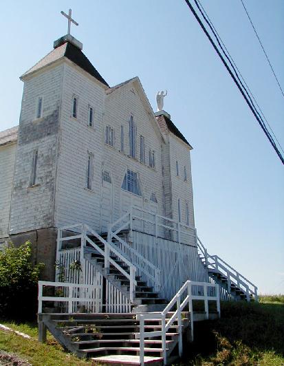
There were still many small villages to pass through. One of them had an unused church that was far different architecturally from all the others we had seen.
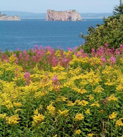
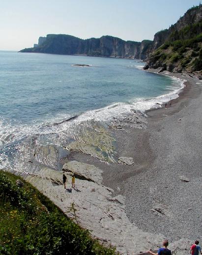
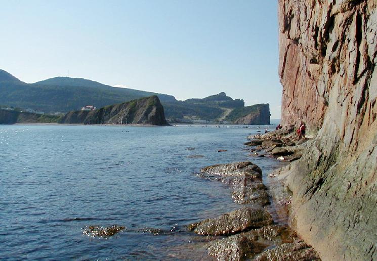
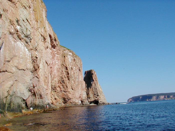
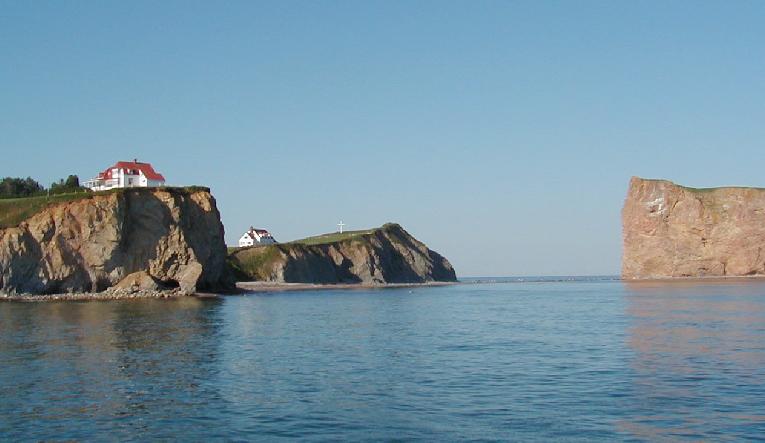
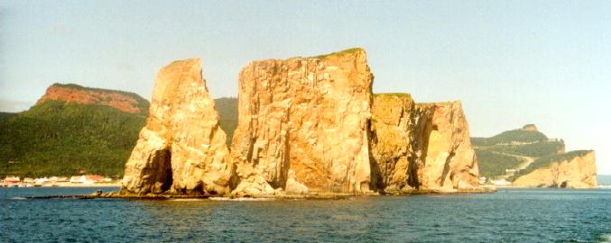
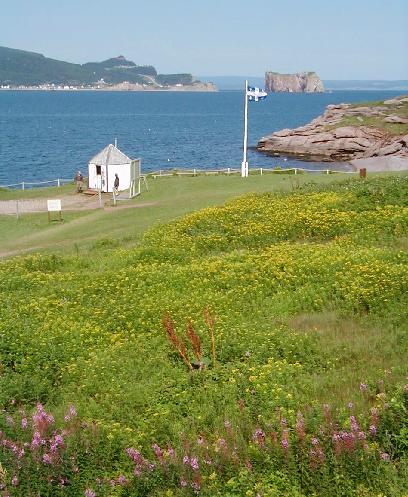
We arrived in the very touristy town of Percé by mid-afternoon and checked into a nice provincial campground right in the heart of town. Percé Rock and Bonaventure Island are included in the provincial park. The rock is a huge monolith just off shore that can be reached on foot at low tide.
We walked into town and headed for the rock. The tide was just low enough to make the crossing.
(Percé Rock from the mainland beach)
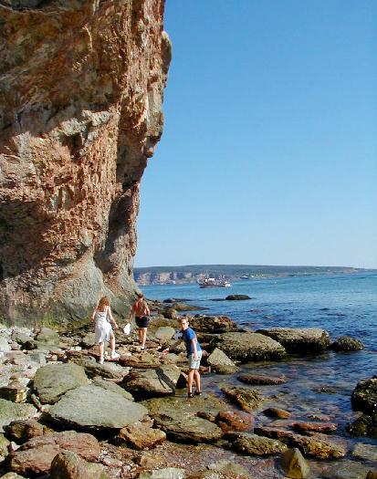
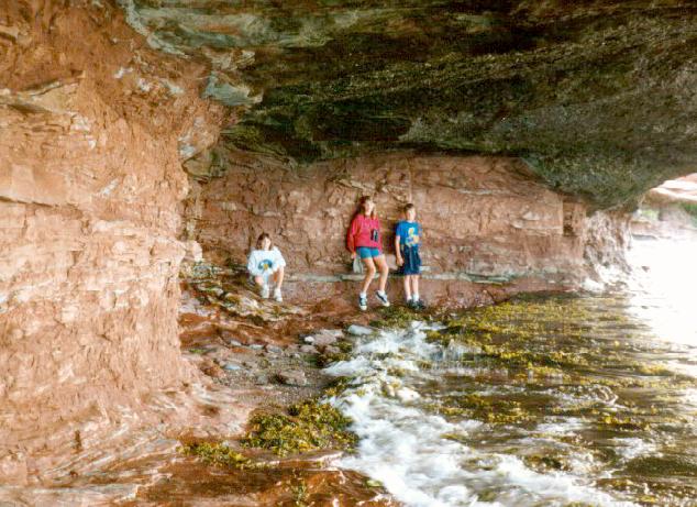
A sea cave near the outer end breaches the rock, and we started making our way around the side in an attempt to get there.
(Traversing the south side of Percé Rock)
The going soon got more difficult. Linda and Kayla decided to stop, but Matt and Joanna wanted to go on. I decided to let them go, and when Linda said I should continue, I did as well. I removed everything that would be damaged by an unexpected dip (especially cameras) and followed.
(View back to the mainland || The cave is located just past the people clinging to the rock.)
Soon I was knee deep in the surprisingly warm water, walking on smooth limestone with an algae film that made it seem like greased glass. It wasn't long before I slipped and went most of the way in, much to the delight of onlookers watching from behind. The cave was well worth the effort. Matt and Joanna were still dry. On the way back I slipped again. This time I just let it go all the way, and laid all the way back in the water kicking my arms and legs. The crowd watching was now much larger (it was still a couple of hours before low tide.), and I'm sure I was the subject of a number of photos.
I arrived back at the crowd without further incident and announced that I must have too much mass for the frictionless slope, which got a laugh from the few English-speaking folks there. A number of people were now attempting the traverse to the cave, and I insisted we wait until someone else took the plunge. In short order, and teen-age boy scout stole my spotlight.
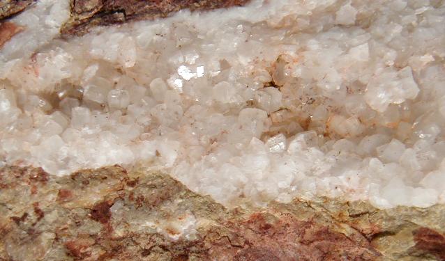
On the way back, Linda pointed out several fossils she had spotted earlier. Matt brought my attention to some calcite crystals in a vein on the rock face.
(Calcite crystals on Percé Rock)
Since we were in a park, the fossils and crystals remained in place for others to enjoy.
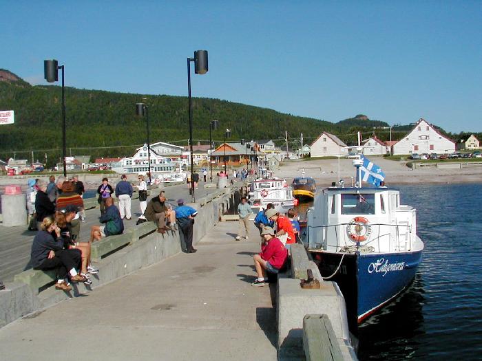
Back in town, we bought tickets for a 9 AM boat tour to the rock and around Bonaventure Island and joined the masses looking through the many shops.
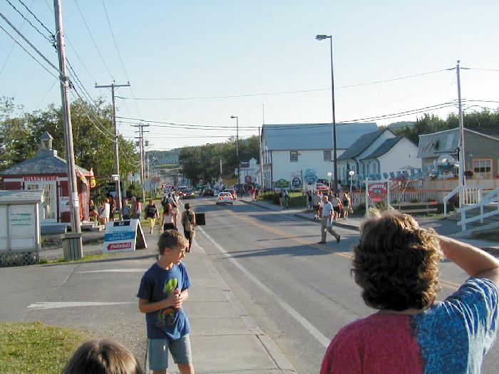
That night the town was rather lively. From our trailer many sounds drifted in from afar. A hint of music and revelry was occasionally punctuated with load hoots and hollers. Still, we all slept soundly, and arose early enough to pack up camp before the boat tour. We arrived at the dock about 20 minutes early, enabling us to be the second group in line for boarding.
The view towards the rock from the end of the pier was quite nice.
(Percé Rock and mainland bluffs from the dock)
Fog was hanging out over the water, but the dock was in full sun. Our position in line allowed us to get seats on the open deck above the main level and on the right side for the best views of the island's bird colonies.
First we cruised around Perce' Rock. Linda and Kayla finally got a good look at the sea cave through the rock. The tour guide announced that prior to 1845 there were two holes through the rock. In that year, the more easterly cave collapsed, leaving the present separate sea stack.
(Percé Rock from the tour boat | Town from the north side of the rock | The "Hole" | The rock from the east)
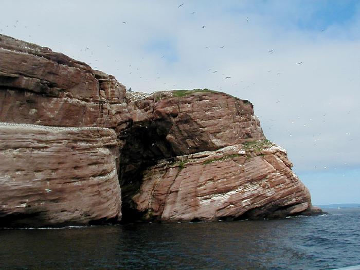
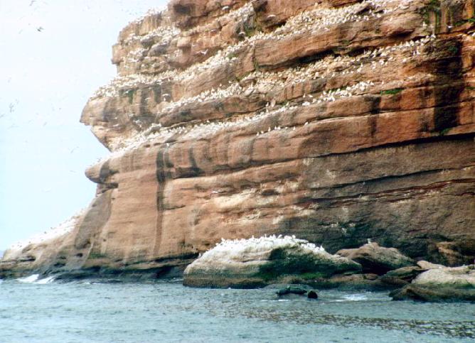
The boat then began a clockwise trip around l'Île Bonaventure. The island is home to 250,000 Gannets which posses a six foot wingspan.
(Ganets on l'Île Bonaventure | Another view)
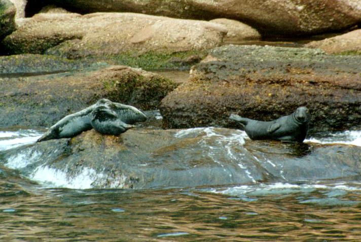
There were many seals along the island's shore as well.
(Seals haul out on l'Île Bonaventure)
The side of the island that faces Percé has a number of historic buildings that now are part of the park.
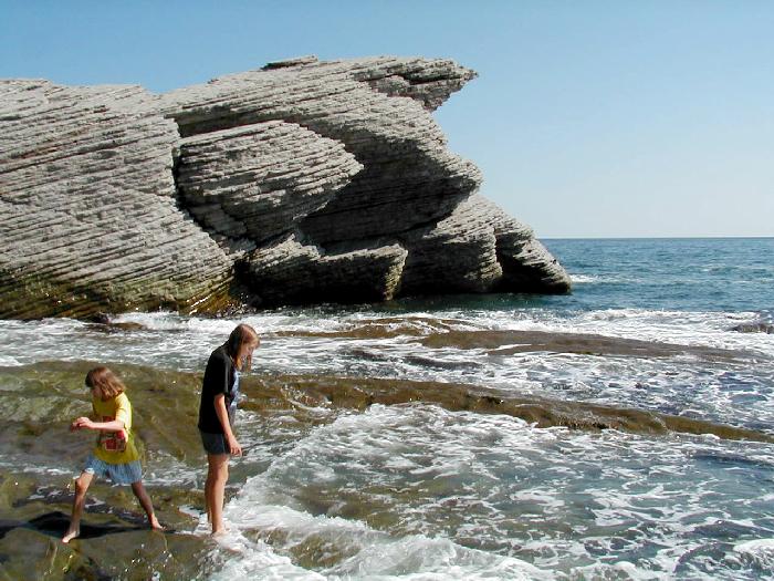
We got off the boat at the island, but didn't feel like hiking to the bird colonies. Instead we explored the buildings near the dock and walked to a secluded beach that ended in the sea cave.
(Kayla, Joanna, and Matt in the sea cave)
There were endless quantities of wild raspberries to eat, and the flower covered shores distracted us from watching the time.
(Percé Rock from l'Île Bonaventure)
We missed the next boat from our charter company. Their boats were supposed to stop at the dock approximately every 50 minutes. We relaxed on the nice lawn above the dock, enjoying the view back to Percé.
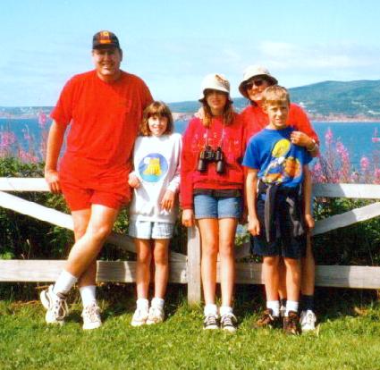
(The guard station flies the Quebec flag on l'Île Bonaventure | Family photo)
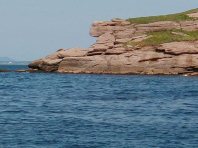
Another company's boat welcomed us aboard upon request. I guess once you are on the island, you and your money have already parted, so if there is room, any of the companies will take you back. As we pulled away, the captain pointed out a nearby rock that looked a lot like a monkey's face.
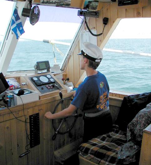
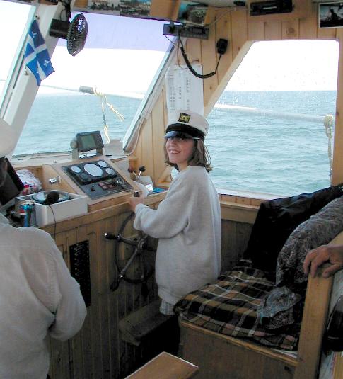
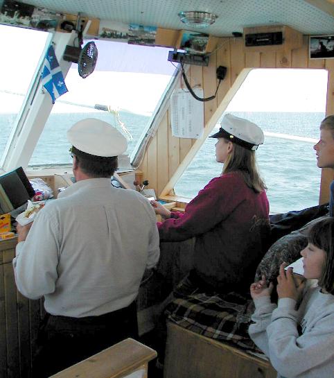
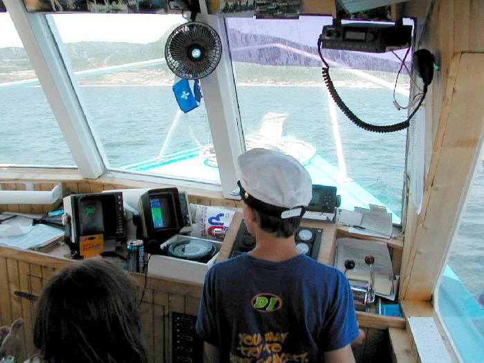
It was a smaller boat and since it was early, there were only a few others returning to the mainland. It was quite a surprise when the captain let all of the kids have a turn at the helm.
(Matt at the helm || Kayla takes her turn || Joanna takes the wheel)
He even took the time to train Matt on instrument navigation.
(Matt navigates by instruments)
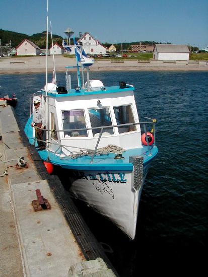
In ten minutes we were on shore, waving good bye to the friendly captain and first mate.
(The friendliest boat in Percé)
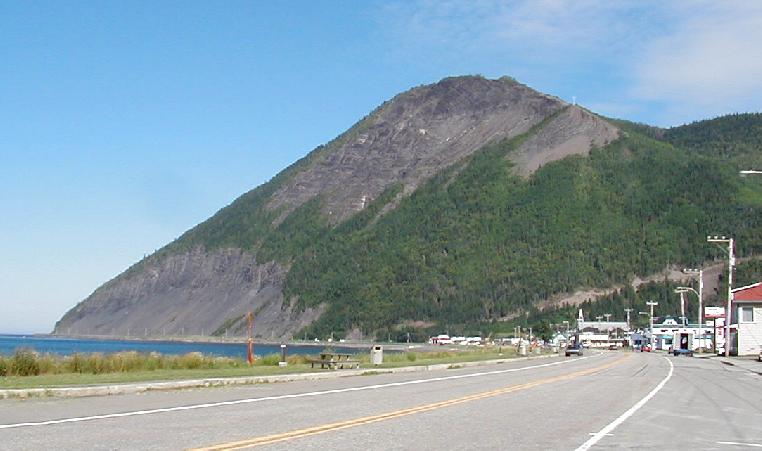
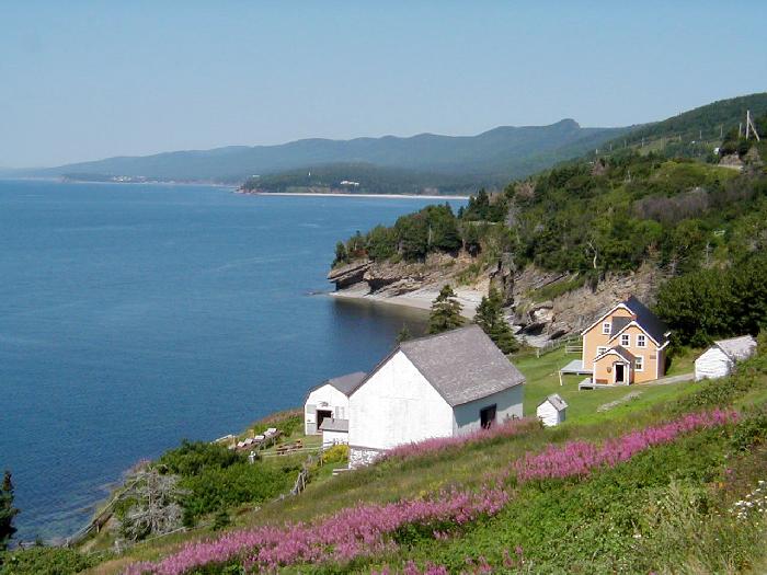
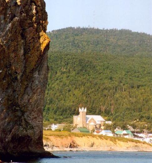
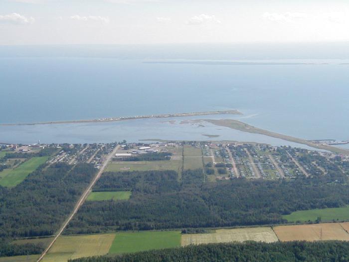
Below Percé, the coast was much less impressive, except for a huge mountain (Mount St. Joseph) rising high above the town of Carleton. I had picked up a brochure describing a road that goes to the summit, and couldn't pass on the view.
(Carleton from Mont St. Joesph)
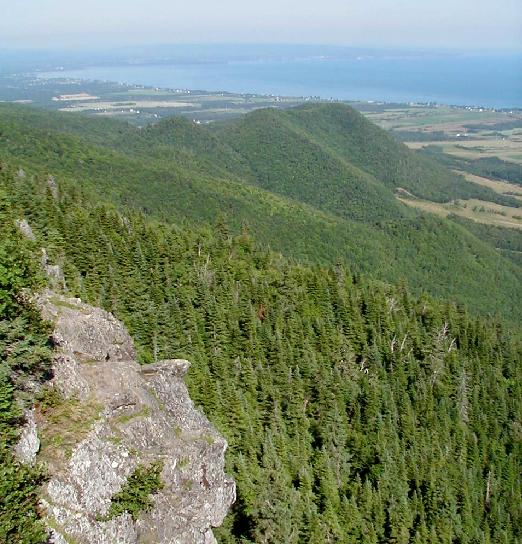
From the summit, the 250 year old colonial land divisions were clearly visible.
(Looking northeast from Mont St. Joseph)
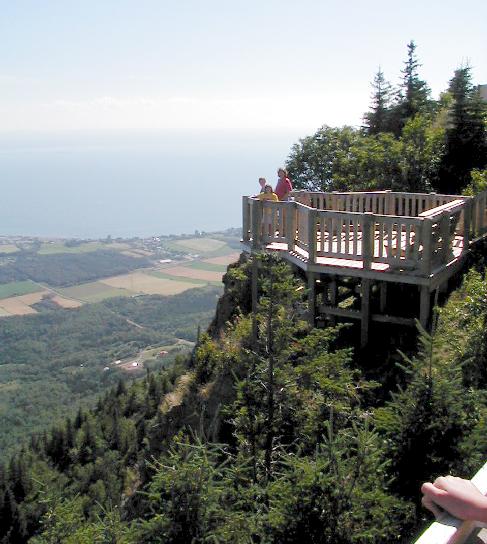
The quick drop to the narrow coastal plain was spectacular.
(Linda, Matt, and Kayla enjoy the view)
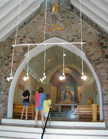
The summit was home to the area's first television station, founded in the late 1950's. Up to 30 employees had to make the trip to the top everyday up until 1998, when the studios were moved below. The site was also home to a beautiful chapel, built many years before the TV station marred the summit.
(A newer building completely encloses the old chapel)
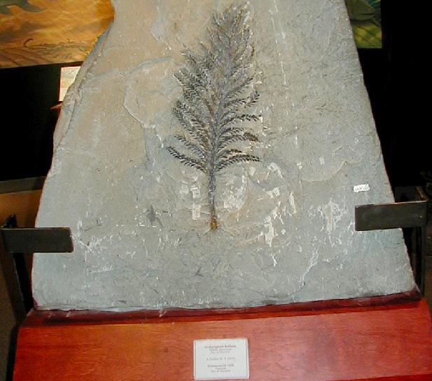
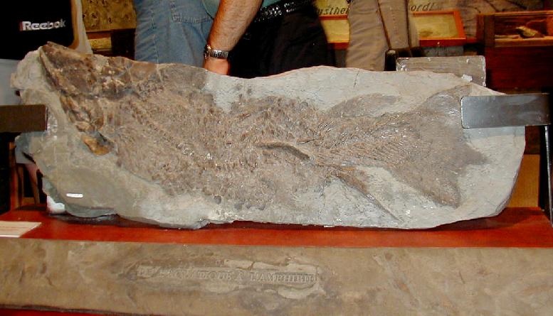
The trip up the mountain didn't take too long, and we made it to Miagusha Provincial Park before closing time. The park protects a rich fossil exposure and has a nice visitor center with many fossils on display.
(This plant fossil greets you at the front of the museum || A large fish fossil)
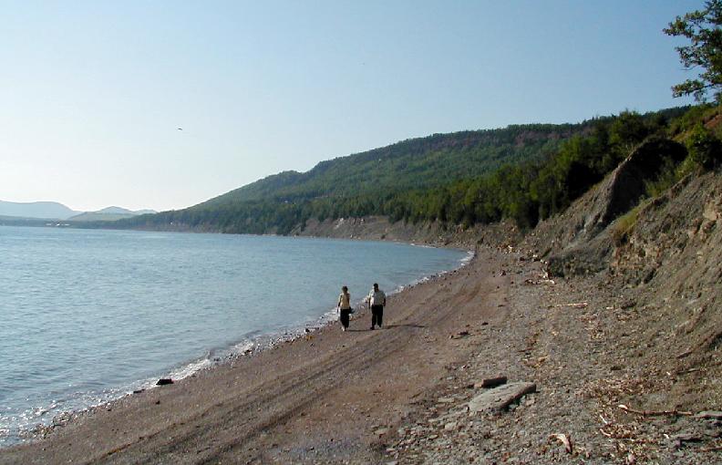
The beach at this park was the first place on the entire trip where biting insects were a problem. As a result, we didn't spend much time looking around.
A short time later, we crossed back into New Brunswick, and the road trip home began. That night, we ended up back at the same motel in Grand Falls with the nice indoor pool. We had forgotten about the lost hour (New Brunswick is in Atlantic Standard Time) and only had an hour to swim before the pool closed. Boy did that hot tub feel good after such a busy week of hiking and riding. It was raining the next morning, and it continued all the way through Maine. We found a reasonably inexpensive motel in Connecticut and bypassed New York in favor of Allentown and Harrisburg Pennsylvania, and were home early the following afternoon.
This trip far exceeded my expectations. The only disappointment was that we never saw a moose. Everything in Quebec and New Brunswick was incredibly clean. Both public and private rest rooms were spotless, without so much as a cobweb in sight. Litter, including cigarette butts, was rare.
The US dollar went a long way in Canada due to the favorable exchange rate. Heck, gas wasn't even that much more, running from about $1.89 to $2.04 per gallon north of the border. I had to pay $1.77 once in Connecticut! At any rate, we can't wait to go again. I'd love to have a summer place there to enjoy during my oh so distant retirement.