According to H, Mehri is mentioned in KBo 4:14 at III 68: RlA 1,263 [I don't see this reference].
Tukulti-ninurta 1 conquered from Qutu to Mehri: H posits that this implies that they are not neighbours, but in fact separated. Another inscription mentions land in the following order: Quti; Uqumani; Elhunia; Šarnida and Mehri, also mentioning army from Babhi. Elsewhere, that TN1 conquered Babhi and Uqumani as far as Šarnida and Mehri. Mehri and Šarnida are adjacent in another inscription. H concludes that TN1's campaign was from S to N from Quti, Uqumani, Elhunia, Šarnida and then Mehri with Babhi further to the north.
TP1 mentions that his conquests extended from Qumani to Mehri.
Adad-nirari 2 mentioned that he conquered the vast land Qumani, stretching as far as Mehri, Salua and Uruatri. TP1 also made an expedition to Habhi and en route conquered Baza, Sarbalia, Didula and other towns of the land Mehri located on the river Ruru.
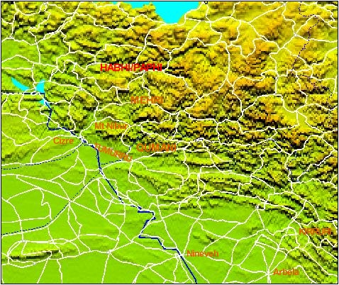
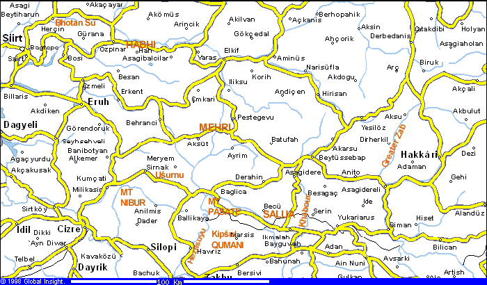
Qumani/Uqumani is located on the ara from Mt. Nibur (modern Djoudi-dagh) and to the SE, with its capital Kipšu placed at modern Gefse), 14 km NE of Zakho.
Arbakku, a city of Habhi, has been identified with modern Evrak. Habhi is shown here along the bank of the Bhotan Su. H says that Habhi is bordered to the SE by Kirruri, which he places in the Levinsuyu, a R bank tributary of the Greater Zab [this is not consistent with Saggs' analysis of Kirruri].
H says that there is a modern town Mekhri, near Ayrim on the map - and derives this from ancient Mehri. Salua is identified with modern Suli.