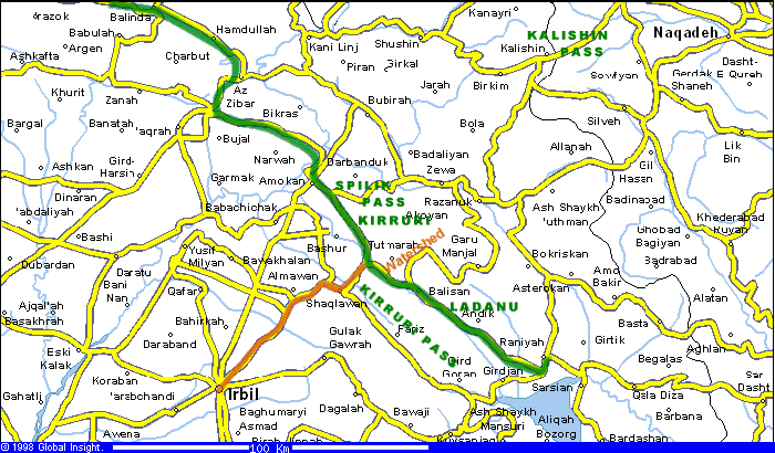
| The following analysis is based on Saggs, Iraq,
___. In the Shalmaneser III Kurkh Inscription, Shalmaneser describes
an itinerary from Urartu to Gilzanu, then to Hubuskia (placed in the
higher reaches of the Greater Zab) and states: "I entered (the
campaign area) by the pass of Enzite and I came out by the pass of
Kirrruri opposite Erbil [ina SAG Erbil]". The hills at Shaqlawa
(together with the passes there) are the best candidates for
"opposite Erbil". "The present road from Erbil to the
northeast crosses a first range and then descends into the Bastura valley,
crossing the Bastura within 5 km of the point at which Sennacherib tapped
it for Erbil's water supply. (see Safar, Sumer 3, 23-5). The road
thenclimba a second range to Salahaddin, from the eastern end of which
five ranges culminating in the chaine magistrale of the Zagros are visible
beyond. The route then goes on past Shaqlawa, eventually turning NW into a
long wide plain with mountains on both sides and the Spilik pass, leading
to the Rowanduz gorge) towards its north end. This long wide plain, the
Dasht-i-Harir is very fertile and has a number of prominent tells along
it. This...would fit perfectly with the requirements for the land
Kirruri."
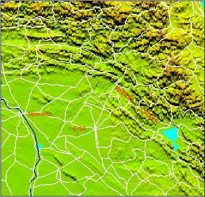
"[Tukulti-ninurta 2] went into the mountains E of Shaqlawa (Shakh-i-Harir
and Bejan Dagh, one range being known to the assyrians as Mt Urrubnu and
the other as Mt Ishrun) and then turned S, crossing the watershed between
the Great Zab and the lesser Zab...There are easy cols of about 4,000
feet, one of them inking the Barazan valley, which is the central part of
the Dasht-i-Harir) and the Balisan valley. The Balisan valley is a
tributary of the Lesser Zab, which takes its course between Koi Sanjaq and
Rania. The Balisan valley, leading straight down to the Rania plain, would
fit well the requirements for Ladanu, whose people to escape the ASsyrians
would have fled straight down the Balisan River and over the Lesser Zab."
|
|