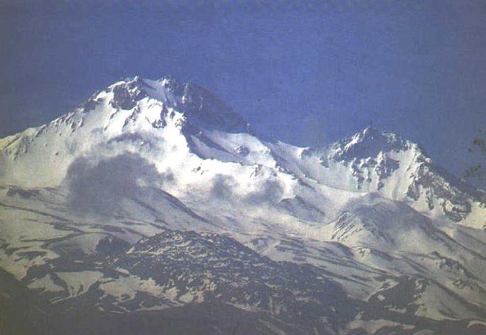
One of Turkey’s most important mountaineering and winter
sports centers, Mount Erciyes rises from the South of the Kayseri
valley.The Sultan Marshes lie to its West and to the South falls the
Develi Valley. Its summit is always covered in snow and ice, Mt. Erciyes
ranks as central Anatolia’s tallest volcano. Approximately 18 kilometres
in diameter and covering an area of 1000 square kilometres, the mountain’s
stratification and geology make it a fascinating geographical
formation.The region’s climate, influenced by that of the Anatoian
plateau, is considered typical of steppe geography. Certainly the winter
brings considerable snowfall to the higher elevations.The northern side of
the mountain enjoys a somewhat more temperate climate encouraging the
cultivation of vast areas of vine and fruit orchards between 1100 and 1600
metres. Above that altitude, vast meadows stretch far into the distance.
The higher elevations display typical alpine vegetation. Herds of animals
graze year round on the East, North and West slopes of the mountain.
Trips and Climbs
Mountaineers attempt Mt. Erciyes either on the
Northwestern flank or from the South and find the best climbing in June,
July, August, and September.
Regional Attractions
Tourists visiting the area should also see the fantastic
rock formations, underground cities and fabulous frescoes in rock carved
churches in neighboring Cappadocia.The Sultan Marshes, a habitat for many
different species of birds, has fortunately been designated a national
park and wildlife preserve.