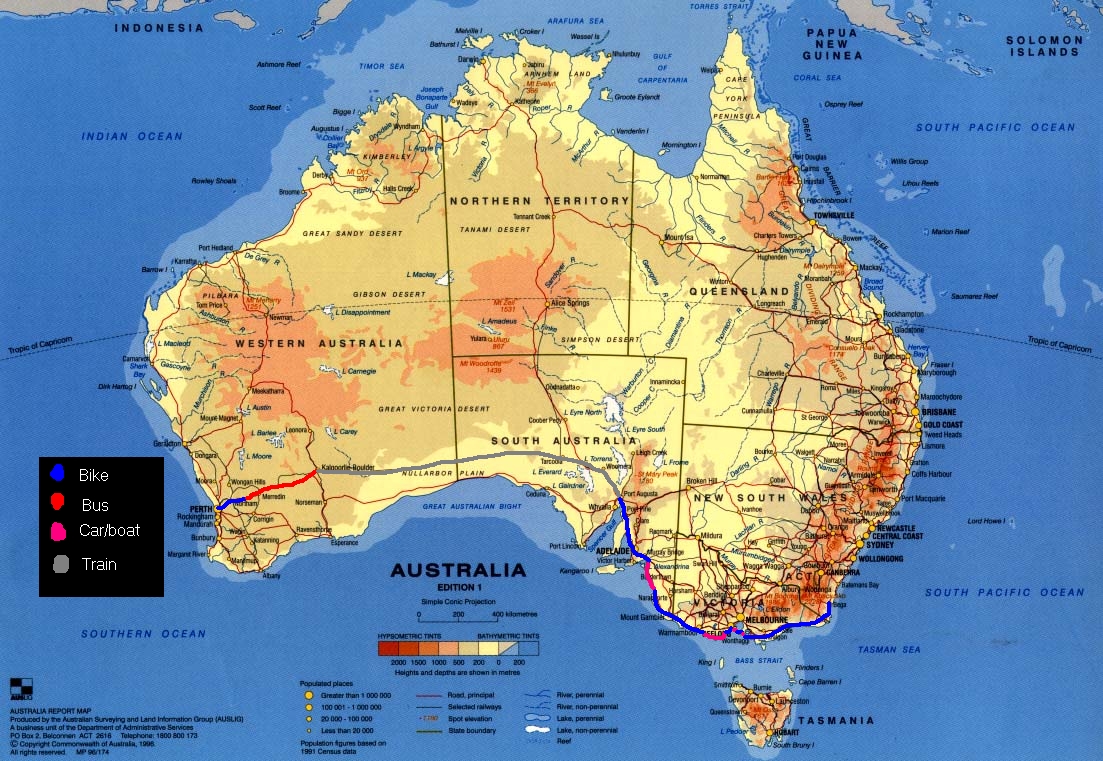
| Route | ||||||||
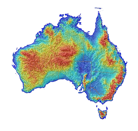
| First stretch was 200 km east of Perth. Took bus to Kalgoorlie. Took train to Port Augusta. Rode with bike across to Clare (look at the topographic map!!) then rode to Adelaide | ||||||||
|
|
|||||||
| This shows my route, and what where im thinking of going next | ||||||||
| This map is a height map (topologic?) Now you can see why it was a hard ride | ||||||||