 |
|
|
|
|
|
|
|
|
|
|
|
|
|
|
|
|
|
Epping Forest from the Air |
|
|
|
The following Photos are of Epping Forest from the Air. |
|
|
|
 |
|
|
|
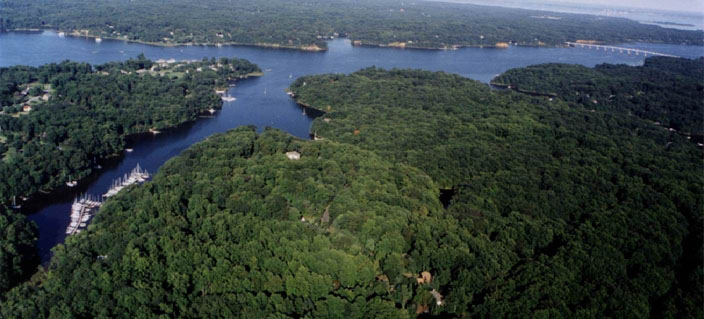
The Penisula in the middle is Epping Forest. The Marina on the left is the Safern Marina, which is in Clements Creek. Clements Creek forms one of the Boundries of Epping Forest. The creek to the right of the Epping Forest Penisula is Saltworks creek, which forms another boundry of Epping Forest. The river in the middle is the Severn River. The Bridge to the right is the Rt.50/301 Bridge going across the Severn River. If you were going across the bridge heading to the top (East), you would be heading towards the Bay Bridge. If you were to continue to the right on the Severn River - you would be at Annapolis and the mouth of the Severn - which leads into the Bay. |
|
|
|
 |
|
|
|
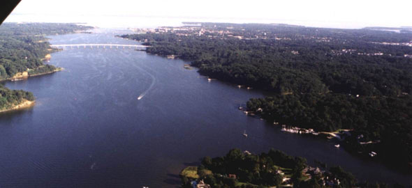
Another Photo from the Air. Epping Forest is to the right. The Marina that you see in the right hand side is the Epping Forest Marina. The Beach area is just to the right of that. This picture is looking down the Severn River towards the Bay. You can see where the Bay meets the river. That is where Annapolis is. |
|
|
|
 |
|
|
|
 |
|
|
|
To Photos Page |
|