| BROADMOOR and CENTRAL CITY |
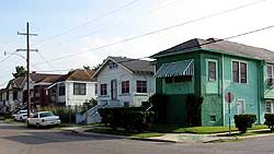
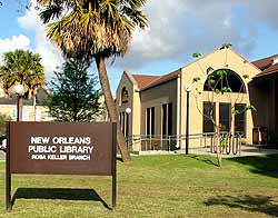
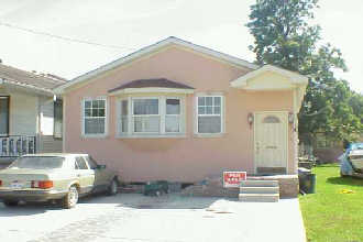
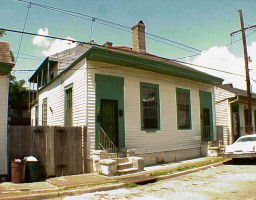
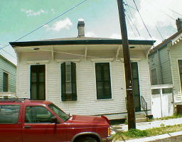
Broadmoor In the early 1800s, the Broadmoor neighborhood was a twelve-acre lake that connected to Bayou St. John via a stream. Even today, when a heavy rainfall occurs, the area still experiences significant flooding problems. Often cars are parked on the neutral grounds, higher elevated land comparatively, in anticipation of rising water. Between 1920 and 1924, the largest percentage, 35 percent, of all construction in the area occurred, significantly contributing to the neighborhood's development. By the 1940's, at least 50 percent of the housing units were owner occupied, making it a stable, thriving community. A variety of commercial enterprises were scattered along its boundaries. In 1996, after years of serious flooding in Uptown New Orleans, Congress authorized a three-phase project to improve drainage in the area. The New Orleans Sewerage and Water Board and the U.S. Corps of Engineers were assigned the task of administrators of the $140 million project, which includes construction of new pumping stations and better drainage canals throughout the city. The Claiborne Canal Project, concentrated mainly in the Napoleon and Claiborne Avenue area, consists of the building of new underground canals. Today, Broadmoor is a neighborhood of mostly low and some middle-income residents living in double shotgun, Spanish and mission revival homes. Boundaries: Louisiana to the east; Claiborne to the south; Jefferson/Nashville to the west; and Eve Street/MLK to the north. Average housing costs: $40,000-70,000 Average rent: 1 bedroom: $400-500 2 bedrooms: $550-700 3 bedrooms: $750+ For more information on this area, visit: Information on Broadmoor Information on Claiborne Canal Project Rosa Keller Branch Library Map of Broadmoor How is crime in this area? CLICK HERE |
| *chat* *contact me* *forum* *guestbook* *sitering* *homes* *jobs* *mardi gras* *neighborhoods * *politics* *restaurants* *schools* *things to do* |
 |
 |
 |
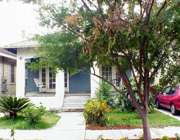 |
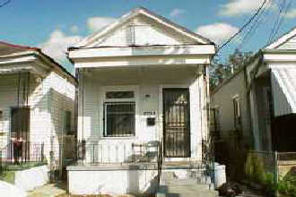
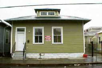
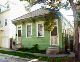
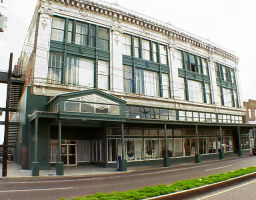
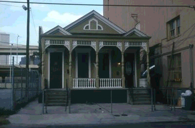
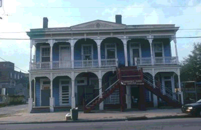
Central City For 170 years, Central City was home to the many immigrant, ethnic and working class populations of New Orleans� history � German, Irish, Italian, Jewish, and now African American residents. Old working class neighborhoods are often targets of highway projects, and urban renewal. Central City is an unusually well preserved working class neighborhood. From the 1830s to the 1950s Central City was known as "back of town." Central City began to be developed in the 1830s. At that time, it was a large, mosquito-infested, swampy area, 3-10 feet below sea level. The houses in Central City were built specifically to be rental property. Designed by contractors not architects, most of Central City�s 2800 shotgun houses are one-story, frame construction, raised 2-4 feet above grade on brick piers (but still below sea level), and set very close together with porches and stoops right up against the sidewalk or street. C.J. Peete Public Housing Project was constructed in 1941 and 1955, with 1403 units at its largest capacity. In 1998, after years of neglect, the Housing Authority of New Orleans (HANO) began demolishing these buildings with the ultimate plan of revitalization. Less than 1/3 of the projects are occupied now, but this area of town is still in bad neglect and is home to most of the drug and criminal activity in New Orleans. Boundaries: St. Charles Avenue to the south; Louisiana to the west; Gert Town to the north; and the Pontchartrain Expressway to the east. Average housing costs: $40,000-60,000 Average rent: 1 bedroom: $300-375 2 bedrooms: $400-500 3 bedrooms: $500-600 For more information on this area, visit: Information on Central City Jewish History in Central City Central City Development Corporation Ash� Cultural Arts Center Dryades YMCA Street Fighting, Mardi Gras style Map of Central City How is crime in this area? CLICK HERE |
 |
 |
 |
 |
 |
 |
 |
 |
 |
 |
 |