 |
 |
 |
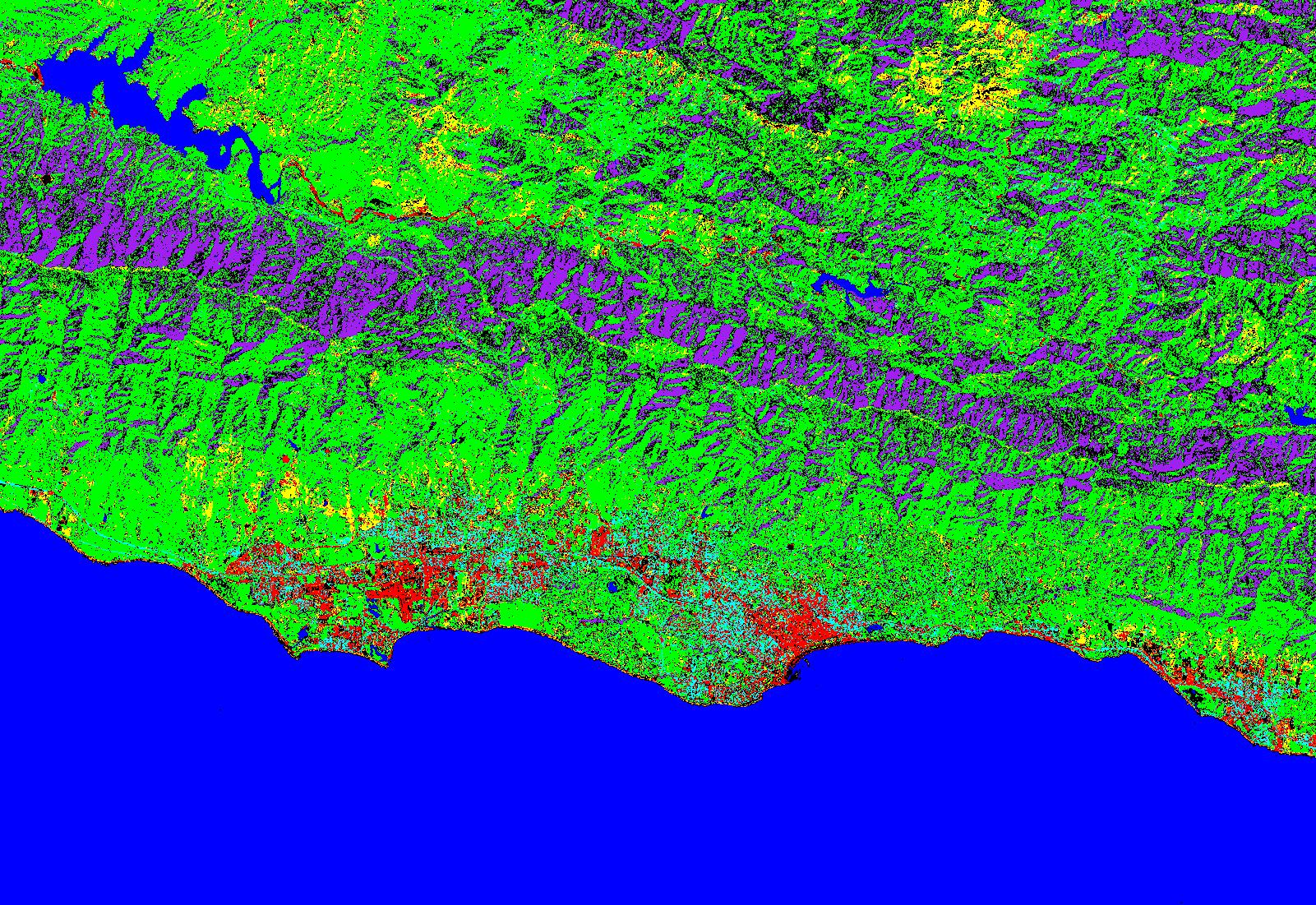
| Using remote sensing software can yield highly accurate maps of the urban and Wild-Land interface. The picture below uses hyper-spectral satallite imagery to differentiate between materials on earths surface and groups them together according to your application. |
| Links to some examples of the work I have done. |
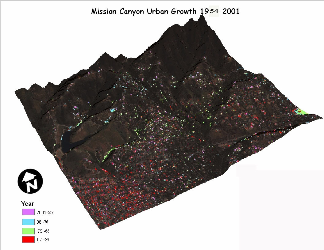
| This Map was made using aerial and satellite photography. The images were analyzed using ENVI; a remote sensing software,which produced the resulting data of urban growth over the past 5 decades. |
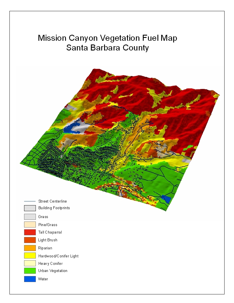
| GIS software is a powerful tool to map out fuel loads. This map was later used to compute fire hazard maps for the Santa Barbara County Fire Department. |