Here you have some explanation of useful issues:
2. UTC Time
3. Doppler effect
4. Circular polarisation
5. Orientation with compass
6. Maidenhead Grid square Locator
The first problem when I wanted to get in contact with a satellite was to know when and where I should point my antenna.
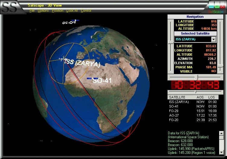
There are a lot of "Satellite Tracking" programs in Internet. You can download the orbit trajectory description of a satellite (Keplerian element) and then the software calculates the current position and even predicts the next passes near any location.
I don't extend much on the subject, just let you know my favorite program: SATSCAPE.
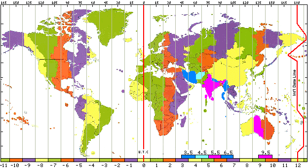
When using the "Satellite Tracking program" -as described in the paragraph above- you will get the position of the satellite according to the UTC time in most software. That applies as well for the schedule made for future passes.
Therefore you need to know what is the conversion between the UTC and your Local time.
UTC means Universal Time coordinates. This time scale substitutes the former GMT (Greenwich meridian time), altough in many literature you will find the UTC notated as GMT.
Here below, you'll find attached a map with the Time zones distribution all over the earth.
For Spain:
Winter Local time = UTC + 1 hour
Summer Local time = UTC + 2 hours
Well, up to now you learned where to point your antenna and at what time.
If you start trying to catch the signal of your satellite you can experience the first problems.
Why is it so difficult? One of the reasons is the Doppler phaenomena.
Maybe you remember that form the times of the school. If not read the following:
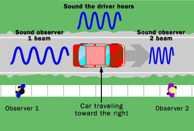
By analogy, the electromanetic waves emitted by a moving satellite also exhibits the Doppler effect.
The waves emitted by the satellite moving toward us is squeezed; its frecuency appears to increase and is therefore said to be blueshifted. In contrast, when it is moving away is stretched or redshifted.
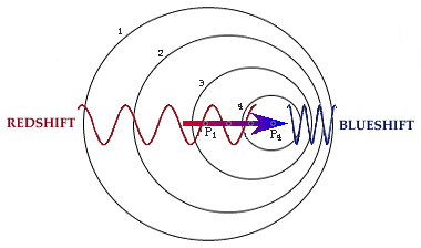
Satellite approaching:
Receive: shift up
Transmit: shift down
Satellite moving away:
Receive: shift down
Transmit: shift up
I told you, there is not only a single problem to get the sats. Appart of the Doppler effect you need to know about Circular polarisation.
Most antennas are either horizontally polarised or vertically polarised (see the diference between the directive yagi and your normal vertical antenna in a vehicle, in example). Satellite spin or tumble and the passage of the signal through the ionosphere mean that the user has no way of knowing the polarisation of the incoming signal at any instant. For this reason most satellite antennas are circular polarised and to take advantage of this you should use similar polarisation at your station.
There are two circular types: RHCP and LHCP, to denote Right or Left Hand Circular Polarisation.
Circular polarisation produces a signal with a rotating wavefront. You can imaging this by visualising an antenna spinning on its axis as it transmits. But it would need to spin very fast indeed to achieve the desired effect and the receiving antenna would need to be spinning at exactly the same speed.
This would present an impossible mechanical problem but fortunately it is a simple matter to produce a spinning wavefront electrically.
The helix antenna produces such an effect naturally without any help at all. Helixes make excellent satellite antennas but are difficult to construct and are cumbersome at vhf.
Most circularly polarised antennas used by amateurs are dipoles or yagis. To produce a circularly polarised wavefront from a yagi it is necessary to build two and mount them at right angles. They can share the same boom as in the case of the crossed yagi or be entirely separate entities connected by a feed harness. They need to be fed 90 degrees out of phase and have the driven element in line to produce circular polarisation.
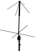
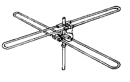
"turnstyle" yagi.
The hand of polarisation (RHCP or LHCP) can be changed by reversing the feed connections to the delayed antenna. This can be relay controlled to allow changing polarisation from the operating position.
This arrangement produces a wavefront which is spinning at the frequency of operation: 145.9 millions revolutions per second on two metres. Quite hard to do mechanically !
I wanted to start tracking satellites, but I decided it was too early to buy a Rotor, and unknown gear like PC comm cards, etc.
What I decided insted is to try using the pass predictions from the "Satellite tracking software" program and move the axis of my antenna just by hand.
All I needed to know was the time start, the azimut, and use a fixed elevation.
Then, I was using a compass to align the antenna to the horizon.
Afterwards I was building a Circular grid (it is not easy to find a good one in Internet!) at the lower point of my mast.
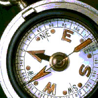
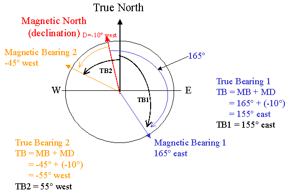
It is very useful to have a map of the place you are, showing the Local Declination (angle difference between the Coordinates of the North Pole and the Magnetic north in the Earth) so that you can correct to get the right heading.
If you don't have the map, get information at:
http://www.ngdc.noaa.gov/cgi-bin/seg/gmag/declination1.pl
In the other hand, you could try to point to a Telebridge in a known position. Then you should be using a software to calculate the Heading from your actual location.
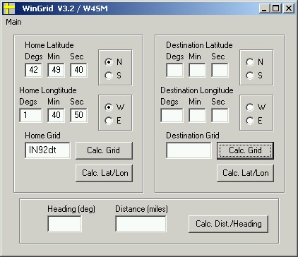
I'm using Win Grid. You can download it from its author's page (Stacey Mills) at: www.keplerian.com
Finally, if after all these difficulties you are succesful and able to hear signals coming form a satellite, most of the times you will recognise Callsign identification of the amateur who is transmitting through that satellite and its Locator.
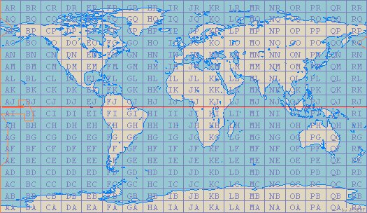
The locator gives a quick reference of the earth position of the operator. Instead giving the complete Latitude and Longitude data, a simple code gives the same information.
The earth is divided into squares of 1� latitude by 2� longitude and measures approximately 70x100 miles in the US. A grid square is indicated by two letters (the field) and two numbers (the square).
Each subsquare is designated by the addition of two letters that measures 2.5 minutes latitude by 5 minutes longitude.
You can use the already described program Wingrid to obtain the real Latitude and Longitude of a Grid square.