 Debbie
saying YEA we made it!
Debbie
saying YEA we made it!
St.
Eustatius (Statia) 1/2/03 - 1/3/03
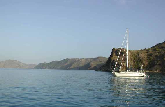
We had a great sail
over from St. Barth to St. Kitts. At least that is where we thought we
were going. The wind was 15-25 knots and the seas were about 4-6 feet.
We were on a close reach and Early Out loves a close reach. We averaged
7-7.5 the whole 40 miles. We were both all smiles. We were about 4 miles
past St. Eustatius, also known as Statia, when we decided we shouldn't
pass this little island up. It's a small island just north of St.
Kitts. So we headed the boat downwind and into the port of Oranjestad.
According to the book you need to take a park mooring and set a stern anchor to keep your bow pointed into the swell. When we first grabbed the ball it was a little rocky so we decided to take their advice and put out a stern anchor. What a huge difference in comfort. We went from very rolly side-to-side motion to a very gentle up and down motion.
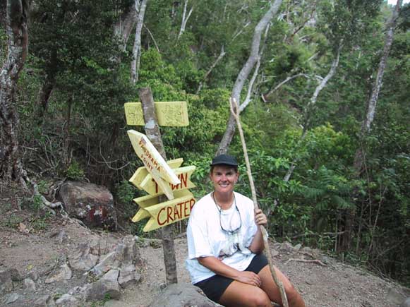
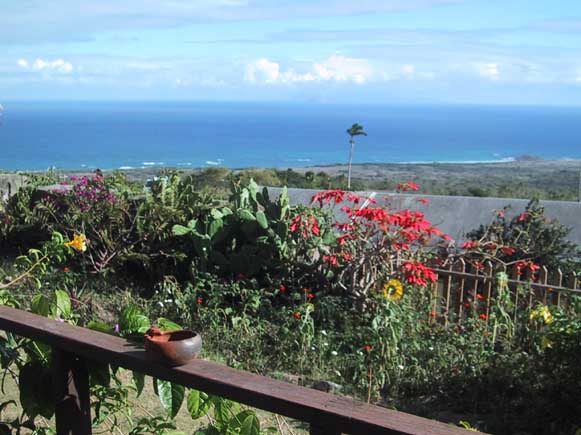
St. Eustatius, is basically a volcano that rose up from the bottom of the ocean. Big Dutch trading port in the 1700's but not much in the way of tourism. No Beaches. The one they had was washed away with Hurricane Lenny and it hasn't come back yet. But there is lots of history here. And many friendly people. Everyone on the island waved and/or honked their horn at us. Which on this island, means hello - not get out of my way. We wanted to hike the volcano named the Quill. We went ashore to gather information and talked with several nice folks along the way. In the park office the guy behind the counter had an Ohio State shirt on. What a small world. Turns out he went there and is a big fan. Ohio State had just won the national championship the night before so he was very excited to talking to Fred, someone who could appreciate the big win for the big ten.
After receiving instructions on how to get to the Quill, we started on our hike. It was a very steady grade, up 2000 ft., and then a little farther to an observation point. Very beautiful and lots of good exercise as well.
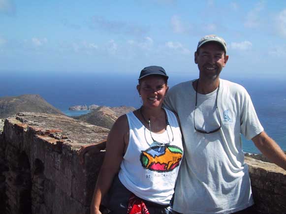
Debbie
saying YEA we made it!
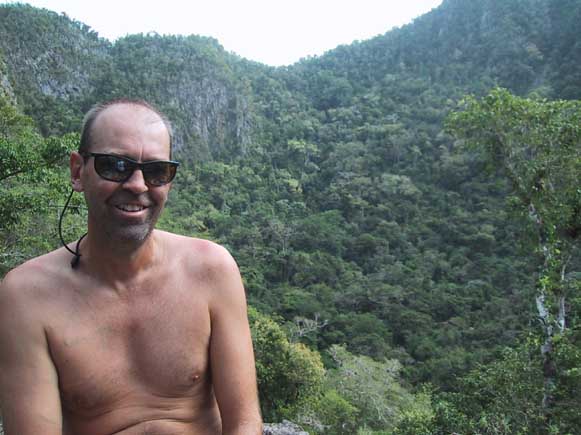 Fred
cooling off after making it to the rim
Fred
cooling off after making it to the rim
After our hike we decided to walk around town some. There was a very well maintained fort - Fort Royal - overlooking the harbor that was impressive and certainly kept a lot of the pirates and buccaneers away in the early years of sailing in the Caribbean.
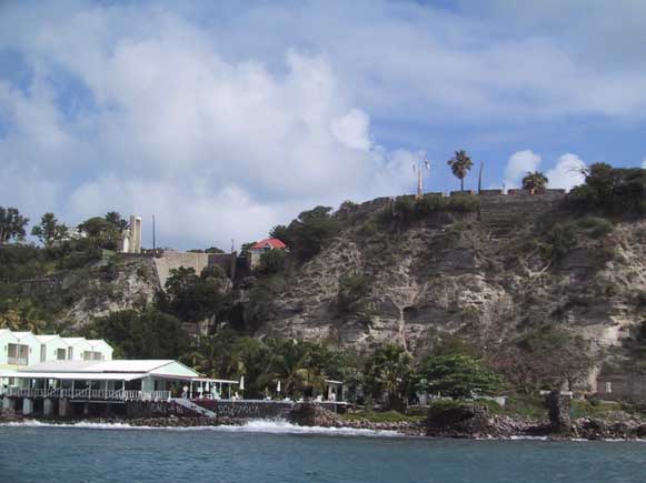 View
from the anchorage - Catholic Church on the left; Fort Royal on the right
View
from the anchorage - Catholic Church on the left; Fort Royal on the right
On Sunday we found the St. Eustatius Roman Catholic Church (built in 1910) had mass at 9:00 so we headed in around 8:15. It was only about a mile walk, but the last 200 yards was up a steep hill called the Slave Trail. We wanted to get up the hill and cool off before we went inside the church. I was a nice mass with some strong voices in the parish making the hymns sound good.
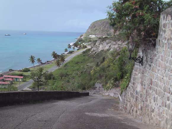 Slave
Trail leading into town
Slave
Trail leading into town
After mass we dropped
the mooring pennant and picked up our stern anchor without any fuss and
headed for St. Kitts. Shortly out of the harbor we heard Significant
Other on the radio. They had left St. Martin early in the morning and
were heading to Statia. We told them we had just left and they should
consider St. Kitts. After a couple of updates on the conditions they decided
to follow us to Basseterre, St. Kitts.
St.
Christopher (St. Kitts) 1/4/03 - 1/9/03
Our first anchorage in St. Kitts was Basseterre.
This is where we had to clear customs. That's a story in itself.
There was no real dingy dock close to customs, so you had to tie up next
to rocks and a small concrete wall. Then after you paid them some
money, had to walk several buildings down and pay someone else more money.
Still not sure why. Then had to get in the dingy and go all the way
across the harbor (about a mile) to the police station to clear immigrations.
The only dingy dock there cost you $5/day. So our first impression
of St. Kitts was not the best. But it did get better. First
of all, Jan met her dad and his friend Pat here. They were on a Holland
American cruise ship that stopped here. So the timing was great and
Jan was so excited. It was also great that Fred and I had a chance
to meet her dad since we've heard so much about him. They're very
nice folks.
The anchorage in Basseterre was pretty rolly from the swell, so later we moved over to White House Bay - only about 4 miles away. This became our daily routine. We'd go in to Basseterre in the morning and move back to White House Bay in the evening where the anchorage was much better.
From time to time friends back home ask us what we do all day. Well here is a little story to help you understand. Fred wanted to get one our propane tanks filled in Basseterre. After asking around town, it sounded like the best place to go was near customs. Significant Other also needed propane, Fred offered to take along their tank and filled it as well. Since the was no real dinghy dock at the customs office, we decided Debbie would stay with the dinghy while Fred marched off with the two tanks. After asking some folks near the customs office, Fred headed down the road to the Shell station in the direction they pointed. He walked and walked until finally we could see a Shell sign right on the bay. Instead of carrying two full tanks all the way back Fred thought he would be smart to get back in the dinghy with Deb and head over to the Shell station directly by the water. We arrived at the where the Shell sign was and all we found was an unattended fuel pump, great! So Fred left Debbie once again at a not so good dinghy dock to march down the road to find some propane. After asking a couple of folks, there was another Shell station "just down the road a ways". It was mid afternoon and the hot sun was beginning to take it's toll on Fred. So he huffed his way down with the two propane tanks about 1/2 mile to the Shell station. He arrived at 3:01 PM. Guess what, it's a industrial Shell station and it closes down at 3:00 PM. Why is it that island time is only prompt at closing time?!?!
After asking some more folks where he could get propane, Fred carried his two tanks another 1/4 mile in the other direction to a Texaco station. When Fred arrived all hot sweaty and in not such a good mood, the not so friendly attendant there said to take a taxi across town to pay for the propane and then come back to fill them. Given his poor attitude and Fred's not so good attitude at this point, it was obvious that there wasn't going to be any tanks getting filled here today.
The next day, Fred and Mike went to try again at the Shell 'station'. Mike stayed with the dinghy since Fred knew where the place was. After walking the 1/2 mile again with the two propane tanks and waiting in line for some time, Fred was told they could not give change for a $50 bill and they didn't take credit cards, oh great! In this very industrial part of town there weren't two many places that could give you change so Fred huffed towards town. After passing some shanty houses in not such a good part of town he saw a sign down one of the side streets for a 'Bar and Store'. Walking down the street he had second thoughts with lots of folks hanging out windows and sitting on street corners checking out the white guy who was clearly in the wrong place. When he got to the bar there was no one there except a lady behind the counter sitting on the floor who could not stand. I asked to buy a Coke and she yelled across the street where a boy came over to give me a Coke and some change. Guess what, couldn't change $50! So she directed me further down into this lovely community to a local grocery. After looking around and being looked at, he finally found the grocery, got change and got the heck out of there. Everything went smoothly from there except his back aching after carrying two full propane tanks that last 1/2 mile back to where Mike was now taking a nap in the dinghy. What a way to spend your day!
 Early
Out - anchored in White House Bay, St. Kitts
Early
Out - anchored in White House Bay, St. Kitts
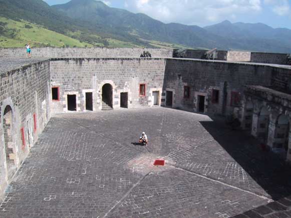
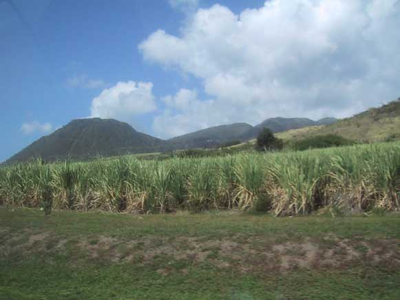
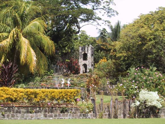
During our time here we took a taxi ride around the island. What a great decision this was. We had a super taxi driver, Vincent. His taxi was named "Who Loves you Baby" and he grew up on the island. For the 3 ½ hours it took us to get around the entire island, he provided us with great insights on the history of the different villages, their government, culture, laws, etc. And don't be caught cursing or swearing here - its unlawful and you'll be fined. You would never guess that in today's world places would have community bath houses. But this island has that and community water spigots for those who don't have water in their home. They have many animals on the island. But do you know how to tell if one is a sheep or a goat? (The sheep do not have any wool here - too hot!) Here's how - goats always have their tail up; sheep, tail down. And did you know that they don't "party" here. Their word for party is "limen". Another one I thought rather funny is when we refer to someone having a "spare tire" around their middle, they call it a tool shed. I think my dad is wondering about all those education dollars he spent on me to learn this stuff. Anyway, our taxi driver was quite a guy and we learned a lot from him and came back with a very different view of the island. We stopped at a few key spots along the way. One being the Brimstone Hill Fortress. The Fortress was designed by British Army Engineers and built by African slave workers. The first cannon was mounted in 1690. Its a very impressive place. The other being Romney Manor which is a beautiful old 10 acre estate garden. This is the headquarters for Caribelle Batiks where they hand make colorful designs in fabrics. Our tour also took us past Ross University - a well know veterinarian school that apparently has folks from all over attending. We saw many sugar cane fields and a great view of the black rocks on the northern shore.
 Fred
looking for refuge - Brimstone Hill Fortress
Fred
looking for refuge - Brimstone Hill Fortress
 Close
up of the sugar cane - about ready to be harvested
Close
up of the sugar cane - about ready to be harvested
 Gardens
at the Caribelle Batiks headquarters
Gardens
at the Caribelle Batiks headquarters
Nevis
- 1/10/03 - 1/14/03<
Had a great sail over to Nevis. The
anchorage here seems to be less affected by the swells which is a welcome
change. This island is very pretty with its lush green mountains
and palm trees lining the beaches. We haven't been too impressed
with the main town of Charlestown though. Streets are not very clean
and buildings pretty run down. But they do have great outdoor fruit/vegetable
market which is always wonderful to find - but I'd recommend soaking the
fruit/veggies to kill any bugs before bringing them inside your boat.
We did travel out of the main area and saw some beautiful sites - one being
the Golden Rock Plantation Inn. Built in 1815 as a Sugar Plantation
it's now been converted to an Inn. Gorgeous plants everywhere and
very nice people. Its up on a hill so you had a terrific view of
Monserrat and beyond. The Inn is where we caught the trail to the
rain forest - Derrick from the boat Dream Weaver joined as well.
First we walked thru a nature trail that pointed out various species of
plant and trees. Even saw some monkeys! Then the source trail
started and as the steep climb continued, the vegetation changed to more
of what you'd expect to see in a rain forest. The trail was great,
at first. Then the rain came (which one should expect in a rain forest).
All the sudden these thick, white clouds came rolling over the mountain
- almost looked like snow. It startted out as a light mist, then the
harder rain came. And after the rain stopped, the trail turned very
muddy and slick. And at this point, we were on a pretty narrow section
with very steep cliffs. So Jan & I decided to head back down
and enjoy a Carib beer while our burley men continued on. After we
all got back together and heard how the rest of the hike went, we were
very happy that we turned back when we did.
 View
from the Golden Rock Plantation Inn - fabulous, isn't it!
View
from the Golden Rock Plantation Inn - fabulous, isn't it!
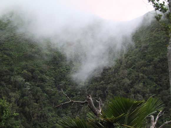 Mist/rain
coming over the mountain - very impressive
Mist/rain
coming over the mountain - very impressive
Another day we talked on the beach and checked out the resort there - The Four Seasons. What a beautiful spot. And while enjoying a beverage at the beach bar, I saw a monkey, of which later I found out was only 4 months old. Went in for a closer look and before I knew it, I was holding him. Yes, its true. A first for me, that's for sure. But he was a very friendly monkey. I really think he wanted my beer.
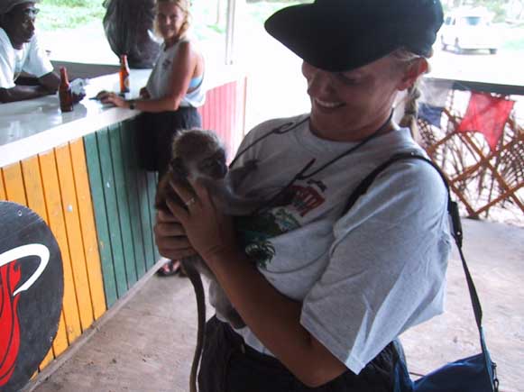 Debbie
socializing with the locals -- a monkey
Debbie
socializing with the locals -- a monkey
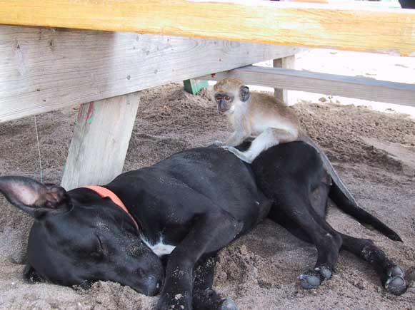 Later
the monkey was spotted trying to wake the dog
Later
the monkey was spotted trying to wake the dog
Looks like we're heading out tomorrow.
Our plan was to sail from Nevis to Guadeloupe. But now we've decided
to be bold and stop at Monserrat first. That's where the very active
volcano is. We just can't resist getting as close to it as possible.
Apparently the southern end of the island is off limits, but there's an
anchorage on the northern end open. Should be interesting.
But if the guys think their going to get us to hike up this volcano, their
crazy!! :-)
Monserrat
- 1/15/03
On our journey to Monserrat we finally caught
a fish. And what a fish it was - a Mahi Mahi. It was 42" and
approx. 10-15 lbs. What a beautiful fish - bright green and blues.
We drug it behind the boat for sometime to wear it out. As I was
pulling in the handline, the fish showed he still had some spunk left by
doing a little dance on the water. Was able to get it close enough
to the boat for Fred to gaff it and bring it aboard. I went
to work on cleaning it and that evening we dined on a delicious meal from
the sea. Since our dingy was on deck, Fred swam some pieces over
to Mike & Jan, once we anchored in Monserrat, so they too could enjoy
some fresh fish as well.
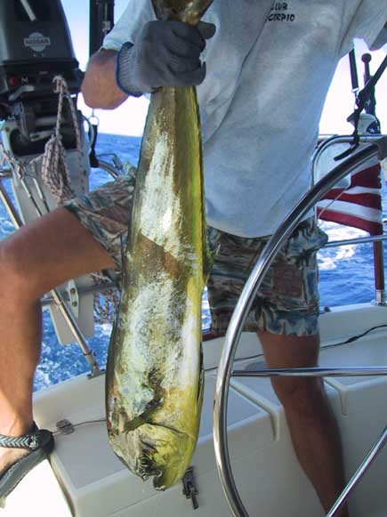 The
first Mahi Mahi on Early Out -- delicious!!
The
first Mahi Mahi on Early Out -- delicious!!
We decided since the weather looked good we'd take off the next day for Guadeloupe. So we didn't check in with customs or go ashore. We did however snorkel the reef off Potato hill. It felt good be in the water, but it appears the ash from the volcano killed most of the reefs. I imagine it will take sometime for them to recover. We did pickup some volcanic sand here to bring back for the kids. Little Bay, the harbor we anchored in was very beautiful. Would like to spend more time exploring next time around.
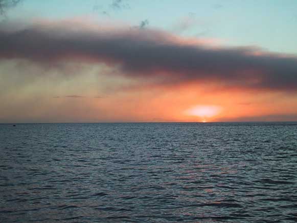 The
sunset highlighted the ash in the air from the volcano
The
sunset highlighted the ash in the air from the volcano
We sailed around the windward side of Monserrat so that we could get a close look at the active Soufriere Hills volcano. It first erupted in 1995 destroying their capital, Plymouth. Prior to the eruption, 11,000 people inhabited the island - now down to approx. 4,000. There's a two mile exclusion zone around the volcano so many folks lost their home, or were forced to leave their homes and relocate. By sailing around it, we were able to get within a mile or so of it. Very impressive. You could see the large flows of lava/ash that carried down into the water. Apparently its extended the shoreline quite a bit. We could also see smoking ambers towards the top. An amazing site.
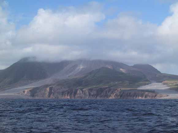 The
southeast side of Soufriere Hills volcano on Monserrat
The
southeast side of Soufriere Hills volcano on Monserrat
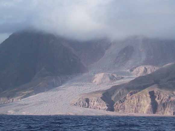 Closer
look at one of the large lava/ash flows from the volcano
Closer
look at one of the large lava/ash flows from the volcano
Guadeloupe
- 1/16/03 - 1/28/03<
Deshaies
We enjoyed an outstanding close hauled sail
over to Guadeloupe. One of our best in a while. The sun
was shining and the winds were between 15-20, seas 3-5. Auto
was steering the boat and I enjoyed sitting on our rail seat just looking
out into the deep blue water with nothing in site. Fred on the other hand
was all excited about catching a fish yesterday and was working hard on
a repeat performance today. Unfortunately it wasn't meant to be though.
All we caught was a 2 ft. barracuda.
Guadeloupe, which is part of France, has a population of about 330,000. Certainly much more than any of the islands we've visited lately. Its made up of two islands in the shape of a lopsided butterfly with a river separating the two halves. Mid afternoon we arrived and anchored in Deshaies which is on the western shore. Its a very pretty anchorage well protected by surrounding green hills and mountains. There's a tropical river here which sounds interesting, so we'll be checking that out later. We put the dingy in the water and shortly were off to Mike & Jan's boat to celebrate Jan's grandson - Jake's - 4th birthday. She was missing him and had a birthday party in his honor. She made brownies and we brought a homemade card and some of the volcanic sand we picked up from Monserrat as a present.
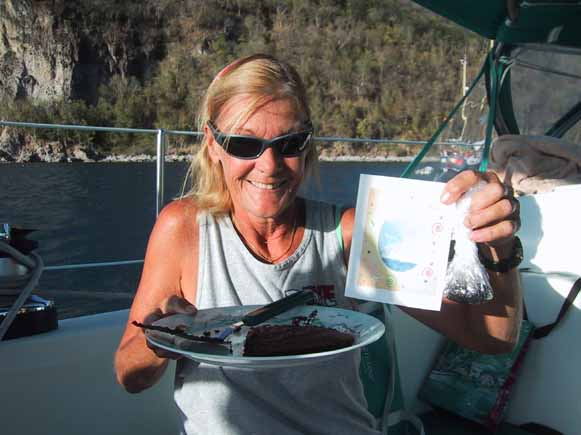 Jake's
birthday party - Jan holding the brownies, card & present
Jake's
birthday party - Jan holding the brownies, card & present
During our evening get together, we always
watch to see if there's going to be a green flash or not. Its something
that occurs just as the sun is ready to set. If the horizon is clear,
you can sometimes see a very brief green flash right before it hits the
water and disappears. Mike has been saying that he always sees a
green flash when the sun goes down. Well, we know that can't always
be true. Sometimes we do see one, but Mike seems to see them all
the time - even if its cloudy. So after having the green flash discussion
with him and questioning whether or not he really sees them, we were delivered
the picture below. I still don't believe it -- do you??
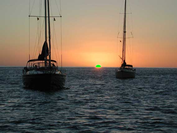 Picture
taken by Mike of a green flash - believe it or not......NOT!
Picture
taken by Mike of a green flash - believe it or not......NOT!
We headed in town for a closer look. Nice, clean buildings - found a bakery, butcher, grocery, post office and more. Couple things we learned, they don't speak English at all.....so we're continuing to spiff up on key French words. And this is the first place we've found where they won't accept U.S. dollars -- only Euros. Our guide book told us the pharmacy would exchange U.S. dollars for Euros so we did that because our guide said no ATMs were here. Later we found one ATM and did get some additional money. Wish we would have found the ATM first as the pharmacy charged for the exchange. Oh well.... Also have to remember that most of the stores close from about noon to 3 PM. Then reopen again. So if you need supplies, go early, or later. We took a hike along the tropical river and thru part of the rain forest. It wasn't the most impressive trail, but great to get some exercise. Tomorrow is boat project day!
Pigeon
Island
Afternoon came and we decided to continue
on. But not long after leaving our nice anchorage in Deshaies, the
wind piped up to 25-30 knots. What we thought was going to be a relaxing
sail, turned out to be a windy/salty one. But we arrived and
anchored in the cove south of Pte. Malendure - just opposite Pigeon Island.
Too late to go ashore, so we'll go exploring tomorrow. One of the
main attractions on Pigeon Island is the Cousteau Underwater Park.
Hoping for a sunny day tomorrow to go snorkeling there.
Our sunny day came so off to the Cousteau National Park. Mike & Jan did a dive and said it was fantastic. Fred and I went snorkeling around the island. The water was crystal clear and we saw beautiful reefs, many fish and even a sea turtle. It was well worth the stop.
Pointe-a-Pitre
Not much in the town near Pigeon Island
so we decided to continue around the western wing of the butterfly to Pointe-a-Pitre.
But we got a little later start than we wanted to. The winds were
blowing 20+ in the anchorage and we figured they were higher further out.
So we waited a few hours until they diminished. Instead of going
directly to Pointe-a-Pitre, we made a brief stop at Basse-terre,
but did not go ashore.
The next day we continued our trip. We thought we would be able to sail most of the way, but guess what, the winds changed to NE and was now on our nose...again! We finally got to sail after we rounded the corner and headed up the middle of the butterfly. Found a great anchorage on the western side of Pointe-a-Pitre. Lots of wind for George, but no waves because of protection from a reef. This is the first island where we've actually found real civilization. As I mentioned earlier, there are about 330,000 people on this island. We've seen people jogging, walking, biking, swimming - something we haven't seen on the other islands. There are high rises and a highway believe it or not. We rented a car - cheaper than an taxi - and did some hiking. On our ride to the trail we saw they grow lots of bananas and some sugar cane on the island. And that they have a lot of bull here. Really, all the places you see a fair amount of grass have bulls tied to a long leash and we figure that's how they mow their grass around here. So going down the road you see bulls everywhere. Haven't figured out why bulls vs. cows, but it probably has something to do with bulls not needing to be milked twice a day. It is also very interesting driving without really knowing where you are - as we couldn't read a thing and not all streets are marked. One map we had showed pictures of gas stations, so we navigated by that for a while counting the stations til they ran out. But we did arrive at the trail leading to the waterfalls - confirmed by a big picture they had on a sign. The trail started off by going thru the rain forest. But boy did it rain. Again, we should have learned our lesson and worn rain gear...oh well. And this trail was muddy. And I do mean muddy. One step I took my leg sunk down to my knee. Pulled it out to that nice sucking noise sticky mud makes. Luckily we had sandals on which made clean up easier. Unfortunately Jan took a tumble and had to walk around with a nice big brown spot on her shorts for the rest of the day. We felt like a bunch of kids playing in the mud - what fun! The rain forest was very tropical - the best we've seen so far. Lots of the big leaf plants, ferns and trees. The walk took longer than we thought - because of all the rain and mud, so we didn't make it to all the waterfalls. But the one we saw was great. Amazing how much wind and mist came off it as it crashed into the stream below.
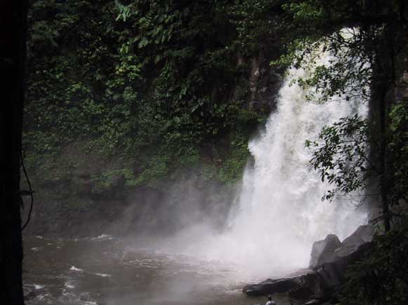 Waterfall
- Chutes du Carbet - notice how small Freed is in the bottom of the picture
Waterfall
- Chutes du Carbet - notice how small Freed is in the bottom of the picture
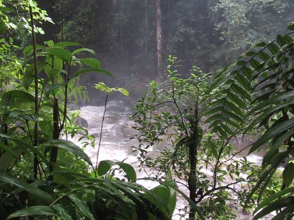 Tropical
vegetation along the falls
Tropical
vegetation along the falls
After our hike we treated ourselves to a late lunch at a very quaint restaurant (Saveurs Tropicales) right by the start of the trail. It was another interesting experience as our waitress (also the cook and owner) did not speak any English. So we all sat with a menu we couldn't read trying to figure out what to order. Luckily we've learned some key words that mean chicken, tuna, ham, cheese and french fries. So that was a start. Our meal ended up being terrific. Mike, Jan & Fred had a smoked chicken sandwich. I on the other hand went wild. I pointed to something on the menu, asked "good" - she nodded and I ordered it. Boy was she right -- delicious.
Another day we did some exploring in the dinghies. Went up the river that separates the two halves of the butterfly. It was a pretty river - reminded me a lot of the ICW in North Carolina. Not much in the way of buildings or town - mainly mangroves, mangroves and more mangroves. It was a fun ride. On our way back we stopped to checkout the downtown area. Lots of buildings, people and a wonderful fresh fruit market. Interesting experience at the market. We wanted to buy a couple tomatoes. The lady didn't speak English, but we pointed to a tomato and put up one finger trying to find out what the price was for one. She said one Euro. We thought that was rather steep for one tomato, so we tried to buy two tomatoes for one Euro. She shook her head and we said merci and started to leave. She shouts something about two tomatoes for 1 Euro - or that's what we thought she said. Finally I gave her one Euro and all the sudden she's filling our bag with tomatoes - not one, but 12. Wow, what a deal.
We spent several more days in hopes that
Mike & Jan's computer would be fixed. The latest being they installed
the new hard drive and loaded the operating system, but it was in French!
Their trying to download an English version of Microsoft off the web or
something, but its not going well. Can you believe it. But
it was good that we hung around as we got to see Pete & Mary from
Noelia
- folks we sailed with in the Caribbean 11500 rally. We haven't seen
them since leaving the Virgin Islands so we had lots of fun catching up
over a pizza and a couple drinks on their boat.
Iles
des Saintes - 1/28/03 - 2/2/03
Ilet
a' Cabrit
Well, Fred and I decided we'd move on and
let Mike & Jan catch up with us as soon as their computer started talking
English. The wind was good and we enjoyed a nice sail over to the
Saints. These are a small set of islands about 5 miles south of Guadeloupe
that are still very much French. In fact, they spoke less English here
than anywhere else we had been. But we manage to survive once again. Our
first anchorage here was a remote one - off Isle De Cabrit. Nothing
much on the island, except some very entertaining goats. We sat in our
cockpit with a cocktail and watched for an hour as a mother and kid negotiated
a 300 rock wall we would have never attempted to climb. There was also
a huge iguana that would move now and then. This was what we call cheap
entertainment. When we arrived we saw that water was so clear we just had
to jump in and see what we could find. Found some nice reefs and
fish. Fred saw a fish which the French lady also snorkeling called
a bat fish --later we learned it's official name - a flying gurnard.
It felt really good to be back in the water again. After all, it
had been almost a week! :-)
Bourg
des Saintes
Since we sailed so much on the way here,
we needed to give our batteries a good charging so the next day we motored
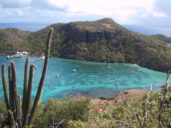
around the islands checking things out. Eventually anchored in Bourg
des Saintes which is on the main island of Terre de'n Haut. What
a beautiful picture. Again, the water was crystal clear - we could
see the anchor on the bottom down a good 30+ feet. The wind was blowing
for George and the town with all its red roofs was very picturesque.
Couldn't wait to see more. On our way into shore we saw a boat from
Cleveland, OH. Of course, we had to stop by and say hi. Come
to find out we had actually met them, briefly, at a party in Annapolis
for the Caribbean 1500 group. Very nice couple - on the boat Surprise.
Fun catching up with them and later had them over for cocktails.
Made it to shore. The only bad thing I have to say is: Where's
the dingy dock? There really is no real good place to leave your
dingy. So we pulled it on shore and tied it to a tree. Would
rather have locked it to a dock, but I guess this worked.
 Fort
Napoleon
Fort
Napoleon
 One
of the beautiful views from the Fort - Marigot harbor
One
of the beautiful views from the Fort - Marigot harbor
The first day we walked around town and up one of the roads to the Eastern (windward) shore to see the big crashing waves and a nice beach. On the way we passed a cemetery. They bury their dead above the ground here in large rectangular boxes with white 6" tile all around the outside. It was a very neat, clean looking site with lots of flowers.
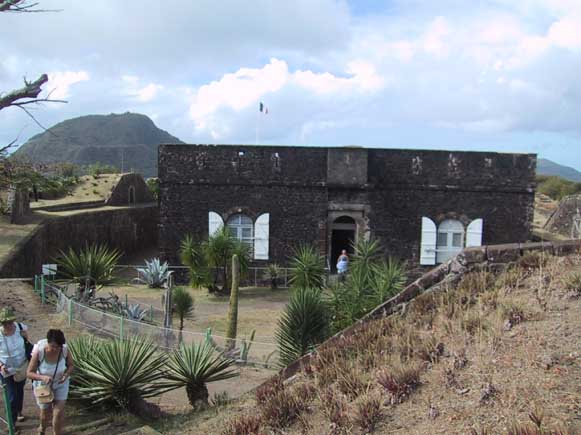
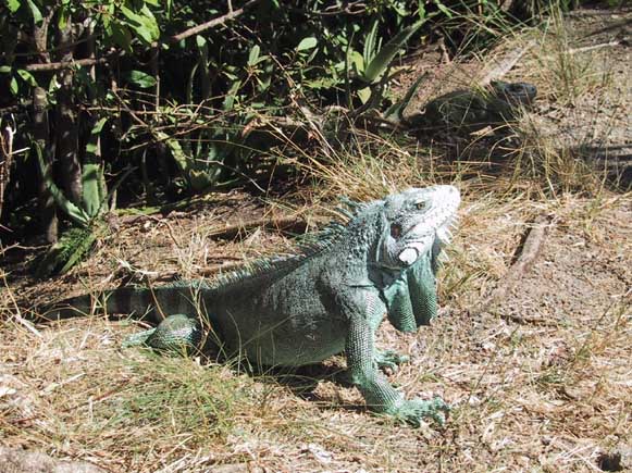
The next day we hiked up to Fort Napoleon. It wasn't a tough walk, but it was a hot windlass morning so the moderate increase in elevation seemed higher than it really was. The Fort was well preserved and was a combination fort, nature preserve and museum. The outside grounds are well maintained and with main different indigenous plants all labeled. Walking along the paths was also fun because of all the iguanas. They were everywhere. They look fierce but are really harmless.
 One
of the many iguanas at Fort Napoleon
One
of the many iguanas at Fort Napoleon
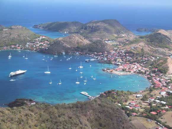
The next day we decided to hike up the tallest
hill to an overlook which actually had a height of 309 meters (almost 1000
ft.). The trail was an old road that they only let foot traffic and garbage
trucks up. We did not see and garbage trucks on our hike but we did walk
past a large pile of burning garbage. In the Caribbean they don't have
the room for garbage dumps so they burn their trash, all of it. So for
about 200 yards of our climb we tried desperately to hold our breath. It
was much easier or the way down. All along the path that wound around the
hill were overlooks with fantastic views in all the directions. We
had a nice clear day and enjoyed spectacular views of Guadeloupe, Dominica,
Marie Galante and the harbor down below.
 View
of the harbor from top of the hill
View
of the harbor from top of the hill
 Debbie
& Fred - enjoying the scenery from top the hill
Debbie
& Fred - enjoying the scenery from top the hill
Next day headed around the corner to Pain a' Sucre to try the snorkeling
there. Nice anchorage, but not the best snorkeling.
Heading out tomorrow for Dominica.