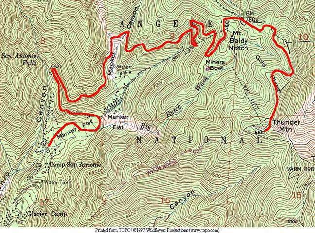
Topographic Map Mini Lab
1. What is the contour interval of the map?
2. What is the highest elevation on the map?
3. What is the lowest elevation on the map?
4. What is the vertical relief (difference in elevation)
of the ski lift which travels up from near the
water tank in Manker Flat to Mt. Baldy Notch?
5. If you were to dam the streams which
flow southwest out of Mankers Flat so that
the water backed up to the 7000' elevation
contour line, how deep would this new
reservoir be at
6. In which direction does the stream
in the bottom center of the map, named 'Canyon,'
travel? Be as specific as possible.