Key Points
Observed Winds
represented by wind barbs
The symbol highlighted in yellow (in the diagram above) is known as a "Wind Barb". The wind barb indicates the wind direction and wind speed.
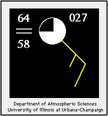
Wind Barbs
determining wind direction
Wind barbs point in the direction "from" which the wind is blowing. In the case of the diagram below, the orientation of the wind barb indicates winds from the Northeast.

Observed Dew Point Temperature
indicates the amount of moisture in the air
The value highlighted in yellow located in
the lower left corner (in the diagram above) is the dew point temperature in
degrees Fahrenheit. In this example, the reported dew point temperature is 58
degrees.

Identifying Tropical Air Masses
on a map of surface observations
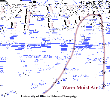
Below is a map of surface observations and the leading edge
of a tropical air mass surging northward into the Ohio Valley has been
highlighted in red. Southerly winds behind the boundary signify the continued
northward transport of warm moist air.
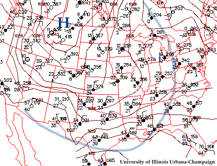
Below is a map of surface observations and the leading edge
of a large arctic air mass blanketing much of the United States has been
highlighted by the blue line. The center of this air mass is a high pressure center located in northern
Montana (indicated by the blue "H").