River#12 & #13: Nicola River. Picnic Area to Red Rock Canyon (Day 1). Red Rock Canyon to first highway bridge (Day 2). May 10th (Sat) and 11th (Sun).
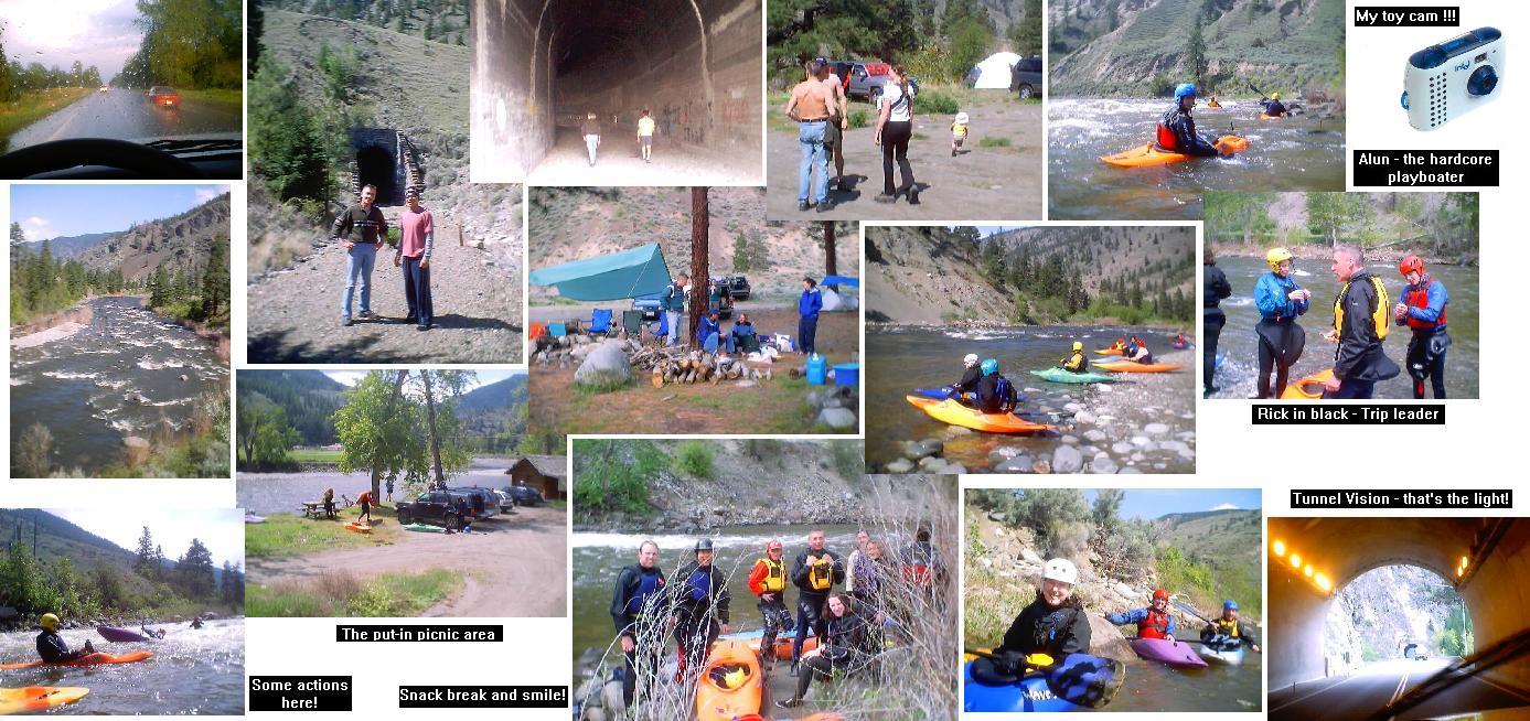
We had 12 people on this trip - Rick (leader), Phil, Megan, Jane, Dave, Janez, Alun, James, Heidi, Unknown#1, Unknown#2, and me. In the morning, Rick, Phil, and I went to check out an old tunnel near the campsite (see pics). If you go thru this tunnel, at the end you could get a very good aerial view of Nicola river (see pic). The tunnel is on the right hand side of the river. Nicola is a beautiful river, class II run, with one or two class III-. People called this viewpoint 'Red Rock Canyon.' There were some graffiti on the tunnel walls as high as to the top. Wondered how they got up there? Our campsite was stationed as a mid point for both take-out, in day 1, and put-in, in day 2. The put-in for day 1 was just driving up on the road to a picnic area on your right hand side. You could see it easily because there were some picnic tables and a small house there (see pic). Later, we stole some woods from this picnic area for the night.
Those pictures that I took were actually taken with my 'Web cam' - a low quality, digital + movie, toy camera. After trying out for the first time, I was impressed that the picture qualities weren't too bad. The picture resolutions were low tho but people were recognizable.
On my way home, I passed thru 7 tunnels. Nice tunnel views and there were names like Alexandra tunnel, Hell's gate tunnel, China Bar tunnel, Terrace tunnel, and so on. As I was driving along highway #1, Thompson river and Fraser river were also nearby. These rivers are WIDE!
Directions: From Vancouver, take highway #1 east. #1 will take you thru Chilliwack, Hope, Yale, Lytton, and Spences Bridge. At Spences Bridge (the closest town to campsite) connect to highway #8 and it'll say towards Merritt. About 25 minutes drive to the campsite. You'll pass an Osprey farm, 2 small railway bridges (non-functional) on your right hand side, and then a Nine miles garden (that's just a name, not really 9 miles long). Soon after Nine miles garden, the campsite is just in an open area on your right hand side. If you look at the map, you're actually traveling south towards the campsite. The put-in is just driving further south to a picnic area on your right hand side. The campsite is our first day take-out. The second day take-out is by driving north towards Spences Bridge. It's after the first bridge (not the 2 non-functional bridges) and the parking is on your left hand side.