 |
|
|
|
|
|
|
|
|
|
|
|
|
|
|
|
|
|
|
|
|
|
|
|
|
|
|
|
|
|
|
|
|
|
|
|
|
|
|
|
|
|
|
|
|
|
|
|
|
|
|
|
|
|
|
|
|
|
|
|
Pig Pen & Lick Log Falls |
|
|
|
 |
|
|
 |
|
|
|
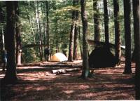
This April trip consisted of Greg and myself. It is a 0.9 mile hike to the campsite. There are 4 rather large campsites availabe in this area. All the waterfalls are within a mile. Access to both upper and lower Lick Log Falls is a little treacherous, so please use care. For directions, you can e-mail me or search the web. |
|
|
|
|
|
|
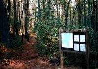
Trailhead to the falls. |
|
|
|
|
|
|
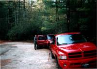
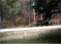
Nicholson Ford Rd. access. |
|
|
|
|
|
 |
|
|
|
|
|
|
|
 |
|
|
|
 |
|
|
|
|
|
|
|
|
|
Foothils, Chatooga, and Bartram trails junction. |
|
|
|
|
|
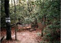
Our campsite. |
|
|
|
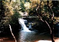
Pig Pen Falls near the campsite. |
|
|
|
|
|
|
|
|
|
 |
|
|
|
|
|
|
 |
|
|
|
|
|
|
 |
|
|
|
|
|
|
|
|
|
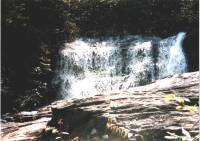
Lick Log Falls. |
|
|
|
|
|
|
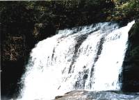
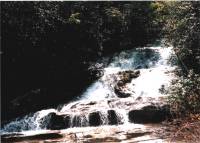
Lick Log Falls, a beautiful sight! |
|
|
|
|
|
|
Upper level of Lick Log falls. |
|
|
|
|
|
|
|
|
|
 |
|
|
|
|
|
|
 |
|
|
|
|
|
|
 |
|
|
|
|
|
|
|
|
|
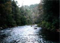
Looking right up the Chatooga. |
|
|
|
|
|
|
|
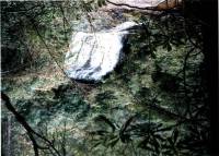
Second level of Lick Log Falls where it empties into the Chatooga River. |
|
|
|
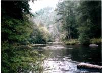
Looking left down the Chatooga. |
|
|
|
|
|
|
|
|
|
 |
|
|
|
|
|
|
|
This portion of the trail took us from Oconee State Park to Nicholson Ford Road access, approximately 8.5 miles. 10.3 miles if you add the portion from camp to the parking lot and back! We made this a day hike and finished in about 4 hours at a leniant pace. All trails are very well marked. Hidden Falls is also accessable from this trail, however we chose to bypass it at this time and will return at a later date. |
|
|
|
|
|
|
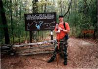
Me at the Foothils Trail trailhead in Oconee State Park. |
|
|
|
|
 |
|
|
|
 |
|
|
|
|
|
|
|
|
|
 |
|
|
|
|
|
|
Trail crosses over Hwy.107. |
|
|
|
|
|
|
Access to Tamassee Knob. |
|
|
|
|
|
|
|
|

|
|
|
|
|
BACK |
|
|
|
|
|
|
|
|
|
|
|
Jumping Branch Trailhead. |
|
|
|
|
|
|
|
|
|
|