Abstract:
Developing Land Degradation and Forest Fire Hazard Models Using Remote Sensing and Geographic Information System in East Kalimantan, Indonesia.
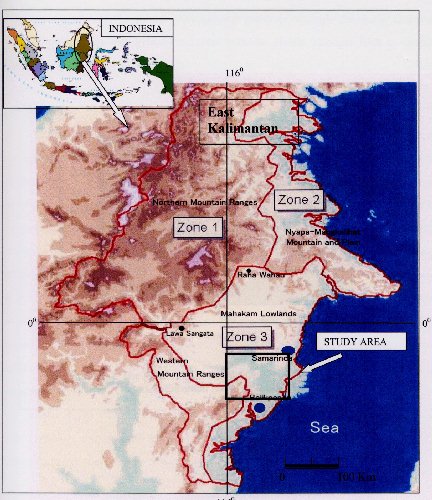
The objective of this research is to develop models of land degradation and forest fire hazard by using remote sensing and geographic information system (GIS). It attempts to extract the information from remote sensing data to derive a model for forest fire and soil erosion hazard based on characteristics of multispectral data, and also attempts to identify areas affected by forest fire of 1997/1998. the area lies within longitude 116o 45’ to 117o 13’ E and latitude 0o 45’ to 1o 8’. The area is one of the most severe eroded areas in east Kalimantan and was severely affected by forest fire of 1997/1998.
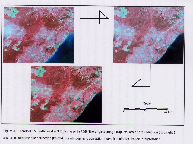
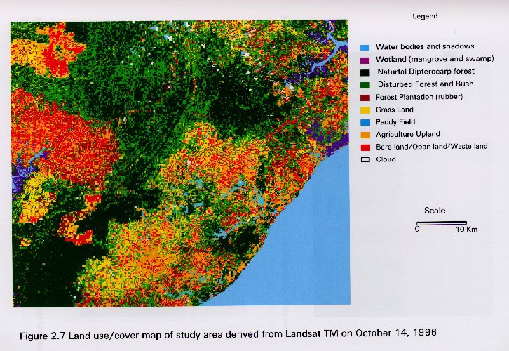
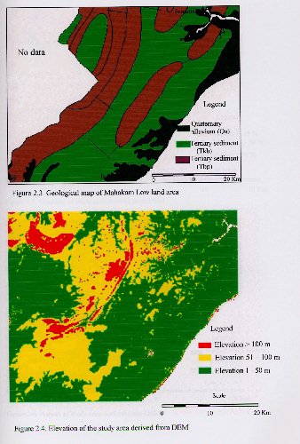
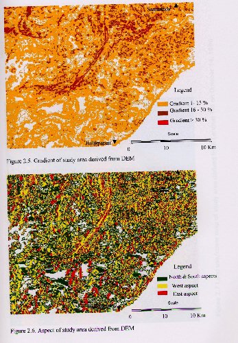
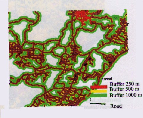
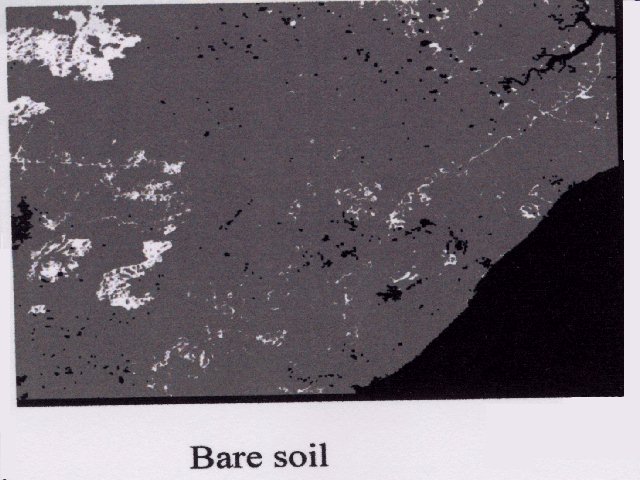
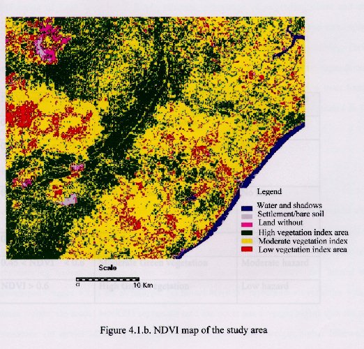
To achieve that purpose Landsat TM and digital elevation model (DEM) derived from topographic maps was used as the main data. The following variables were derived from these data for the model: vegetation fuel type, geology, elevation, gradient, aspect, road, and bare soil. These variables are widely known as basic factors affecting spreads of forest fire and accelerated soil erosion. These variables were weighted according to their impact on the spread of fire and accelerated soil erosion. Supervised classification, Normalized Difference Vegetation Index (NDVI), Tasseled Cap transformation were applied to Landsat TM. The weight variable and quantification scaling type I methods were applied to derive weight for GIS analysis. Multiple end member spectral mixture analysis technique was applied to derive the end member of bare soil. The final analysis was done using GIS analysis approach. The derived models were compared to the reference map and ground check to assess the reliability of the models. The comparison was based on the pixel approach.
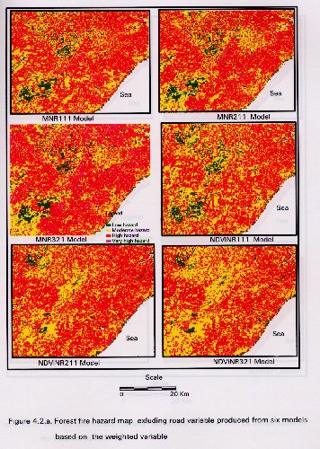
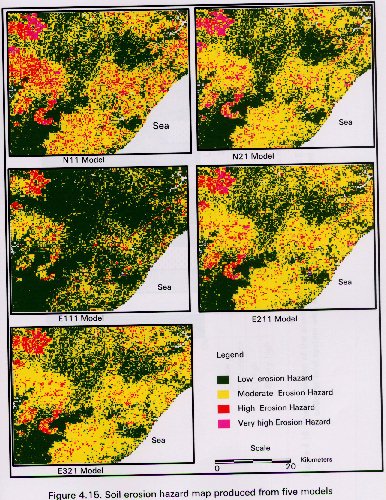
A total of sixteen models of forest fire hazards were developed. These models consider the effect of nature forest fire and also forest fire as a result of human activities. A further five models were develop for soil erosion hazard. The agreement of the models with the reference map varied from 30 to 60 % for the forest fire hazard models, and from 70 to 90% for the soil erosion hazard models. The proportion of the pixels classified as very high hazard to fire was five times more compared with the pixels classified as low hazard affected by forest fire in 1997/1998. It was found out that the forest fire models using NDVI as one of the input variables had better result compared with the model based on vegetation fuel type derived from land use/cover classification. Quantification scaling type I method shows that three variables, vegetation fuel type, elevation, and road were important for forest fire hazard model. Exclusion of these three variables from the model decreased the regression coefficients (adjusted R2) of the model. Combination of variables with a similar weight for GIS analysis resulted in the best model for soil erosion. This mean that adding slope to the soil erosion model for GIS analysis resulted in the best model for soil erosion hazard.
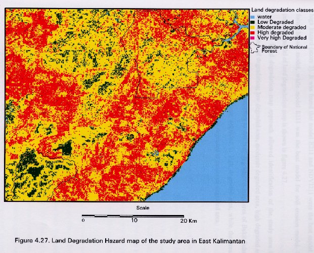
Land degradation hazard map was derived by integration of the forest fire and soil erosion hazards. This map provided a rapid analysis of the area susceptible to soil erosion and forest fire hazard. On the basis of this map it is possible to evaluate the pattern of land degradation in large area.