The Weather for Madison, WI and Surrounding Communities


*****NO CURRENT WATCHES...WARNINGS...OR ADVISORIES IN CENTRAL OR SOUTHERN WISCONSIN*****


School Closings/Delays Marquee
NO CURRENT SCHOOL CLOSINGS OR DELAYS

Main Menu
7-day Forecast
Storm Prediction Center Links
NWS Upper Midwest Links
Southern WI Watches, Warnings, and Advisories Archives
Midwest Doppler Radars
Disclaimer
Current Conditions
Prob. of SVR WX in Southern WI
3-Day Pollen Forecast For Southern WI Cities
Active Tropical Systems
The New 2001-02 Wind Chill Chart
Southern Wisconsin Ski Reports
Upper Midwest Road Conditions
EMPTY
EMPTY


Current Conditions
Enter a City or US Zip:


Forecast
Monday, 16 September 2002
Mostly Sunny   Mostly sunny & pleasant.
High: 75�F
Wind: SW 7-15 MPH
Monday Night, 16 September 2002
Clear   Clear.
Low: 50�F
Wind: Light SW
Tuesday, 17 September 2002
Mostly Sunny   Mostly sunny and warm.
High: 81�F
Wind: N/A
Wednesday, 18 September 2002
Partly sunny   Partly sunny with increasing afternoon cloudiness.
High: 75�F
Low: 52�F
Thursday, 19 September 2002
Showers�� Variably cloudy with a few showers possible.
High: 68�F
Low: 52�F
Friday, 20 September 2002
Showers�� Variably cloudy and cool with a chance for showers.
High: 68�F
Low: 50�F
Saturday, 21 September 2002
Partly sunny�� Partly sunny and cool.
High: 65�F
Low: 47�F
Sunday, 22 September 2002
Partly Sunny�� Partly sunny and cool.
High: 63�F
Low: 40�F
Back To The Main Menu
Back To The Top

Active Tropical Systems
Atlantic Ocean, Caribbean Sea, Gulf of Mexico, and the Eastern Pacific out to 140�W
ATLANTIC SYSTEMS
No Active Systems
EASTERN PACIFIC SYSTEMS
TROPICAL STORM ISELLE
Current Public Advisory
Current Forecast Advisory
Current Forecast Discussion
Tropical Storm Iselle Graphics
Tropical Storm Iselle Archive
Back To The Main Menu
Back To The Top

Storm Prediction Center Links
Click on Thumbnail For a Larger Image

Current Watches For The US
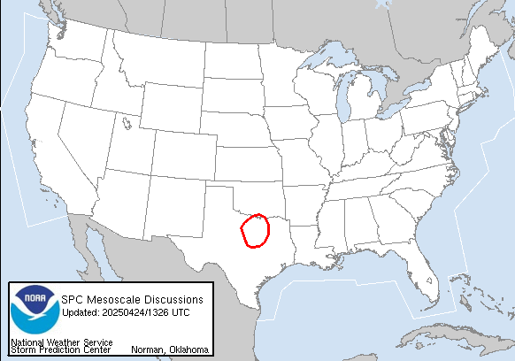
Current Mesoscale Discussions For The US
Current Day 1 Convective Outlook For The US
Current Day 2 Convective Outlook For The US
Current Day 3 Convective Outlook For The US
Current Day 1 Fire Weather Outlook For The US
Current Day 2 Fire Weather Outlook For The US
Current Watch, Warning, & Advisory Display For The US
6-Hour (0600-1200 UTC) Thunderstorm Outlook For The US
Back To The Main Menu
Back To The Top

Upper Midwest Weather Links From The NWS
Wisconsin Hourly Report
Wisconsin State Forecasts
Wisconsin Zone Forecasts
Wisconsin Short Term Forecasts
Wisconsin Forecast Discussions
Wisconsin Weather Summary
Wisconsin Public Information
Wisconsin Climatological Reports
Wisconsin Hydrological Forecasts
Wisconsin Watches
Wisconsin Special Weather Statements
Current Wisconsin Warnings
Iowa Hourly Report
Iowa State Forecasts
Iowa Zone Forecasts
Iowa Short Term Forecasts
Iowa Forecast Discussions
Iowa Weather Summary
Iowa Public Information
Iowa Climatological Reports
Iowa Hydrological Forecasts
Iowa Watches
Iowa Special Weather Statements
Current Iowa Warnings
Minnesota Hourly Report
Minnesota State Forecasts
Minnesota Zone Forecasts
Minnesota Short Term Forecasts
Minnesota Forecast Discussions
Minnesota Weather Summary
Minnesota Public Information
Minnesota Climatological Reports
Minnesota Hydrological Forecasts
Minnesota Watches
Minnesota Special Weather Statements
Current Minnesota Warnings
Back To The Main Menu
Back To The Top

Watches, Warnings, and Advisories Issued By The NWS For Southern WI since 1 January 2001
For 2001 Archives Click Here

Tuesday, 29 January 2002 HAZARD: WINTER STORM

Wednesday, 30 January 2002 HAZARD: WINTER STORM, WINTER WEATHER

Thursday, 31 January 2002 HAZARD: WINTER WEATHER

Thursday, 07 February 2002 HAZARD: WINTER STORM

Saturday, 09 February 2002 HAZARD: WINTER STORM, WINTER WEATHER

Thursday, 28 February 2002 HAZARD: WINTER STORM

Friday, 01 March 2002 HAZARD: WINTER STORM

Saturday, 02 March 2002 HAZARD: WINTER WEATHER

Thursday, 07 March 2002 HAZARD: WINTER WEATHER

Saturday, 09 March 2002 HAZARD: SEVERE THUNDERSTORM

Wednesday, 13 March 2002 HAZARD: WINTER STORM

Thursday, 14 March 2002 HAZARD: WINTER WEATHER

Monday, 01 April 2002 HAZARD: WINTER WEATHER

Tuesday, 16 April 2002 HAZARD: SEVERE THUNDERSTORM

Thursday, 18 April 2002 HAZARD: SEVERE THUNDERSTORM, TORNADO
Back To The Main Menu
Back To The Top

Upper Midwest Road Conditions (By State)
Wisconsin

Iowa

Illinois

Indiana

Minnesota

Michigan


Midwest Doppler Radars
National Weather Service Doppler Radar: United States
WKOW TV 27 Doppler Radar: Madison, WI
WMTV 15 Doppler Radar: Madison, WI
WISC 3 Doppler Radar: Madison, WI
WAOW 9 Doppler Radar: Wausau, WI
WGBA 26 Doppler Radar: Green Bay, WI
National Weather Service Doppler Radar: La Crosse, WI
National Weather Service Doppler Radar: Milwaukee/Sullivan, WI
National Weather Service Doppler Radar: Green Bay, WI
National Weather Service Doppler Radar: Minneapolis, MN
National Weather Service Doppler Radar: Duluth, MN
National Weather Service Doppler Radar: Des Moines, IA
National Weather Service Doppler Radar: Quad Cities, IA
National Weather Service Doppler Radar: Chicago, IL
National Weather Service Doppler Radar: Central Illinois
National Weather Service Doppler Radar: Marquette, MI
National Weather Service Doppler Radar: Gaylord, MI
National Weather Service Doppler Radar: Grand Rapids/Muskegon, MI
National Weather Service Doppler Radar: Detroit, MI
National Weather Service Doppler Radar: Northern Indiana
National Weather Service Doppler Radar: Indianapolis, IN
National Weather Service Doppler Radar: Cleveland, OH
National Weather Service Doppler Radar: Wilmington, OH
Back To The Main Menu
Back To The Top

Probibilities of Severe Weather in Southern Wisconsin
For: Today, 16 September 2002...
No Risk Of Any Thunderstorms

Tornado (Within 25 Miles of a Point): 0%
Damaging Wind (Within 25 Miles of a Point): 0%
Large Hail (Within 25 Miles of a Point): 0%
For More Information on Day 1 Severe Weather Outlook Click Here
For: Tomorrow (Day 2), 17 September 2002...
No Risk Of Any Thunderstorms

Any Severe Weather (Within 25 Miles of a Point): 0%
For More Information on Day 2 Severe Weather Outlook Click Here
For: Day 3, 18 September 2002...
No Risk Of Any Thunderstorms

Any Severe Weather (Within 25 Miles of a Point): 0%
For More Information on Day 3 Severe Weather Outlook Click Here
Color Key to Percentages

0% = Black
2% = Dk Green (TORNADO ONLY)
5% = Brown
15% = Orange
25% = Red
35% = Magenta
45% = Blue

Color Key to Risks of SVR WX

No Risk of Any Thunderstorms = Black
Thunderstorms Possible...But No Severe Weather Expected = Black
Thunderstorms Possible...With An Isolated Severe Storm Possible = Brown
SLIGHT Risk of Severe Thunderstorms = Green
MODERATE Risk of Severe Thunderstorms = Dk Yellow
HIGH Risk of Severe Thunderstorms = Red

For Probabilistic Outlook Information (From The SPC), Click Here
Back To The Main Menu
Back To The Top

Southern Wisconsin Ski Reports
Tyrol Basin

New Snow:�0" (0 cm)
Base Depth:�0" (0 cm)
Runs Open:�0
Lifts Open:�0 of 6
Surface Snow: Grass
Notes:�CLOSED
Phone Number:�608-437-4FUN (4386)

For more information visit Tyrol's Website: http://www.tyrolbasin.com
Cascade Mountain

New Snow:�0" (0 cm)
Base Depth:�0" (0 cm)
Runs Open:�0
Lifts Open:�0 of 10
Surface Snow: Grass
Notes:�CLOSED
Phone Number:�608-742-SNOW

For more information visit Cascade Mountain's Website: http://www.cascademountain.com
Devil's Head

New Snow:�0" (0 cm)
Base Depth:�0" (0 cm)
Runs Open:�0
Lifts Open:�0 of 16
Surface Snow:�Grass
Notes:�SKIING CLOSED, BUT OPEN FOR SUMMER ACTIVITIES
Phone Number:�800-338-4579

For more information visit Devil's Head's Website: http://www.devils-head.com
Updated: Friday, 26 April 2002, 855 PM CST
Back To The Main Menu
Back To The Top

3-Day Pollen Forecast For Southern Wisconsin Cities
Madison, Wisconsin:
Monday, 16 September 2002: HIGH (9.2)
Tuesday, 17 September 2002: HIGH (9.7)
Wednesday, 18 September 2002: HIGH (9.0)
Predominant pollen: Ragweed, Chenopods and Nettle.
Milwaukee, Wisconsin:
Monday, 16 September 2002: HIGH (8.6)
Tuesday, 17 September 2002: HIGH (8.2)
Wednesday, 18 September 2002: HIGH (8.9)
Predominant pollen: Ragweed, Chenopods and Nettle.
Platteville, Wisconsin:
Monday, 16 September 2002: MODERATE (7.5)
Tuesday, 17 September 2002: MODERATE (8.0)
Wednesday, 18 September 2002: MODERATE (6.7)
Predominant pollen: Ragweed, Chenopods and Nettle.
Key To Pollen Levels
HIGH (8.0-12.0):Pollen levels tend to affect most individuals who suffer from the pollen types of the season. Symptoms may become more severe during days with high pollen levels.
MODERATE (4.0-7.9):Pollen levels will likely cause symptoms for many individuals who suffer from allergies to the predominant pollen types of the season.
LOW (0.0-3.9):Pollen levels tend to affect very few individuals among the allergy-suffering public.
Back To The Main Menu
Back To The Top

The New 2001-2002 Wind Chill Chart (updated by the NWS)

Wind Chill Chart from National Weather Service (www.nws.noaa.gov)
Back To The Main Menu
Back To The Top

Main Page Updated: Sunday, 15 September 2002, 1037 PM CDT


Please Read My Disclaimer


Visitors since 13, May 2001
Counter


Send me your questions or comments...Click Below!

[email protected]


Webpage Created On: Sunday, 13 May 2001
By: Dpiano123

Special Thanks to...
The National Weather Service(www.nws.noaa.gov)
���Interactive Weather Information Network (IWIN)(iwin.nws.noaa.gov)
���The National Weather Service Milwaukee/Sullivan WI (http://www.crh.noaa.gov/mkx)
The Storm Prediction Center(www.spc.noaa.gov)
The National Hurricane Center (www.nhc.noaa.gov)
weather.com
channel3000.com
pollen.com
people.bu.edu/xrpnt/ribbons
wtv-zone.com/dixie-g/HD/XMAS.html
tyrolbasin.com
cascademountain.com
devils-head.com
http://www.iwsinc.net/igc/backgrounds.html (Thanks for the backround!)


GodBlessAmerica
United WeStand

Back To The Main Menu
Back To The Top
Hosted by www.Geocities.ws

1