| Driving Directions to the Starry Starry Nights Observing Sites |
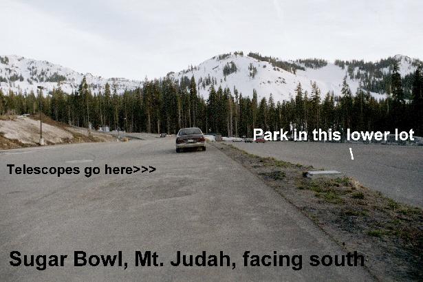
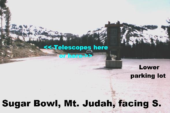
| Wed. Aug. 28: Sugar Bowl Mt. Judah Parking Lot: Take Interstate 80. Exit at Soda Springs Road. (This is 40 miles from Colfax, 55 miles past Auburn, and 80 miles above Sacramento.) Go right (east) at the end of the offramp. Go 3.2 miles (10 minutes) to just past the regular Sugar Bowl parking lot. (We will not be setting up at this location.) Continue another 0.6 miles. You'll see a big sign for Sugar Bowl, Mt. Judah. Turn right here. Go 0.7 miles to the Sugar Bowl Mt. Judah Parking Lot. This is it. The telescopes will be setting up near the entrance to the parking lot. Park on the lower parking lot to your right. Long: 120.2 deg. W, Lat: 39.3 deg. N. Elev. 6930'. Check weather (enter zip code 95728) Pictures of the site: #1 #2 |
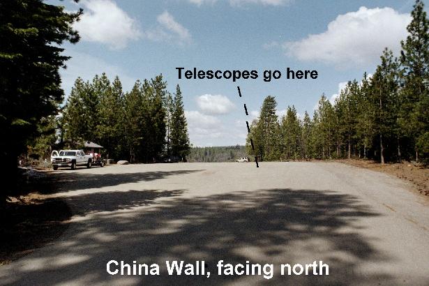
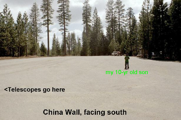
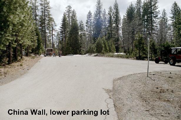
| Thurs. Aug. 29: China Wall, east of Foresthill, CA.: Take Interstate 80 to the Foresthill Road Exit in Auburn. (This is ~30 miles from Sacramento.) Go right (east) at the end of the offramp. Go east 18 miles (about 25 minutes) on Foresthill Road to the town of Foresthill. Continue 12.0 miles (15 minutes) to China Wall OHV Staging Area. This is it. It is on your left and you'll see a sign indicating it. The telescopes will be set up on the main parking lot, near the far (N) end. Park on this parking lot or on the smaller (lower) parking lot to your left. Long: 120.6 deg. W, Lat: 39.2 deg. N. Elev. ~3600'. Check weather (enter zip code 95631) Pictures of the site: #1 #2 #3 |
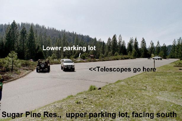
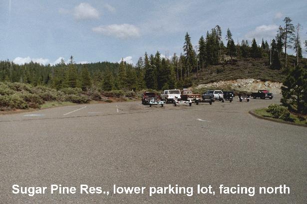
| Sun. Sept. 1: Sugar Pine Reservoir Boat Launch Parking Lot, east of Foresthill, CA.: Take Interstate 80 to the Foresthill Road Exit in Auburn. (This is ~30 miles from Sacramento.) Go right (east) at the end of the offramp. Go east 18 miles (about 25 minutes) on Foresthill Road to the town of Foresthill. Continue 9 miles to the Sugar Pine Reservior exit on your left. It is also known as Road "10". Follow that 5.7 miles to the Boat Launch parking lot, which will be on your right. Enter the area and go right into the large (lower) parking lot. This is it. There are two adjacent parking lots. The telescopes will set up on the upper lot, near the far (north) end. Long: 120.7 deg. W, Lat: 39.2 deg. N. Elev. 3650'. Check weather (enter zip code 95631) Pictures of the site: #1 #2 |
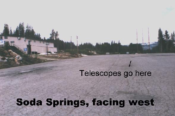
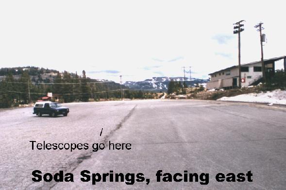
| Tues. Sept. 3: Soda Springs Ski Resort Parking Lot: Take Interstate 80. Exit at Soda Springs Road. (This is 40 miles from Colfax, 55 miles past Auburn, and 80 miles above Sacramento.) Go right (east) at the end of the offramp. Go 0.7 miles to the flashing yellow light. This is the Soda Springs Ski Resort Turnoff. Go right for about 0.3 miles across the RR tracks and a small bridge and then turn right and into the parking lot. This is it. We will set up near the far (W) end of the parking lot. Long: 120.3 deg. W, Lat: 39.3 deg. N. Elev. 6930'. Check weather (enter zip code 95728) Oictures of the site: #1 #2 |
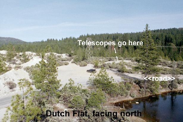
| Mon. Sept. 2: Dutch Flat Dry Diggins: Take Interstate 80 for 12 miles past Colfax to the Dutch Flat exit. At the end of the onramp, go left. Go about 0.5 miles until you see a sign indicating Dutch Flat. Go left there. Travel across the Railroad tracks and continue through the town of Dutch Flat. As you near the end of this block-long town, you wil get to a point where you will see the Post Office on your left and a small bell tower on your right. Just past the Post Office, turn left onto a narrow street. Go 0.2 miles. This is it. We will set up telescopes on a small plateau on your right. Park in the clearing along the road, just below the plateau, or park off the side of the road. Long: 120.8 deg. W, Lat: 39.2 deg. N. Elev. 3200'. Check weather (enter zip code 95714) Pictures of the site #1 #2 |
| 7 Nites from 7 Sites, 2002 |
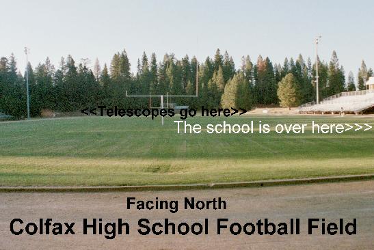
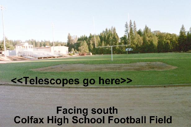
| Fri. Aug. 30: Colfax High School: Take Interstate 80 to the Colfax/Grass Valley exit. At the end of the offramp continue around to the right and over the overpass. Turn right at the stop sign. Go through the next stop sign and continue on this road (S. Auburn St.). It curves to the left and crosses the RR tracks. At the stop sign, continue straight up the hill (0.2 mile) to the next stop sign. Go left onto this road (Rising Sun Rd.) and up the hill (it curves to your right) to the next stop sign. Here go right onto Ben Taylor Road. You will pass the elementary school on your left, but keep going another 0.3 miles to the Colfax High School entrance. This is it. Turn left into the parking lot. We will be setting ujp on the football field. Long: 120.9 deg. W, Lat: 39.1 deg. N. Elev. 2400' Check weather (enter zip code 95713) Pictures of the site: #1 #2 |
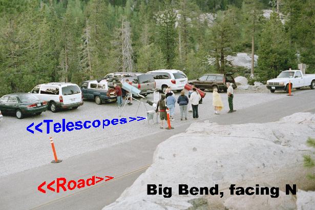
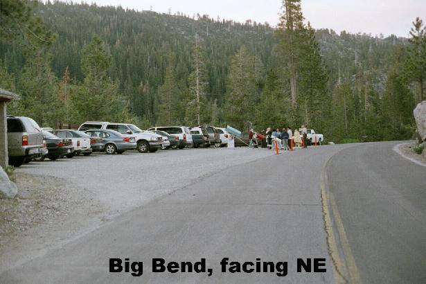
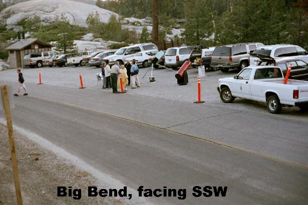
| Sat. Aug. 31: Big Bend (Loch Leven Trailhead): Take Interstate 80. Exit at the Big Bend Exit, which is just past Ciscoi Grove. (This is 30 miles from Colfax, 45 miles past Auburn, and 75 miles above Sacramento.) Go left at the end of the offramp. Go one-half mile (you'll go past the Big Bend Visitor Center) to the Loch Leven Trailhead Parking Lot. This is it. The telescopes will set up in the parking lot. Please park along this road, off the pavement. Long: 120.5 deg. W, Lat: 39.3 deg. N. Elev. 5800'. Check weather (enter zip code 95728) Pictures of the site: #1 #2 #3 See the Big Bend Website |
| To check the weather, click on "Check weather", when the weather page opens, enter the zip code |