ON PRESERVING ALL THE RESULTS FROM
A GEOLOGIST�S
PROSPECTING WORK
�(COBAR-BOURKE REGION ,
1975-1979)
REFERENCE:
Capnerhurst, K.R., 2005. Geochemistry of gossan samples collected on the Cobar-Nyngan 1:250000 sheets. Geological Survey of New South Wales. GS2005/338.
Downloadable at:
http://www.dpi.nsw.gov.au/__data/assets/pdf_file/37209/Cobar_Geochem_GS_Report.pdf
The above report, downloadable from the department�s website (NSW Department of Primary Industries), is an inspiring story about how a NSW Government agency (Geological Survey of NSW) was able to help preserve all the details of an interesting and instructive phase of prospecting over part of Western NSW with poor outcrop, in the late 1970s. It will be interesting to people in future because it also shows in some considerable detail how a geologist in the 1970s went about the day-to-day tasks of prospecting in a dry and low relief wide red-brown landscape with very little significant outcrop, and without the aid of GPS or other modern technological supports. He did have a good vehicle though, not just the old time prospector's donkey.
The samples were ones collected for geochemistry as part of an extensive search for base metals mineralization by North Broken Hill Limited in the Cobar-Bourke area.
Colin Plumridge, the geologist who carried out the prospecting, kept his many interesting notes and maps pertaining to the work, so that many years later it proved possible to supply coordinates for all of the samples.
Original assay data for Cu, Pb, Zn, Ni and Ag was digitized off retained assay sheets. As the samples had not been assayed for Au the Department re-analysed selected samples for gold and for 18 other elements.
Colin Plumridge today is Exploration Manager for Rimfire.
Rimfire�s website profile says of him:
During 1975-1986 Colin lived in Nyngan, before moving to Parkes in 1987.
Colin was an exploration geologist with North Broken Hill Ltd in 1968-1980. He had Australia wide exploration, concentrating on geologically based prospecting and drilling programmes. North Broken Hill at the time held large (but uneconomic) tin deposits at Doradilla which is south of Bourke. It also engaged in widespread exploration for other metalliferous deposits throughout the Bourke-Cobar region.
Concerning Nyngan, where Colin was long based at, it is interesting to note that a major flood occurred (after he had moved elsewhere). In April 1990, Nyngan and the surrounding district in the Shire of Bogan suffered the worst flooding the area has known since being settled. Record heavy rains in the catchment of the Bogan saw floodwaters rise to alarming levels, threatening the town. The townspeople mounted a magnificent effort to save the town, as many as possible manning the levees and filling sand bags. But despite the best efforts of the townspeople and an army of volunteers, the effort to keep out the water failed. The town levee began to breach under the tremendous pressure of the water inundating the plain around the town. Sand bags could not be filled and dumped fast enough to stem the incoming water. By the morning of April 24, Nyngan was under water and isolated in a vast inland sea. Almost the entire population of Nyngan was airlifted to safety until the flood receded and services could be restored. After this flood a new levee, one metre higher than the 1990 flood level was built around the town.
Had Colin still been living in Nyngan at that time then perhaps much of his painstakingly assembled prospecting results, which were kept in a garage/workshop when he living in Nyngan could have been destroyed.
Over the years he was based at Nyngan, Colin did very extensive surface prospecting and surface scree geochemical sampling. Some 6390 samples were collected on the Cobar-Nyngan 1:250000 sheets and assayed for Cu, Pb, Zn, Ni, Ag and Sn.
Colin�s regional prospecting work in the Cobar-Bourke region led to prospective areas being located with some of the areas subsequently being drill tested. Some of this work had been included in exploration licence reporting. However, the vast majority of the results from this prospecting were never lodged with the government in the regular (and likely to be preserved) GS-reports series of the NSW Geological Survey.
Fortunately, while it was still possible, Colin donated all of his original field notes, assays (all assay sheets from the North Broken Hill lab in Moonta SA having been kept) and personally-worked-on maps for government (Geological Survey) curation.
Working out AMG co-ordinates for the samples and getting everything tranformed into digital storage proved to be a large task. It was undertaken and completed by Senior Geologist Kevin Capnerhurst whose resulting documentation covering all samples is in report GS 2005/338.
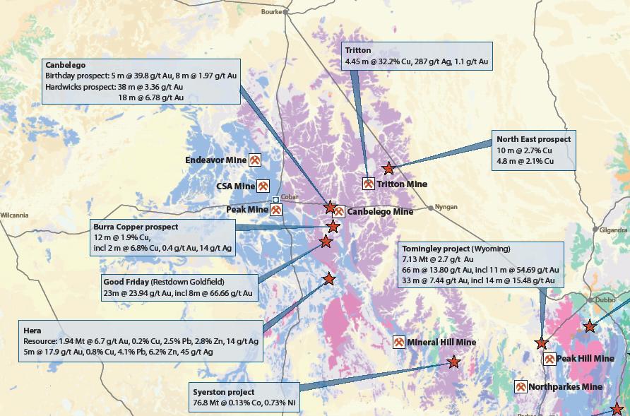
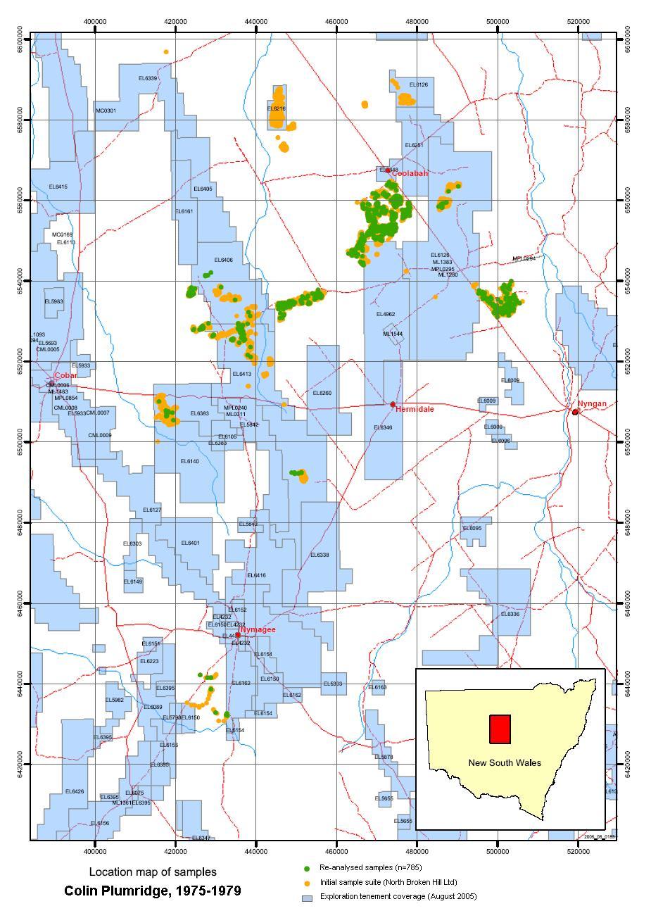
Below is the diagram (from GS 2005/338) showing the distribution of Colin Plumridge�s sampling, and also a regional map (by Department of Primary Industries) showing mines and prospects as at 2005:
Just a few background facts
The majority of the land surface sampled has very little outcrop and consists of a mixture of wind blown dust and semi-transported soil. Lightly scattered over this surface is scree or float, often of fine to course gravel size. Those who sample this material for geochemistry sometimes sweep it up with a broom or rake, so that a sample may represent a square metre or more of surface detritus.
At the time Colin was doing this sort of sampling it seems that an area had to show some encouragement before more than 3 samples would be taken in a 50x50m square.
Fragments in the float material commonly include pieces of ferricrete, laterite, chert, silcrete and quartz.
Colin�s geochemical prospecting work achieved rapid ground coverage. Only one person was involved in the entire operation. Four days per week were spent in the field and one day on sample dispatch, incoming assay evaluation, vehicle repairs and supply purchasing.
The day-by-day log/diary of the operation is quite interesting in its own right, and it may be found in the GS 2005/338 report.
Any anomalous samples had to be relocated despite the absence of landmarks and the presence of dense scrub. One approach to solving this problem was by keeping a small duplicate of each sample. If it was anomalous the duplicate would act as the description and aid in the relocation far better than any rapid geological log.
The storage of the duplicates became a problem and they were discarded once they had filled their purpose. Other materials from the prospecting work did survive though.
Locations were recorded in note form and as shaded in areas on 1:250,000 scale topo maps. Later on in the work a few aerial photos were used.
The field sampling was far too rapid and the budget too small to have used aerial photos for all locations. The main method used landmarks, odometer readings and bearings to locate the vehicle. Prospecting traverses were walked from the vehicle in a series of loops extending 200 to 3000 m away from the vehicle. The vehicle would then be moved forward about 200m and again the loops would be walked out.
To later on assign AMG coordinates, the recorded vehicle position was plotted on 1:100,000 scale topographic maps from the described landmarks. The prospecting loops were known from the shading on the original 1:250,000 scale field maps. The samples were scattered around the loop. Often anomalous samples had been plotted on field maps and these locations were useful.
Rather amazingly, when the Geological Survey came to document all this, it eventuated that none of the samples were actually lost. Perhaps even more remarkable, all the original pulps for the samples were found in the North Mine core shed in Broken Hill. In 2003 an initial batch of 942 samples was submitted for further assaying (see GS Report No 2003/437 for the results). All pulps have since been moved to the Department of Primary Industry�s Londonderry core, from where a further 785 samples were selected and re-analysed for Au and 18 other elements
Eventually every sample location was marked as a pin point on 1:100,000 scale maps and the AMG coordinates were read off on a drafting machine.
The original assays had been performed at the North Broken Hill Ltd laboratory at Moonta SA. The AAS results for Cu, Pb, Zn, Ag and Ni are reliable. The Sn, Au and W results were well performed but the methods used lacked sensitivity in the trace range.
An interesting rock type is present - Ball textured ferricrete
One of the most interesting rock types encountered in sampling the the surface residuum was termed �ball textured� ferricrete/laterite.
This rock should not be confused with common pisolitic laterite.
The ball textured rock has a yellow to brown colour depending on the iron content. The limonitic �balls� are actually spherulitic aggregates of about 2mm uniform diameter. They commonly comprise 30% or more of the rock.
There ball textured ferruginous rocks commonly reached 1000 ppm Cu, Zn and could reach 4000 ppm. The highest assay was 7500 ppm Cu at Coolabah. Silver can reach 3 ppm.
The ball textured rock is found in many locations in the Bourke region. It has been suggested that in the Coolabah area there may be an association with the Cretaceous-Tertiary landscape on which rounded white gravel is abundant.
It has been thought possible that the Coolabah ball textured rock is following a calcareous horizon that may have an elevated metal background.
Dr AWG Whittle, then a consultant to NBH for mineralogical and petrological work, described this rock type in the 1976 Report NBH/219, in the following terms from polished sections:
**********
"The samples provide examples of two stages in the development of the peculiar texture. Sample 13253 represents the earlier stage. The �ball texture�, as seen in polished section, results from the accumulation of high concentrations of goethite at the peripheries of numbers of closely spaced more or less circular areas where incomplete ferruginisation of the shale has occurred. Many of these areas have merged with the progressive ferruginisation.
"In the cross sections which are visible in the polished section, the goethite 'balls' are thin-shelled spherical goethite structures. At their peripheries there exist minute radiating spherulitic aggregates of goethite crystals, with or without colloform goethite. Within the spherical structures, less prominent radiating growths of goethite crystals are mingled with clay minerals and silt-grade quartz. Less than half the total volume of the bulk shale persists without ferruginisation in the case of 13253.
"Sample 13254 consists almost wholly of goethite, with smaller amounts of earthy clay-limonite. The goethite exhibits the ball texture, which is again an expression of completed radiating spherulitic goethite crystal accumulations. In this case most of these have coalesced, but small amounts of nonferruginised shale, and larger amounts of earthy limonite-impregnated shale, are enclosed between the goethite structures. This sample thus represents the almost complete supergene ferruginisation of the shale outcrop. The important point is, that there is no evidence in boxwork or replica structures, of the former existence of sulphides in the shale. The development of the goethite spherules at closely spaced random sites is a normal supergene ferruginisation (cf. lateritisation) phenomenon.
"Whereas true laterites are normally deficient in mobile metals through leaching strictly ferruginised outcrops commonly embody base metal accumulations due to the scavenging of these metals from the groundwaters which progressively deposited and developed the spherulitic goethite structures. This implies that these shales are a type of false gossan; and further, that the source of the scavenged metals is in rocks not far removed from the site. Such rocks would be pyritic; and would contain some base metal sulphides.�
A.W.G. Whittle & Associates
Mineralogical Consultants
April 14, 1976
**********
The thinking at the time was clearly that the ball textured rocks were not gossanous but that they nevertheless could be an ore indicator if they had scavenged metals from pyritic nearby rocks which "would contain some base metal sulphides".
Has this inference ever been borne out by further work? The present writer does not know the answer to that.