Dust Bowl Driving Tour, 2007
After reading the Worst Hard Time in book club, Ellen and I decided to see some of the places mentioned in the book. The Dust bowl was an amazing piece of american history and, to our surprise, was played out on our doorstep - southeastern Colorado, northeastern New Mexico, northern Texas panhandle, western Oklahoma panhandle and southwestern Kansas. We drove from Denver, Colorado to the area, here are area maps. Our day 1 route is traced in yellow, day 2 is in green and day 3 is in blue.
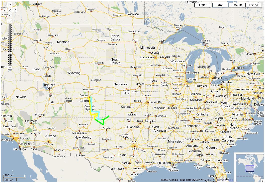
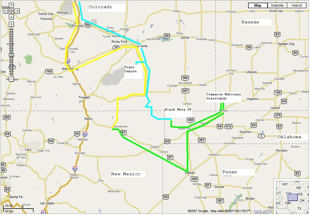
Route
Day 1
Interstate 25 South from Denver to Walsenburg, CO.
Colorado 10 East to La Junta
Colorado 109 South
Colorado 160 West
Colorado 389 South - becomes New Mexico 551
New Mexico 456 South
New Mexico 325 South to Capulin, New Mexico.
Day 2
US Highway 64/87 Southeast to Clayton, New Mexico
US 87 Southeast to Dalhart, Texas
US 385 North to Boise City, Oklahoma
US 56 Northeast to Elkhart, Kansas
Kansas 27 North to Cimmaron National Grasslands National Park
Kansas 27 South back to Elkart, KS
US 56 Southwest back t Boise City, OK
Oklahoma 325 West to Black Mesa State Park
Day 3 OK 325 West becomes New Mexico 456
Sheep Pen Road (NM B067) North (dirt road) becomes Colorado CR 213.8
CR 10.8 West
CR 193.7 Northeast
CR 18.4 East
CR 193.7 Northwest
CR 22.1 Northwest Vogel Canyon
CO 197 North
US 160 North
US 109 North to Vogel Canyon http://www.santafetrailscenicandhistoricbyway.org/vogel.html
US 109 North to La Junta
US 50 West to Pueblo, CO
Interstate 25 North to Denver, CO and home
Day 1 Pictures
Day 2 Pictures
Day 3 Pictures