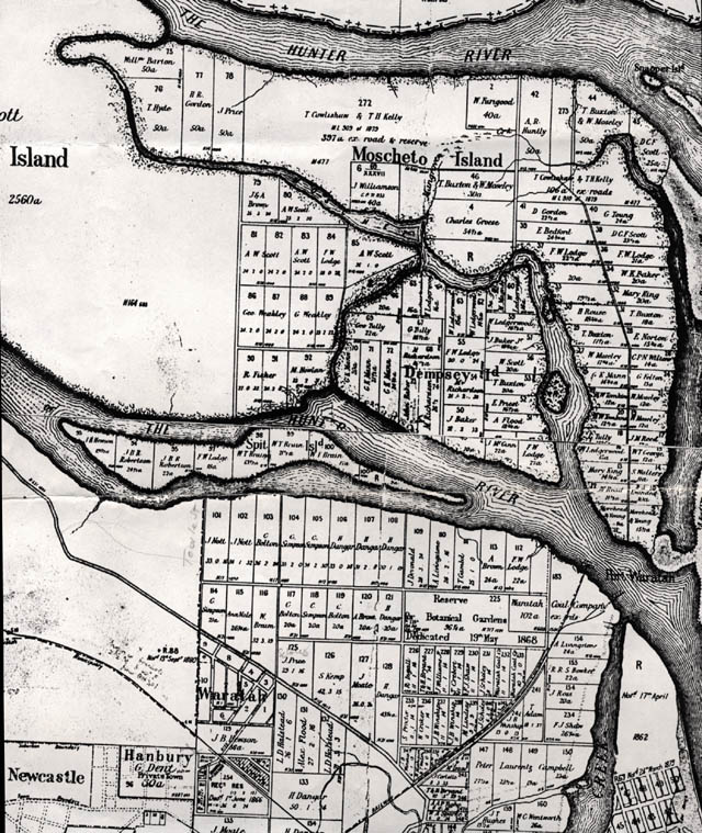
Map showing Ash, Moscheto, Dempsey and Spit Islands and much of Waratah and Mayfield areas, c1890s
- Courtesy of Local Studies Section Newcastle Public Library.