The Massachusetts Department of Conservation and Recreation gives information on the trail needed for a trip on the trail; location, direction, parking areas, etc. It has a link to a map showing parking areas or
go directly to the map.
A more detailed brochure describing points of interest along the trail is published by:
Connecticut River Greenway State Park
136 Damon Road
Northampton, MA 01060
phone (413) 545-5353
A website of the town of Hadley has some more general information on the trail and pictures.
We started the round trip at the western end of the Norwottuck Rail Trail at the Elwell recreation area in Northampton where there is parking. (See the Department of Conservation and Recreation Map.) Immediately, we were at one of the trail highlights, the 1492 foot long bridge across the Connecticut River into Hadley. The trail has great variety in the towns of Hadley and Amherst. There are distant views of the hills of the Holyoke Range as the trail passes through farmland and through pretty towns. There is a pleasant snack and ice cream stop on the trail and some nearby restaurants.
The 3 mile long Northampton Bikeway is a little over a mile from the Elwell Recreation Area terminus of the Norwottuck Trail.There isn't much information on the web about the Northampton Bikeway. It's a pretty trail through the town of Northampton.
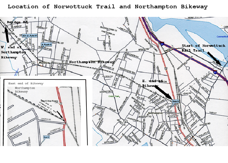
Here is a map made using Delorme software showing the location of the Northampton Trail.
Here are some pictures of a ride on the two trails.