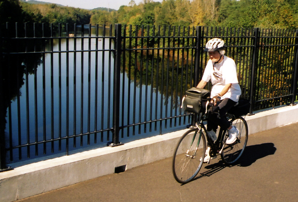
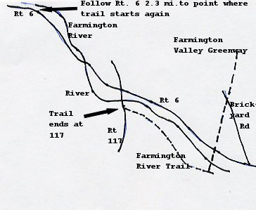
After returning to Brickyard Rd., we continued south and found that the bridge across the Farmington River was open. Crossing the river on a high bridge was the prettiest point on the trail so far. The trail continued south about a mile to the end at the junction with the Farmington River Trail.
We then followed the Farmington River Trail about 2 miles to its temporary end at Rt. 177 in Unionville. The trail through suburbs and close to roads at spots. The trail then detours on roads for about 3 miles. The trail map (number 7) is needed here because there were no markings on the roads for picking up the next section.
Here we followed Rt. 177, which is quite busy, for a half mile through Unionville and then went west 2.3 miles on Rt. 6 to pick up the next section of the trail. Route 6 is busy but has a wide shoulder and goes up a long, but not steep hill to the sign for the parking lot for the next section of the trail.