Pictures of the Trail from the Dam
Here are some pictures I took over a decade ago of the trail to Deep Creek
Hot Springs from the Mojave River Forks Dam north of Hysperia (California). The
hot springs are nearly seven miles up creek from the dam. The pictures are one-quarter the original size; click on one to see
it at it's original size.
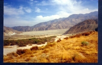 |
This is a picture of the Mojave River Forks Dam. The dam is a rather large
piece of gray concrete that is horizontal across the middle of the picture.
The south is to the right and we are looking to the east. On the left (north)
end of the dam is a spillway (white). Going up and over the spillway gets us to
the area in the next photo. Note that I have not been there for a couple of
years and I have been told the area is now restricted, but since the trail is
part of the Pacific Crest Trail, hopefully there is access to the trail somehow.
Note that in this picture, there are cars parked on the other side of the
spillway, but that has been not possible for a few years. The last time I was
there, it was possible to park on this side of the spillway at the bottom of it. |
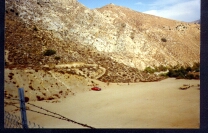 |
This is the other side of the spillway. I probably was at the north end of
the dam (next to the spillway and a bit higher than the top of the spillway)
when I took this picture. The next picture was taken from this parking area and
somewhere around the middle of this picture. That is where the trailhead is
(was). |
|
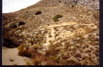
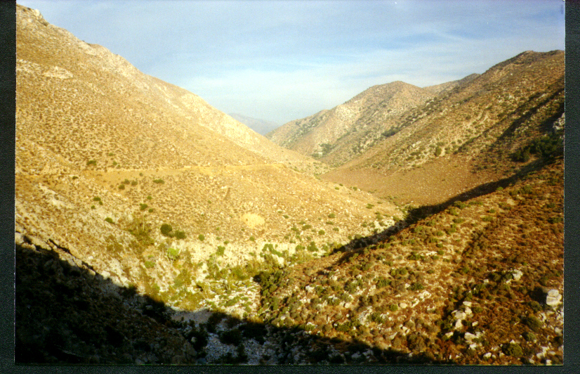
At the beginning of the trail from the dam, there are a few switchbacks going
up about 400 feet. From there, most of the remainder of the trail has only very
gradual elevation gain. There is a small outhouse-size structure along the trail
at the top of the switchbacks. I think that if you look at the photo at it's
original size, the structure is barely identifiable at the top left, but the
elevation gain is a bit more than this photo shows. |
For a great (large)
picture of the dam and spillway, look
at Jim Bruton's picture from his
"Campo to Agua Dulce" hike along the Pacific Crest Trail.
His picture was taken from somewhere along the trail, probably from
approximately the location in my next picture (below). Notice that in his
picture, the spillway is on the right.

|
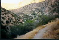
This picture was taken from the top of the switchbacks. You can see the trail
in the middle on the left side. You can also see that the trail is quite easy
along there. The Deep Creek river is at the bottom of the canyon, which is
visible here in the middle at the bottom. |
|
The bridge along the top of this photo is quite amazing. It is not big enough
for cars but the bridge is quite strong enough for people and most anything that
could fit across it. It is at about four miles up the trail from the dam. It is
quite a surprise to see this bridge after walking miles of a relatively
desolated environment. The entire trail up to here is above the creek quite a
bit and this bridge keeps you above the creek. Warning: if you intend to
continue up the canyon, you must use the bridge. The trail does continue on this
side of the bridge, but after you have went about half a mile, the trail begins
to diminish and eventually disappears. There are some switchbacks taking you up,
beginning on the other side of the bridge, and you must go that way. |
 |
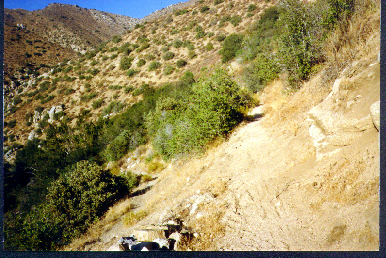
This is a picture of the trail on the other side of the bridge and at the top
of the switchbacks. There is not much to see in this photo, right? |
 |
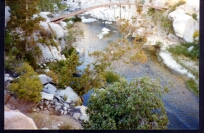
The hot springs at last! They are in the middle of this picture but a bit up
from the middle. On the left is the area where most people arrive; the people
arriving from Bowen Ranch. That trail is not visible in this picture but is on
the other side of the ridge. |
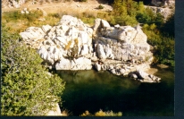 |
The
hot springs!
This picture was taken from the end of the ridge that is the final portion of
the trail coming from Bowen Ranch. Here are the hot springs. Actually,
most of the hot water comes out of the ground in the area in the top left of
this photo, and about two feet from the trail. The trail across the top of this
photo is the Pacific Crest Trail and if you were to go along the trail to the right
, then you would be returning the way we came to the dam. At the bottom of this
really big rock are pools that the hot water flows into. Some of the hot water
comes out from the rock and into the pools.
|
To query the USGS
National Mapping Information to get maps and other information for the area,
enter the following in the query form:
| Feature Name |
St |
County Equivalent Name |
Type |
Topo Map Name |
| Mojave
Dam |
CA |
San Bernardino |
dam |
Lake Arrowhead |
See this Microsoft TerraServer Image Page
for a view from space of the dam (upper right) and a portion of Deep Creek and
the trail from the dam. The dam seems to be not visible due to the
two-dimensional view but the spillway to the right of it is visible as a white
rectangle. The trail is barely visible north of the creek. The dirt road along
the bottom connects Hysperia with Lake Arrowhead.


