Come Fly With Us!
*(Best wind speed for ALL coastal sites: 15-25 mph (hang gliding)
and 5-18 mph (paragliding))*
SITES IN N.W. LOWER MICHIGAN
Come Fly With Us!
*(Best wind speed for ALL coastal sites: 15-25 mph (hang gliding)
and 5-18 mph (paragliding))*
Green Point Flyers Association)
OTHER CONTACTS:
President: Dave
Embertson
Scot Maue (231) 941-1276 ([email protected])
2335 S. LaChance Rd
Craig Carlson: (231) 946-7170
Lake City, MI 49651
Bill Fifer - Traverse City Hang Gliders and Paragliders
231-779-0246 (H) 231-876-5710 (W)
1509 E. 8th St. (231) 922-2844
[email protected]
Traverse City, MI 49684
Website: http://www.geocities.com/decounsl/
GREEN POINT 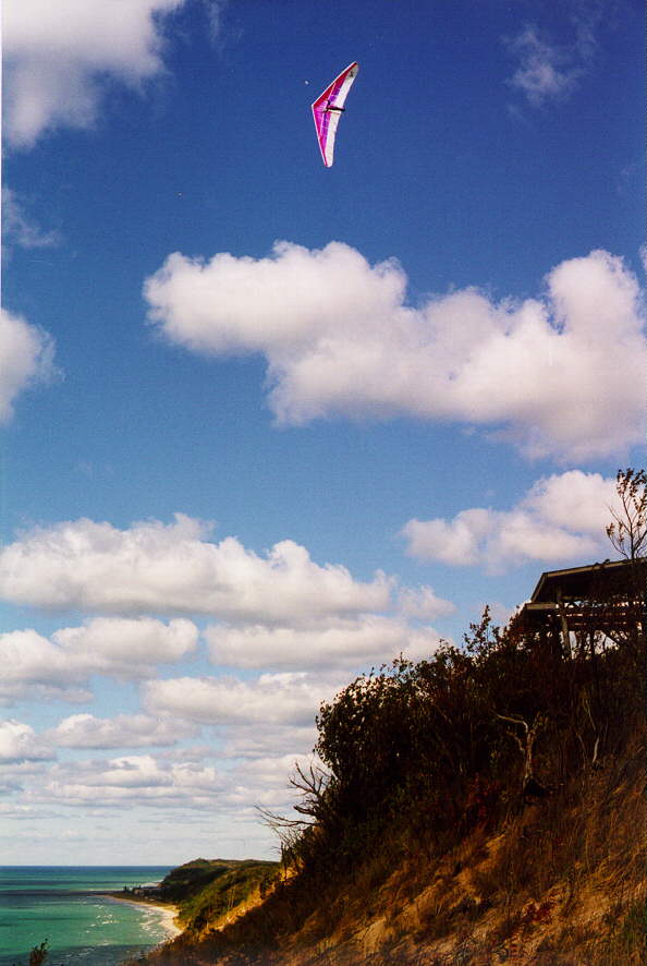 (<--click on photos-->)
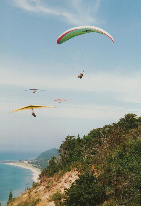
Type: Coastal Bluff along East coast
of Lake Michigan
Features: Beautiful! Privately
owned 10 acres, launch ramp, electric/water, camping
Direction: 260 degrees (W-SW)
Height: 370 feet
Length: 2 miles
LZ: Lake Michigan beach (2+ miles of it!),
top landing meadow
***Directions to Site: From Cadillac, MI-->take M-115 west to Beulah.. From Manistee, MI--->drive north to Beulah on M-31-->Then...turn left/West on M-115--->drive 4-5 miles to Frankfort-->go left/South at A&W restaurant/Shell gas station-->go south, through hamlet of Elberta-->go 1-1/2 to 2 miles south on M-22 to top of long curve and hill-->just before crest of hill, turn right/West off M-22 onto small dirt road-->stay right at first "Y" in dirt road-->through hardwoods-->immediate left turn-->immediate right turn onto gravel driveway-->over small hill and you are there!
***************************************************************************
SLEEPING BEAR NATIONAL
LAKESHORE PARK
- Headquarters, Empire, MI
Intermediate rating and flying permit required for all
three sites below.
***************************************************************************
IMPORTANT!!!
In order to NOT jeopardize our site access,
PLEASE
get permit at Ranger station/Sleeping Bear Park headquarters in Empire
BEFORE flying
Empire, "The Bear", or Pyramid Point!...Thank
You!
***************************************************************************
3 SITES:
1) SLEEPING BEAR 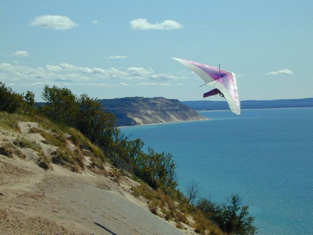 (<--click on photos-->)
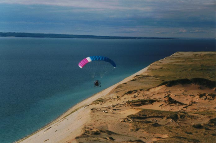
Type: Coastal Bluff along East coast of Lake Michigan
Features: 450 vertical feet of pristine sand cliff - little
vegetation, SMOOOOOTH LIFT!
Direction: 270 degrees (W), (with SW facing 1/4 mile ridge
around corner, to the South )
Height: 450 feet
Designated LZ: Lake Michigan beach, south of ridge, near outlet
of North Bar Lake into Lake Michigan. DON'T land in front of residences
on beach and then cut across their property.
***Directions to Site: From Traverse City-->take M-72 to Empire-->right/North on M-22 to junction of M-109 and M-22-->left/North on M-109-->go 1-2 miles to "Pierce Stocking Scenic Drive" (entrance to Sleeping Bear overlook)-->TURN LEFT-->looping drive brings you to Lake Michigan overlook and launch area. Be careful - there are many spectators here.
2) "EMPIRE"  (click on photo)
Type: Coastal Bluff along East coast of Lake Michigan
Features: Scenic! set next to quaint coastal village
of Empire, soarable in 6-8 mph winds!
Direction: 320 degrees (NW-N)
Height: 400 feet
Designated LZ: Empire (Lake Michigan) public beach, near
town of Empire (1 mile of it), top landing over back - farming fields (watch
for rotor) DON'T FLY ALONE HERE.
***Directions to Site:
From Traverse City-->take M-72 to Empire-->left/South ~1 mile to top of
large hill-->right/West onto Wilco Road-->go about 1 city block-->trail
entrance and parking on left-->3/4 mile hike into launch on top of ridge
overlooking Lake Michigan. Very Scenic!
3) "PYRAMID POINT"  (click on photo)
Type: Coastal Bluff along East coast of Lake Michigan
Features: Scenic!!, launch faces North and South
Manitou Islands! Tip of a peninsula
Direction: 350 degrees (N-NW)
Height: 400 feet
Designated LZ: Over back in farmer's field, also Lake Michigan
beach (around NW corner -
tricky...DON'T do beach LZ in N.E. crosswind!) DON'T
FLY ALONE HERE.
***Directions to Site:
From Traverse City-->take M-72 to Empire-->right/North on M-22 to junction
of M-109 and M-22-->left/North on M-109-->follow M-22 as it turns 90 degrees
to the east and go to Glen Arbor-->continue east on M-22--> go about 4-5
miles-->Port Oneida road on left with small cemetery-->left/North on Port
Oneida Rd.-->go 1-1/2 miles until pavement ends-->follow gravel road to
the right/east-->go 1-2 city blocks-->traihead and parking on left-->1/2
mile hike to launch - uphill all the way, but worth the hike! Definitely
a Hang III launch with NO landing below! DON'T FLY ALONE
HERE.
------------------------------------------------------------------------------------------------------------------------
Other Site:

THOMPSONVILLE AIRPORT -
Thompsonville, MI; (Michigan Hang Gliders, INC.)
Type: Grass runways
Features: X-C, aerotowing, static towing, phone, no control
tower, mostly used for X-C flights
Direction: 270/90 & 180/0 degrees
Height: N/A
LZ: airport, XC fields nearby
***Directions to Site: From Cadillac-->M-115 West-->through Mesick-->through Copemish-->go another 3-4 miles-->turn right off M-115 just southeast of entrance to Crystal Mountain Ski Resort-->airport is on right-->take a right at next small intersection-->1/2 mile-->entrance
