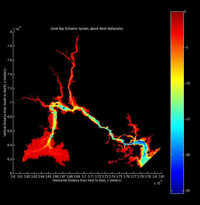
Finite element computational grid, gbes4 of the whole Great Bay Estuary
System. The four straight lines mark the four transect cuts. The southern boundary
is the inlet M2 tidal forcing boundary.The bathymetric contours reveal a center channel through south to north
and tidal flats in Great Bay area, Bellamy River and Upper Piscataqua River.
Two-dimensional color map of bathymetric depth of gbes4
![[back]](http://www.geocities.com/CapeCanaveral/Hangar/9740/images/home.gif)
Last modified: September 21, 1998 (Safak Nur ERTURK)