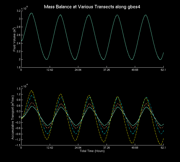
Time series of the total fluid volume (top figure) and the
cumulative transport across the five transects (bottom figure)
for the gbes4 grid. The group of periodic solid lines with
higher amplitudes corresponds to the cumulative transport across
the two transects across the central deep channel. The dotted and solid
lines with much lower amplitudes are the cumulative transport across the
two transects across the western and eastern lower bay tidal flats
and the transect across the mouth of Squamscott river respectively.
The periodic solid line with the most variation in one cycle corresponds
to the seaward transect that with the least variation, the landward transect; etc.
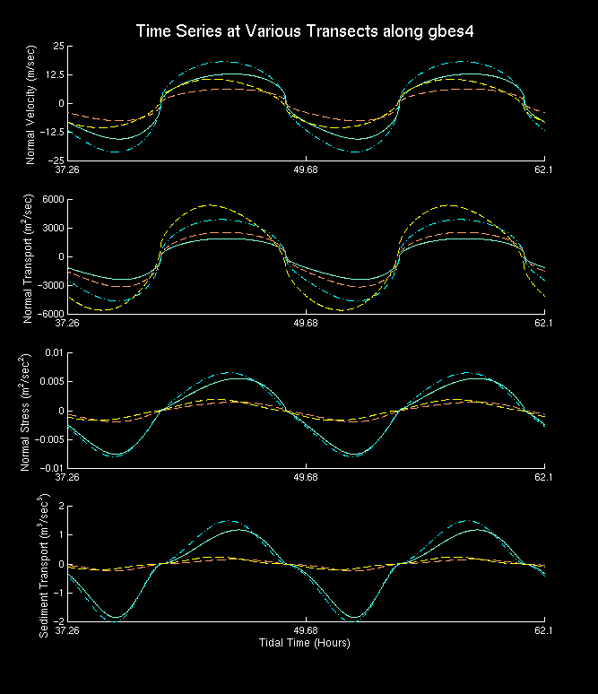
Time series of the maximum normal velocity (top panel), normal
transport (second panel), maximum normal bottom stress (third panel),
and maximum normal sediment transport across the five transects
(bottom panel) during the second half of the simulation (three M2
periods). The periodic solid and dash-dotted lines with higher
amplitudes correspond to the results at the two end transects
across the central deep channel. The much higher amplitude dashed
line is the transect across the middle strait. The dotted and solid
lines with much lower amplitudes
are the results at the two transects across lower bay tidal flats and
the transect across the mouth of Squamscott River.
![[back]](http://www.geocities.com/CapeCanaveral/Hangar/9740/images/home.gif)
Last modified: September 21, 1998 (Safak Nur ERTURK)