| LOOKING NORTH AT THE KAIBAB PLATEAU/UTAH BORDER* Where are we on the AZT? This final segment is a long but joyful 71-mile stretch. It begins at the North Rim of the Grand Canyon and soon departs the National Park for the Kaibab National Forest that provides mile after glorious mile of superb hiking. Just a few miles outside of the Kaibab National Forest, the Arizona Trail reaches its northern terminus at the Arizona /Utah border. This site can be reached by vehicle by traveling east of Kanab, Utah on Highway 89 for about 35-40 miles (east of milepost #26), turning south on road #1065 that goes by the Buckskin and Wire Pass Trailheads. Just over a mile south of the Wirepass TH is the northern point of the Arizona Trail. Route: Right across the road from the North Rim Trailhead is an AZTrail sign. The AZT parallels the highway to the southeast down the little draw about 1/2 mile until it meets the road to Point Sublime. It stays on the Point Sublime Rd about another 1/2 + mile, going past the Widforss trailhead. About 1/4 mile past the Widforss TH, take the left fork in the road and in about 1/8 mile the AZTrail (utility like path) goes north. When I was there it wasn't signed but the trail is distinct and is easy to follow. It crosses the highway (#67) that leads out of the National Park after 3-4 miles and then, 4-5 miles later, returns to the highway at the Park�s North entrance station. Hopefully the Parks people will have put up a sign or two to help when you hike this area. At the Park�s North entrance station, the goal is to get to a trailhead (#101) that�s just outside of the Park�s boundaries. It�s about 1� miles east and a bit north of the entrance station. There�s two ways of getting there: Either 1) take a route that starts behind a ranger�s home east of the entrance station and leads through the forest. This route is initially on a jeep trail and then it�s bushwhacking through a section of thick forest (be sure you have a compass). Or 2), walk out of the Park on Highway #67 about � mile, turn right (east), and walk until reaching FR #610, continuing east on it until reaching the Trailhead for trail #101. Ahh trail #101. Toss out the maps. You�re now into smooth sailing for many, many miles. First stop is the East Rim View, six miles away. The trail will have you whistling and the green valley and trees will make you catch your breath. It�s a good area to throw down the sleeping bag. Just past the East Rim View is scenic Dog Lake. The trail continues through the tall trees, past grazing cattle, passes within sight of Highway#67, ascends Telephone Hill, and comes to a decent campsite (i.e. it has a bathroom) at the Murray Lake Trailhead. The 20 miles from the East Rim view have literally flown by. It�s northward another 9 miles on Trail #101 to Highway 89A and the Orderville Trailhead (more bathrooms). The village of Jacob�s Lake is just a few miles away if there�s a need to resupply or eat some restaurant food. But the AZT on Trail #101 continues north from the Orderville TH, crossing Hgwy #89A and though the trail�s a little faint for a while, it�s discernable. Soon, the trees are less dense and shorter. Near a spot on the map called Government Reservoir, 7 miles from the Orderville TH, the trail skirts a forest of scrub trees/bushes of some type. After another 6 miles the AZT leaves the wonderful Kaibab National Forest. The Kaibab staff sure provides a top notch Arizona Trail, #101, through their forest. Thank you! A mile north of the Kaibab National Forest, the AZT crosses Winter Road (TR1025). It�s just about 9 miles to Utah. The path of the AZT now starts twisting and turning as it weaves through some scrubby looking trees. It crosses the famous Honeymoon Trail that Mormon couples crossed to their wedding site at St. George, Utah. Next the trail is winding in and out, up and down several small canyons. Wheh! Where did that easy trail go? But, finally the AZT turns northeast and soon winds lazily down a long drainage. And then, our Arizona Trail runs along a ridge for a short distance and then suddenly bursts upon one of the most dramatic and beautiful southwestern vistas one could ever hope to see. Absolutely knee-shaking stunning. An 180+ degree view. The Escalante Staircase, Vermillion Cliffs, Paria Plateau, more mountains in the far distance. The colors are just stunningly beautiful. Due east, about 2-3 miles, a handsome red rust colored rock mountain grabs your attention. Making it even more eye-catching, it is outlined by another range many miles behind it. To the north a white creamy colored mountain streaked with red rules the entry into Utah. At the bottom of the range, the green low growth foliage blends perfectly with its stately rock neighbors. Awesome! The trail descends quickly. A green roof is down there. That�s the first class Trailhead with ramadas, bathrooms and more at the finish line. The trail dips down a little and then follows a small rise as you take your final steps on the Arizona Trail. Your feet won�t touch ground. Congratulations, you�ve now hiked the Arizona Trail. Worthwhile Detours from the AZT: Jacob�s Lake has several amenities including a ranger station, restaurant, lodge, camp ground etc. The Kaibab Lodge is along Highway #67 about 25 miles south of Jacob�s Lake and 2-3 miles west of the East Rim View. Places to Camp � There�s some great established camping area in this section but they lack water. Thus except for bathrooms and someone new to talk with, you may as well camp along the trail especially if there�s a pond of water. Length � 71 miles from the North Rim Trailhead to the Arizona/Utah line. Power Rating � Easy physically and the trails are very good. Water* � The only negative on this segment is that water is very scarce as you proceed north. You might get water from the house across from the N. Rim Entrance station. Then between East Rim View and Murray Trailhead there�s Dog Lake, Little Pleasant Valley and Crane Lake. The forest service map shows a lake in the Murray Trailhead area, but I didn�t see anything that looked like a lake. The village of Jacob�s Lake of course has water. I don�t believe there�s any water north of Orderville. And there�s no water at the finish line trailhead. Plus it�s ten miles north to Highway 89 from the AZ/Utah border. Bikeable? Once outside the Grand Canyon National Park, the AZT is very bikeable to the Arizona/Utah border. The last 10 miles might be a bit rough but most appear to be excellent. Permits � Once outside the National Park no permits are needed. Maps** � 1. Kaibab National Forest, North Kaibab Ranger District map, 928-635-8200; 2. Bureau of Land Management (BLM) Arizona Strip Field Office Visitor Map (optional for the last 4 miles of the trail) Tip: Once out of the Grand Canyon National Park, about 1.5 miles east of the Entrance Station, you�ll come to Trail #101. Follow it until the Utah border. Advice - Hopefully someone will be at the Arizona/Utah border when you finish your hike. First, to share the jubilant moment and secondly, to give you a ride. Remember it�s still 10 miles on a desert, dirt road #1065 to a very isolated spot Highway 89. Cautions � There�s no water at the trailhead at the Arizona/Utah border. Life on The AZT � You will be pumped as you inch closer to the Arizona/Utah finish line. And the ecstatic feeling of completing this journey is indescribable. It�s truly a natural high. Enjoy it. You earned it. * Remember just about all water sources are seasonal in Arizona. Check with as many sources as possible before entering an area, including the local National Forest Service. **(In addition to On the Arizona Trail guide book) HOME EMAIL ME NEXT CHAPTER |
 |
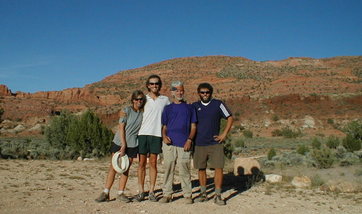 |
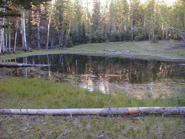
| Top) The lovely Dog Lake near East Rim View Below) Happy hikers at the Arizona/Utah terminus of the Arizona Trail |