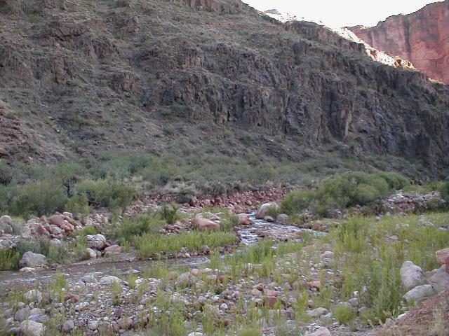
| THE ONE AND ONLY GRAND CANYON* Where are we on the AZT? This segment starts at the South kaibab Trailhead near Yaki Point on the South Rim of the Grand Canyon and ends 21 memorable miles later at the North Rim trailhead. Route: This describes the AZT route starting from the South kaibab Trailhead on the South Rim. But as mentioned a previous chapter, there are two other starting points, including the very popular Bright Angel Trail. The trail across the Canyon is well marked but there are no AZT signs. Either walk or take the tram to the South kaibab Trailhead. There's water at the trailhead but no more until reaching the Bright Angel Camp area. The trail heads north, very steeply down the South Kaibab trail. In 2 miles it reaches Cedar Ridge, a popular stop for day hikers because there are outhouses. Continuing on, after three more miles the trail crosses the Tonto Trail. Then after another sharp descent, the trail reaches a short tunnel and crosses the Colorado River on a suspension bridge before reaching the Bright Angel Campground, just over 7 miles from Yaki Point. If you have reservations, pick a site and relax. At Phanton Ranch a quarter mile away there�s refreshments and often Ranger talks in the evenings. After stopping at Bright Angel Campground, head north through Phantom Ranch and, don�t worry, you will soon find the easy-to-follow trail. It stays alongside Bright Angel Creek through the Canyon�s towering walls for 7 miles before reaching Cottonwood Camp. Cottonwood is a good spot to take a break, or to camp overnight if you have a permit. After a couple of more miles, the trail soon leaves Bright Angel Creek as it passes next to a yard and the house of some folks who run the Roaring Springs water pump operations. Man, talk about living away from the rat race. And it�s less than 5 miles to the North Rim. But these five miles are a multi huffer. Up and up for about 3,400 feet. Partake of the many large rocks along the way to sit on and catch your breath. Two miles from the rim there�s water and an outhouse. And then Pine trees appear and finally you are at the top. Congratulations you are now a Rim-to-Rim hiker. Right across from the North Rim Trailhead is an AZTrail sign. But at this point you are probably ready for cold beer. So head south on the paved road for a mile to the North Rim Camp area and two miles south to the Grand Canyon Lodge. Worthwhile Detours from the AZT: Of course an extra day at the Grand Canyon with a tram tour and a couple of Ranger talks at the several visitor centers are near mandatory. And the Grand Canyon Lodge area at the north rim is much less peopled but with the same amenities. Places to Camp � For camping out of the Canyon, there�s Mather Campground on the South Rim and the North Rim Campground . Check this website for info: http://www.kaibab.org/gc/misc/gc_camp.htm Reservations are mandatory below (see permits below), so get one months ahead for Bright Angel Campground and Cottonwood in the Canyon. Both have picnic tables, running water and sit-down toilets. And of course there�s beer, lemonade and iced tea at Phantom Ranch next to Bright Angel Campground. Length � A feat of twenty-one miles. Starting at elevation of 7,260 feet, descending to 2,425 feet and climbing out at the North Rim at 8,240 feet. Ooh your aching feet. But it's a great sense of accomplishment. Power Rating � Satisfyingly difficult. Water* � There�s water and portajohns at the S. Kaibab trail head. But no water sources along the South Kaibab Trail from the trailhead to the Colorado River (7 miles). But from the river north, there�s plenty of water sources: 1) the Bright Angel/Phantom Ranch area and Cottonwood Camp have fresh water; 2) the trail from the Colorado River to the North Rim follows Bright Angel Creek for 9 miles; and 3) there�s a rest station with water about 2 miles from the top of the N. Rim. Bikeable? Not allowed!! Permits � If you are a really precise AZT hiker and can foresee when you will get to the Grand Canyon, you can get a permit to camp in the Grand Canyon up to 4 months in advance http://www.kaibab.org/bc/gc_trail.htm . But, if you are not sure what day you will get there, you will need to go to the Back Country Office and hope they have a permit available. Of course, weekdays are your best chance of getting a walk-in permit. Maps** � Due to the Grand Canyon�s worldwide popularity, nearly every bookstore with a travel section has maps of the Grand Canyon. And there are plenty of shops in the Grand Canyon area to buy a map. Advice � 1) This section of the AZT will take quite a bit of administrative preparation before getting to the Grand Canyon. It�s a well run but heavily regulated National Park. Be sure you prepare, if only to know what is expected to camp and backpack in the GC. 2) Try the Grand Canyon Crunch ice cream at the Bright Angel Lodge ice cream parlor. Cautions - Do not try to hike out of the Grand Canyon in the late morning/afternoon during the months of June, July, August, and September. The heat will sap your strength especially carrying a backpack. Either start before daybreak or hike late in the afternoon and evening. Time your hike accordingly and get permits so you can camp at Bright Angel or Cottonwood Campgrounds. Life on The AZT � If you have never hiked in the Grand Canyon, it is one adventure you won�t forget. It offers an unequaled natural setting; photographs just can�t capture its grandeur. It attracts friendly people from all over the world (the Bright Angel Trail is often referred to as the �autobahn� because of the many Germans on it). And hiking it is quite a challenge to any hiker regardless of experience. * Remember just about all water sources are seasonal in Arizona. Check with as many sources as possible before entering an area, including the local National Forest Service. **(In addition to On the Arizona Trail guide book) HOME EMAIL ME NEXT CHAPTER |
 |
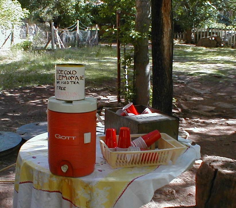 |
| L) Bright Angel Cr. next to the trail Below) This stand was near the house at Roaring Springs. Sweet! Nary a person in sight. |