| FOUR PEAKS WILDERNESS � WILD & WHOLLY* Where are we on the AZT? This section starts at Lake Roosevelt Dam, Roosevelt, AZ, and ends 35 miles later at Sunflower, AZ. Route: After you have walked north across the bridge by the dam, look closely and you�ll see a small Vineyard Trail #131 sign on the west side of the road. Prepare to ascend. They didn�t place the dam here because it�s the highest spot in the area. The trail climbs to Vineyard Mt. and by some kind of transmitting tower. Soon you will be treated to one of the most spectacular panoramic views on the Arizona Trail. It�s why you are on the AZT. To the south, southeast and southwest is the Salt River and Apache Trail road winding for many miles through some very rugged Arizona desert and mountains. Blocking the northwest skyline is the jagged looking Four Peaks Mountains. About 3 miles from the bridge the trail come to FR #336. Turn left (south) on it and proceed about 300 yards. Turn right off of FR #336 and follow a windy ridge for about 2 miles to Mills Ridge Trailhead. Mills Ridge TH is only a parking lot with a TH sign. But it may be the flatest spot around to throw down for the night. Enjoy the splendid views!. The Four Peaks Wilderness area is just ahead. The AZT route follows trail #130 as it winds south and west across Buckhorn Creek, which was flowing in March 2005. The trail is a bit difficult to find as it approaches Granite Springs. As you reach the creekbed, turn upstream and follow rock cairns near the creekbed that will take you to a sign saying "Granite Springs". The trail from Granite Springs northwest is good and contours the mountain well. In approximately 3 miles pass by the junction with the Alder Creek trail, #82. Stay on trail #130. It winds back and forth through several large drainages. But, as you enter a several mile stretch of charred forest, you�ll sadly view the effects of the 1996 Lone Pine fire. Virtually nothing survived. But lots of new growth is sprouting. Continue on trail #130. The trail is good and views are too. Fortunately tho, in the spring of 2001, several small streams were flowing and provided places to wash up. In December 2003 there were a few small pools of water but nothing substantial until Pigeon Springs.. The AZT leaves trail #130 at the junction with trail #134 that leads to Pigeon Springs and FR #648. Pigeon Springs often has water. At FR #648 head north along the road, turn right � mile away at the first junction with FR #143 (a left turn leads 18 miles to the highway to Phoenix), and proceed on to a microwave type building. Turn left at the junction just before that building and turn onto FR #422. The AZT stays on this road for 9 miles as it slopes down the mountain. The road leads through some decent camping areas where I saw some deer milling about. Just when you�ve had more than enuff dirt road walking, the AZT turns west at trail #73 and proceeds down Boulder Creek. It�s a welcome change down a trail alongside a pleasant springtime stream. That only lasts a couple of miles as the trail leaves the stream bed and crosses an open field. Shortly thereafter, the trail ascends half way up a small mountain and follows a path and rocky road around it. As you leave the little mountain, watch closely for an AZT marker and rock cairn, as the trail then leaves the jeep road and turns right (north, I think) and in 50 yds. passes thru a gate.. It then follows a faint but cairn marked trail for about a mile down a gentle descent into a wash area and onto a rough rancher road. There's a few AZT markers along the way but they seem to be favorite targets of some NRA members. After about another mile on this road the trail comes to an unmarked intersection. You may think that you turn right (north) but instead turn left and proceed steeply up the road for about 1/8 of a mile. At the top of the hill is another intersection. Continue straight ahead on FR #1452 as it heads south and then curves to the west. In less than 1/2 mile, surprisingly you come to some AZT markers, where you turn right onto the AZT.. At this point you are about 2 miles east of Highway #87. The trail now is pretty easy to follow and gives a grand view of the Sycamore tree filled Bushnell Tanks area. There is usually water somewhere in Sycamore Creek which runs thru that area. At Highway #87 the AZT crosses under the highway. This general area by Highway #87 is called Sunflower. Search me why they call it �Sunflower�. There are no Sunflowers. And it�s not a town. Nor are there any stores or any retail business or even any houses grouped together. There's a place for sale where the AZT crosses the highway at milepost #218. And a couple of miles west of the highway within eyesight of the AZT, there are a few quite nice homes. Worthwhile Detours from the AZT: For anyone wishing to scale Four Peaks continue west on the Four Peaks Trail #130 instead of taking trail #134 to Pigeon Springs. Trail #130 leads � mile to the popular Lone Pine Trailhead. FR #648 also leads to the Lone Pine Trailhead. Places to Camp � There are plenty of places to lay your sleeping bag in this section, especially near the many springs. The Sycamore Creek area is the closest thing to an established camp site, tho I didn�t see any picnic tables. Also, as mentioned above, there�s an area a few miles north of the microwave building on FR # 422 that looks comfortable too. Length � 35 miles, with some of them at least 2 miles in length. Power Rating � I consider the section from the Lake Roosevelt Dam to Pigeon Springs the most arduous hike of the Arizona Trail. Water* � Proceed with caution. In the late winter and spring of 2001 there were plenty of streams. Granite Creek and Pigeon Springs had water. So did Boulder Creek. Sycamore Creek near Sunflower runs year round. Also, there are houses in the Sunflower area (see above). Bikeable? Only the section on the Forest Roads #422, 143 and 648 and the area east of Sunflower until reaching Boulder Creek are open to bikes. Permits � None needed Maps** - 1) Tonto National Forest Map; and 2) the Tonto Basin Ranger District Roosevelt, AZ, 85545 also has copies of topo maps on which they highlight the AZT for most of this segment. Advice � I believe the AZT from Lake Roosevelt to Pine, AZ. is the longest stretch where there isn�t any place to resupply. It�s a difficult stretch of roughly 90 miles. Cautions - You will lose the trail in this section. Don�t panic. But don�t wander too far in any direction looking for it. It disappears but will resurface. Life on The AZT � The blackened fire charred forest was very eerie. Even now trees continue to topple as their root support finally gives away. I worried about one falling on me as I slept in their midst. And as to that age old question of the sound a tree makes when it falls, I swear I heard something that sounded like �Geroneeeemoooooo!�. * Remember just about all water sources are seasonal in Arizona. Check with as many sources as possible before entering an area, including the local National Forest Service. **(In addition to On the Arizona Trail guide book) HOME EMAIL ME NEXT CHAPTER |
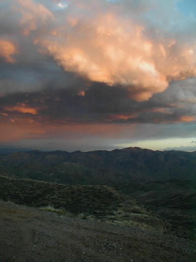
| An evening cloud show from Mills Ridge Trailhead. |
 |