![]()
"You
live where...?"
...someone
once asked incredulously.
![]()
![]()
"You
live where...?"
...someone
once asked incredulously.
![]()
In a nutshell, we live in Israel, in an area geographically known as Judea -- though most politicians and media-typees just love to call this area the "West Bank".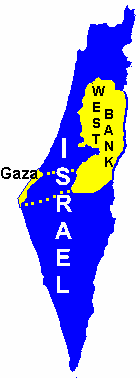
We're up at least 3,300 feet (930 meters) in elevation, up in the Judean Highlands on a mountain ridge between Bethlehem and Hebron. We live in a small village of 180 families, population of about 850 people, called Elazar in the Etzion Bloc of communities. (Oh by the way, it might be of interest to the reader that most politicians and media-types like to refer to all the 140 or so communities in Judea, Samaria & Gaza as "West Bank Jewish settlements".)
The following maps and pictures should illustrate our location more clearly. Click on the map below to enlarge it. When you have it open, locate Jerusalem, notice Bethlehem just south, then notice that on the main highway between Bethlehem and Hebron is a community of "Elazar" circled in blue on the map. That's where we live ...
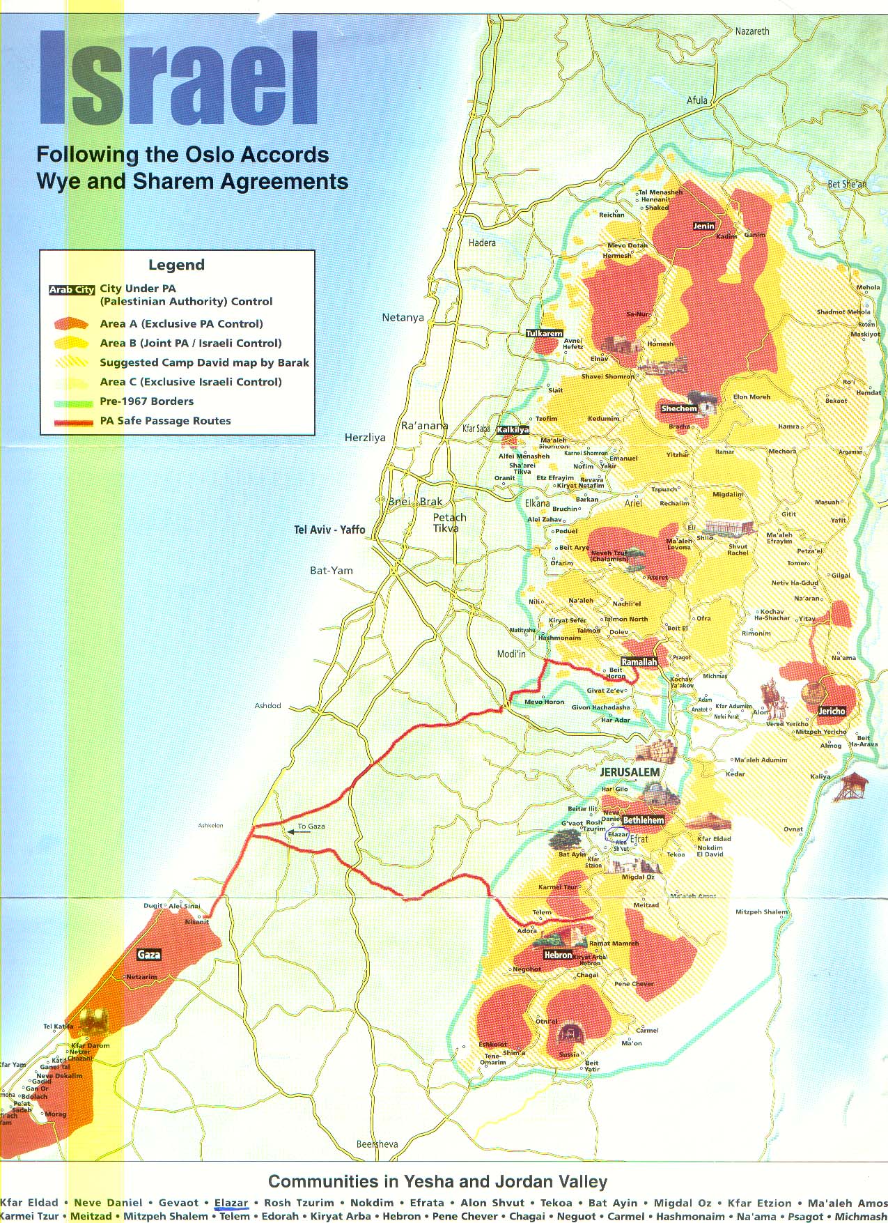
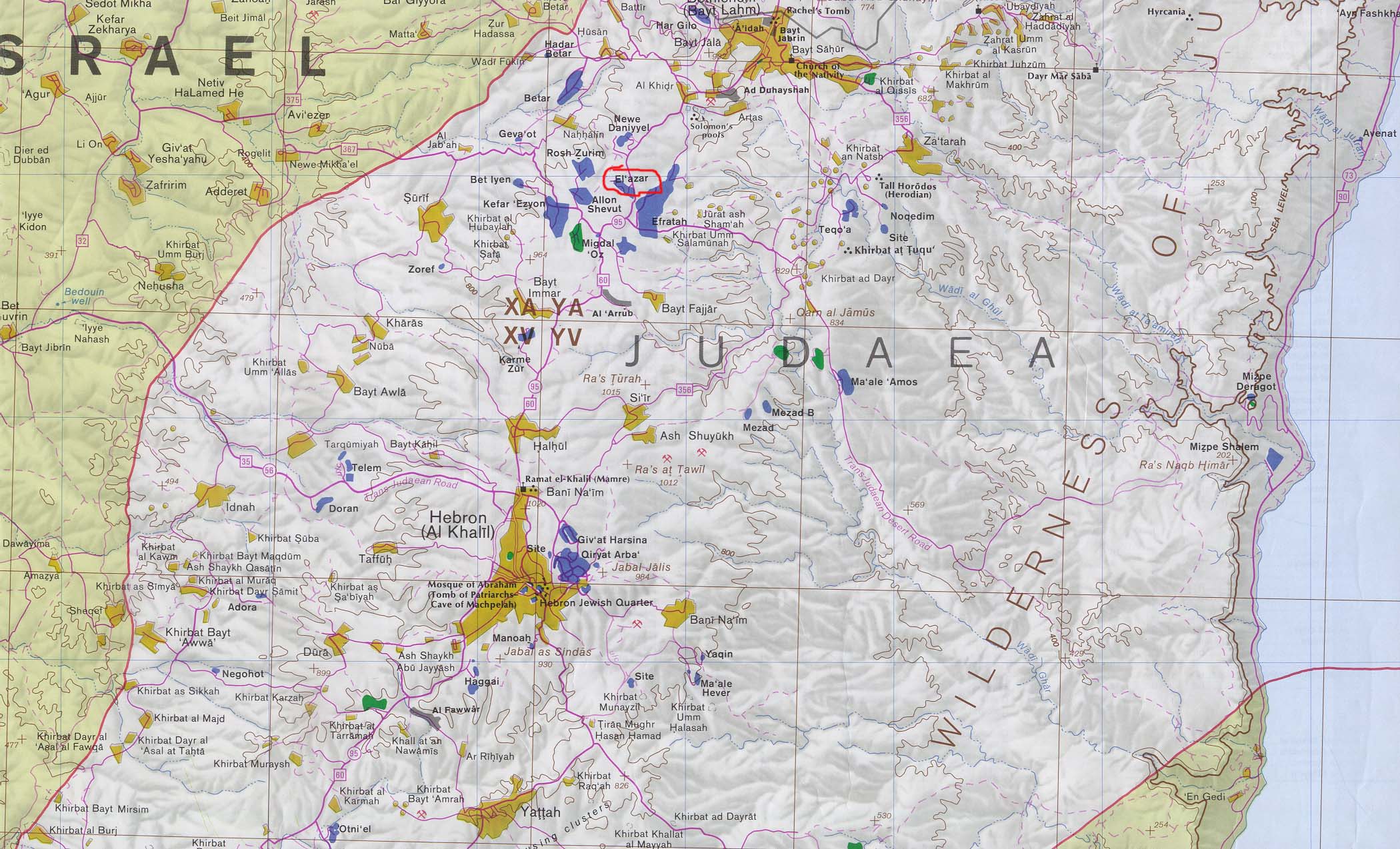
In case you were curious, the US State Dept. has released a map of our area into the public domain. Our community has been blessed to be on it. If you open this map note that I circled Elazar in red. I'm including it here because it's a very comprehensive map with all the Arab towns and villages on it as well, for those who are interested. If nothing else, at least the State Dept. got the geographical name of this territory correct as they call it "Judea", yet for political reasons they insist on referring to it only as the "West Bank."
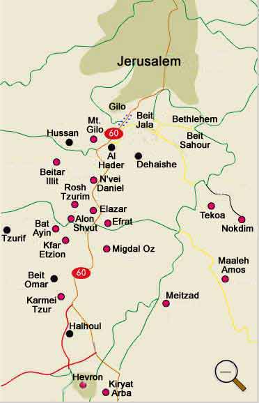
There is a simpler map that makes the point quite well. The red dots signify Jewish communities while the black dots indicate major Arab towns...
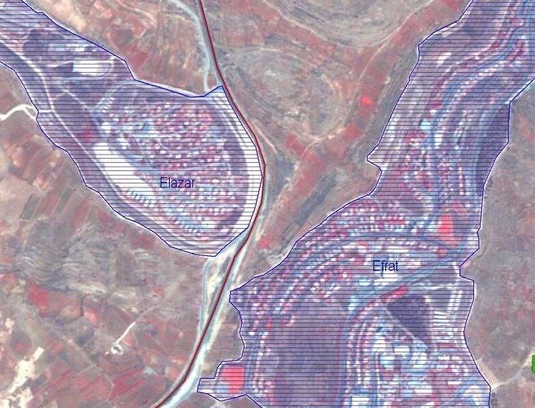
Here's a picture of Elazar taken from the next hill over in Efrat, looking somewhat northwest. The line of houses in the foreground are not part of Elazar but are in Efrat. Incidentally, the reason that the foreground fields in Efrat have no buildings on them is due to the fact that these parcels of land are owned by Arab farmers and they have not put up that land for sale, despite repeated generous offers by the municipality of Efrat:
Now Elazar is in the Etzion Bloc, often called the Etzion Regional Council, which is essentially Etzion Township.
Elazar also situated right next to the municipality of Efrat, a city of 6,600 souls, right across the valley east of us. Another map (below) will help illustrate this. The red line here is the main highway that runs from Jerusalem to Hebron, through Be'ersheva, ultimately to Eilat. Incidentally, the map below was donated through the generosity of certain Arabs who have problems living anywhere near people who are different from them, so that's the reason for them having drawn the lines blotting out our communities...
