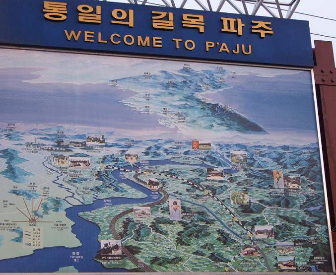
This is the map of the Area at P�aju city. At this point you have to transfer to a special DMZ bus, and are right outside the DMZ. .
| DMZ | |||||||||||||||||||||||||||
| I went on DMZ tour on December 31, 2004. The DMZ is the demilitarized zone between North and South Korea. It extends 2 kilometers into each country, no arms are allowed into it and travel into it is extremely prohibited (actually you can�t go into it except for designated locations.) Because of this the area is considered an excellent nature preserve and is home to many species of wildlife. It has remained virtually untouched by human hands since it was established in 1953. This is the map of the Area at P�aju city. At this point you have to transfer to a special DMZ bus, and are right outside the DMZ. . |
|||||||||||||||||||||||||||
|
|||||||||||||||||||||||||||
|
|||||||||||||||||||||||||||
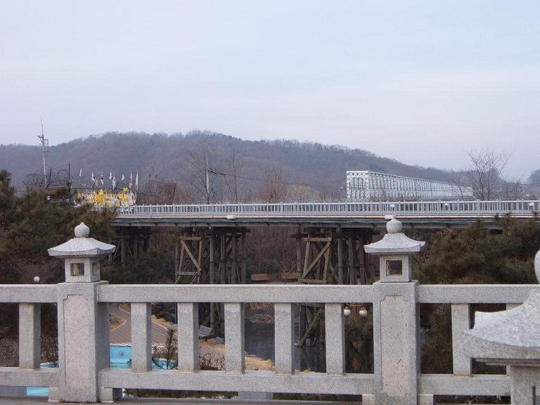
| This is Freedom bridge. Until the completion of the new 4 lane bridge, built by the Hyundai Corporation in 1998. (Our guide said that One of the Higher ups in Hyundai came from North Korea in his father�s stolen car, He returned in 1998 with 1001 cars to replace the car plus interest, she also said that the bridge was built because Hyundai is financing large industrial parks in North Korea to exploit the cheap labor) The freedom bridge was the only bridge into North Korea, it is called Freedom Bridge because it is across this bridge the Captive UN soldiers were returned to South Korea. | |||||||||||||||||||||||||||
|
|||||||||||||||||||||||||||
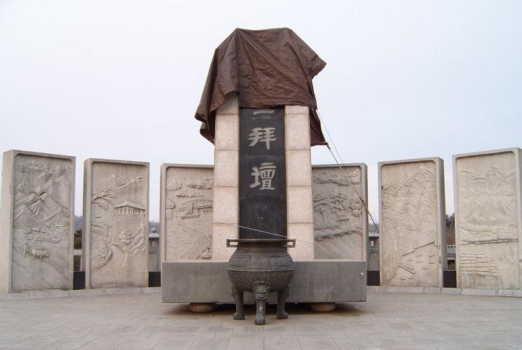
| This is a Memorial alter there are 7 large stone tablets (one is hidden behind the incense burner) they represent the 5 provinces in north korea and the 2 divided provinces. It was built because people who still have family in North Korea frequently came here to pray for their relatives. So the government erected a permanent alter. | |||||||||||||||||||||||||||
|
|||||||||||||||||||||||||||
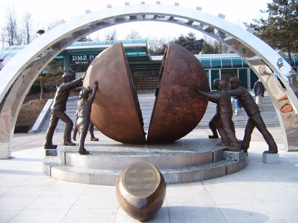
| This is at the site of the 3rd infiltration tunnel. You can�t take pictures inside the Tunnel or from the road, you can take them in the parking lot in front of the Tunnel and that is about it. SO this is the large statue in front of the tunnel opening. Inside the sphere are the 2 halves of korea. The tunnel trip was pretty interesting. You take a little tram cart down (the track is 250m long) The tunnel itself is 1635m long, has a 2m height, and 2m width. It slopes slightly towards North Korea to prevent stagnation. The tunnel is now blocked off at the middle by four separate concrete walls, between which are dynamite and landmines. We wore nice little construction hats, which I was glad for as the ceiling was lower the 2m in places and I occasionally bumped my head. They had fun fact like signs posted along the way that were filled with propaganda and it was fun. Things like: "NK shows its treachery by claiming that the South built the tunnel." It is estimated that the tunnel could accommodate 10,000 troops per hour. | |||||||||||||||||||||||||||
|
|||||||||||||||||||||||||||
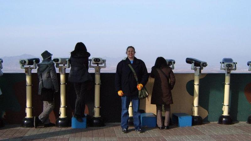
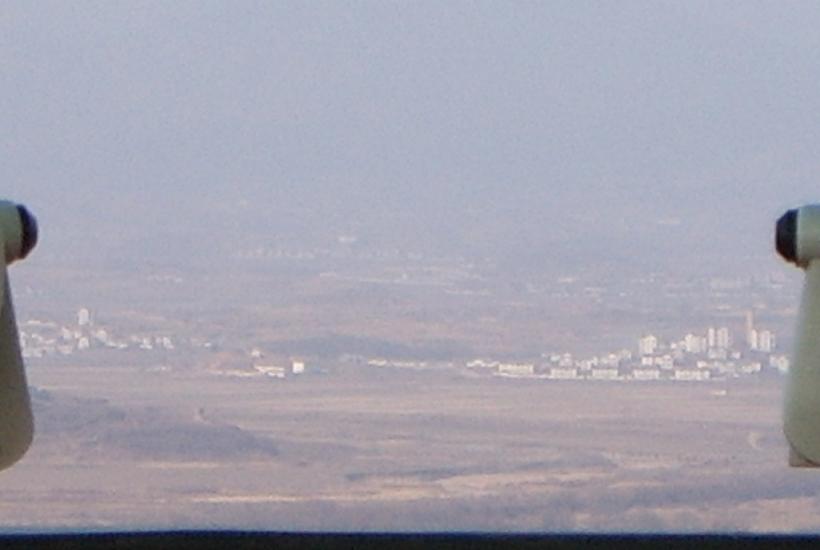
| Right so there I am and behind me is North Korea. It is damn cold, the rivers are actually freezing up there. This is from the Dora Observatory. Directly behind me is the 2nd largest NK city whose name is escaping me right now, to your left is a NK farming village, and two your right are 2 NK propaganda villages (they aren�t real, they are only painted buildings, and no one lives there. I got to use those little binocular things which was fun though they were freaking freezing and I got an "ice-cream" headache from them). The Picture without me is a picture of the 2 Propaganda villages, you have to stand behind a photo line to take pictures so that is why the are so fuzzy. | |||||||||||||||||||||||||||
|
|||||||||||||||||||||||||||
|
|||||||||||||||||||||||||||
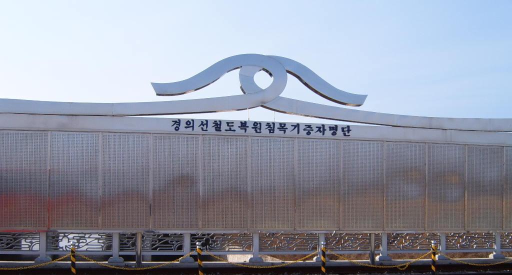
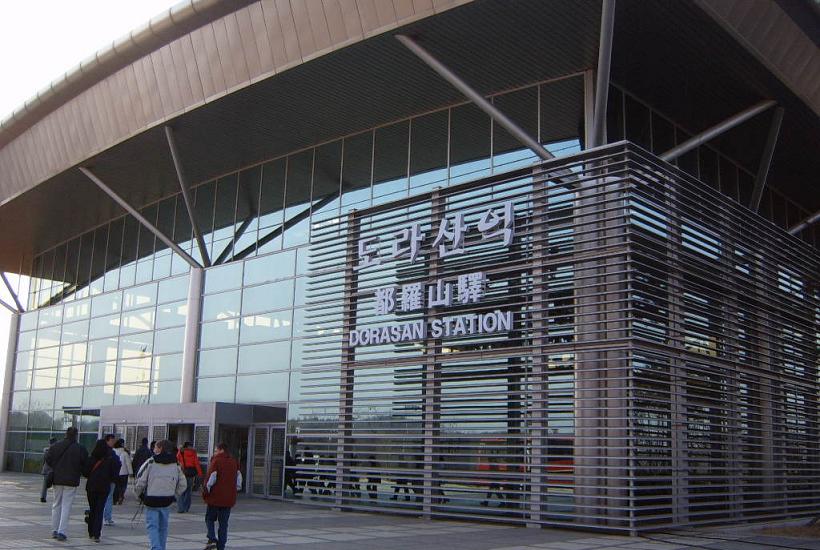
| Last this is the farthest SK train station, part of a recent NK/SK agreement is to re-open the railroad that was closed with the start of the Korean war. This station is the customs/entry point. SK has finished their have of the railroad but the North is way behind schedule. Anyway I got a nice souvenir stamp in my passport. Also the shiny silver thing is actually a wall the names of people who donated funds to make the Station possible, it was built by primarily people with family still in NK. | |||||||||||||||||||||||||||
|
|||||||||||||||||||||||||||
| As always let me know if you have questions or concerns. I am always helpful. Also sign my questbook, you are visiting my website be proud. | |||||||||||||||||||||||||||